Malanów elevation
Malanów (Greater Poland, Powiat turecki), Poland elevation is 170 meters and Malanów elevation in feet is 558 ft above sea level [src 1]. Malanów is a populated place (feature code) with elevation that is 21 meters (69 ft) smaller than average city elevation in Poland.
Below is the Elevation map of Malanów, which displays elevation range with different colors. Scale of the first map is from 128 to 192 m (420 to 630 ft) with average elevation of 161 meters (=528 ft) [note 1]
These maps also provides idea of topography and contour of this city, they are displayed at different zoom levels. More info about maps, scale and edge coordinates you can find below images.
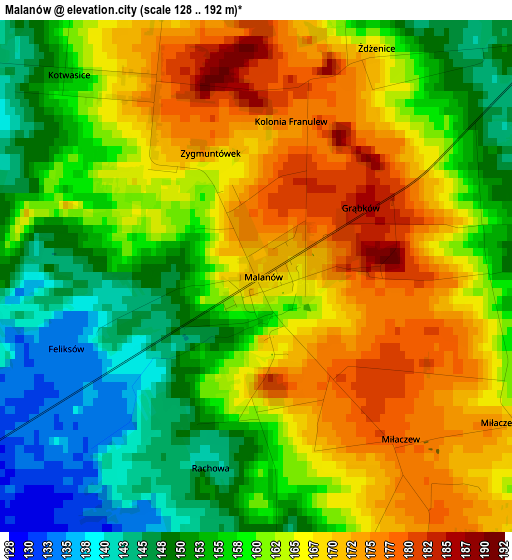
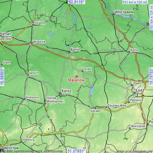
| \ | Map #1 | Topo.Map |
| Scale [m] | 128..192 m | × |
| Scale [ft] | 420..630 ft | × |
| Average | 161 m = 528 ft | × |
| Width | 6.02 km = 3.7 mi | 192.7 km = 119.7 mi |
| Height | 6.02 km = 3.7 mi | 192.7 km = 119.7 mi |
| ↑Max Latitude | 51.980655° | 52.8119° |
| Latitude at center | 51.95358° | 51.95358° |
| ↓Min Latitude | 51.926488° | 51.07851° |
| ← Min Longitude | 18.347335° | 16.98503° |
| Longitude center | 18.39128° | 18.39128° |
| →Max Longitude | 18.435225° | 19.79753° |
Nearby cities:
Cities around Malanów sort by population:
• Turek elevation 121 m
10.2 km,  47°
47°
• Tuliszków 130 m
15.2 km,  334°
334°
• Rychwał 105 m
20.3 km,  310°
310°
• Lisków 142 m
13.4 km,  178°
178°
• Koźminek 128 m
17.6 km,  191°
191°
• Władysławów 115 m
17.6 km,  19°
19°
• Stawiszyn 120 m
19.6 km,  258°
258°
• Dobra 120 m
15.9 km,  104°
104°
• Żelazków 124 m
18.5 km,  233°
233°
• Goszczanów 137 m
19.6 km,  156°
156°
• Przykona 111 m
15.5 km,  78°
78°
• Kawęczyn 134 m
10.8 km,  117°
117°
Multilingual:
 En español:
Malanów elevación 170 m.
 En France:
Malanów élévation 170 m.


Sources and notes:
- [note 1] Map square and city borders are not equal. Map elevation data is calculated only from area inside that square.
- [src 1] Elevation data from geonames database provided with same terms of usage.
- [src 2] The elevation map of Malanów is generated using elevation data from NASA's 3 arcsec (90m) resolution SRTM data.
- [src 3] Base (background) map © OpenStreetMap contributors tiles are generated by Geofabrik and OpenTopoMap.
Copyright & License:
This Malanów Elevation Map is licensed under CC BY-SA. You may reuse any part from this page, if you give a proper credit by linking to this URL:
 More info on terms of use page.