Mogilno elevation
Mogilno (Kujawsko-Pomorskie, Powiat mogileński), Poland elevation is 93 meters and Mogilno elevation in feet is 305 ft above sea level [src 1]. Mogilno is a seat of a third-order administrative division (feature code) with elevation that is 98 meters (322 ft) smaller than average city elevation in Poland.
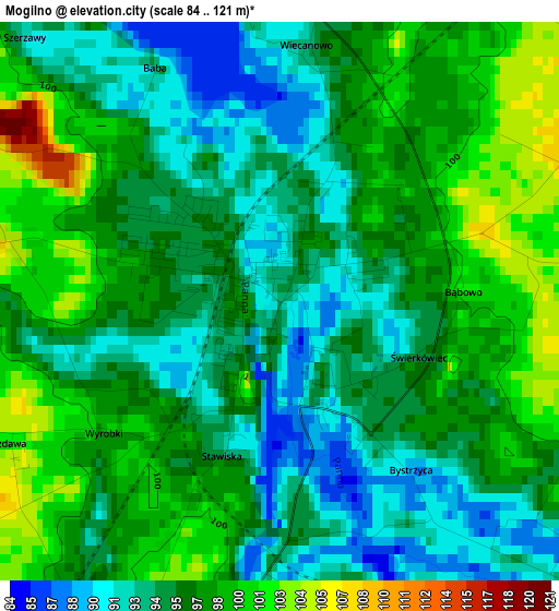
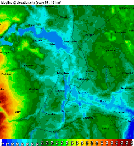
Below is the Elevation map of Mogilno, which displays elevation range with different colors. Scale of the first map is from 84 to 121 m (276 to 397 ft) with average elevation of 96 meters (=315 ft) [note 1]
These maps also provides idea of topography and contour of this city, they are displayed at different zoom levels. More info about maps, scale and edge coordinates you can find below images.
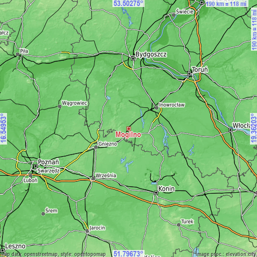
| \ | Map #1 | Map #2 | Topo.Map |
| Scale [m] | 84..121 m | 75..161 m | × |
| Scale [ft] | 276..397 ft | 246..528 ft | × |
| Average | 96 m = 315 ft | 102.1 m = 335 ft | × |
| Width | 5.93 km = 3.7 mi | 11.86 km = 7.4 mi | 189.7 km = 117.9 mi |
| Height | 5.93 km = 3.7 mi | 11.86 km = 7.4 mi | 189.7 km = 117.9 mi |
| ↑Max Latitude | 52.684708° | 52.711339° | 53.50275° |
| Latitude at center | 52.65806° | 52.65806° | 52.65806° |
| ↓Min Latitude | 52.631396° | 52.604716° | 51.79673° |
| ← Min Longitude | 17.911835° | 17.867889° | 16.54953° |
| Longitude center | 17.95578° | 17.95578° | 17.95578° |
| →Max Longitude | 17.999725° | 18.043671° | 19.36203° |
Nearby cities:
Cities around Mogilno sort by population:
• Kruszwica elevation 83 m
25.4 km,  85°
85°
• Janikowo 92 m
15 km,  45°
45°
• Trzemeszno 107 m
14 km,  219°
219°
• Barcin 79 m
23.1 km,  358°
358°
• Strzelno 106 m
15 km,  102°
102°
• Pakość 80 m
18.2 km,  28°
28°
• Rogowo 96 m
21.8 km,  289°
289°
• Gąsawa 86 m
18.2 km,  312°
312°
• Orchowo 110 m
17 km,  166°
166°
• Wilczyn 102 m
23.4 km,  143°
143°
• Wilczogóra 104 m
25 km,  145°
145°
• Dąbrowa 104 m
9.9 km, 355°
Multilingual:
 En español:
Mogilno elevación 93 m.
 En France:
Mogilno élévation 93 m.


Sources and notes:
- [note 1] Map square and city borders are not equal. Map elevation data is calculated only from area inside that square.
- [src 1] Elevation data from geonames database provided with same terms of usage.
- [src 2] The elevation map of Mogilno is generated using elevation data from NASA's 3 arcsec (90m) resolution SRTM data.
- [src 3] Base (background) map © OpenStreetMap contributors tiles are generated by Geofabrik and OpenTopoMap.
Copyright & License:
This Mogilno Elevation Map is licensed under CC BY-SA. You may reuse any part from this page, if you give a proper credit by linking to this URL:
 More info on terms of use page.