Piekary elevation
Piekary (Lesser Poland, Powiat krakowski), Poland elevation is 206 meters and Piekary elevation in feet is 676 ft above sea level [src 1]. Piekary is a populated place (feature code) with elevation that is 15 meters (49 ft) bigger than average city elevation in Poland.
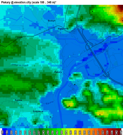
Below is the Elevation map of Piekary, which displays elevation range with different colors. Scale of the first map is from 188 to 348 m (617 to 1142 ft) with average elevation of 222.2 meters (=729 ft) [note 1]
These maps also provides idea of topography and contour of this city, they are displayed at different zoom levels. More info about maps, scale and edge coordinates you can find below images.
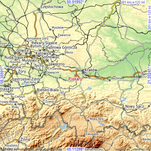
| \ | Map #1 | Topo.Map |
| Scale [m] | 188..348 m | × |
| Scale [ft] | 617..1142 ft | × |
| Average | 222.2 m = 729 ft | × |
| Width | 6.28 km = 3.9 mi | 200.9 km = 124.8 mi |
| Height | 6.28 km = 3.9 mi | 200.9 km = 124.8 mi |
| ↑Max Latitude | 50.053175° | 50.91992° |
| Latitude at center | 50.02495° | 50.02495° |
| ↓Min Latitude | 49.996709° | 49.11299° |
| ← Min Longitude | 19.752215° | 18.38991° |
| Longitude center | 19.79616° | 19.79616° |
| →Max Longitude | 19.840105° | 21.20241° |
Nearby cities:
Cities around Piekary sort by population:
• Skawina elevation 218 m
6 km,  157°
157°
• Rząska 245 m
8.8 km,  23°
23°
• Sidzina 231 m
7 km,  126°
126°
• Kaszów 235 m
5.7 km,  285°
285°
• Rączna 233 m
2.6 km,  230°
230°
• Liszki 226 m
2.5 km,  307°
307°
• Rzozów 238 m
7.9 km,  179°
179°
• Kryspinów 215 m
2.1 km,  4°
4°
• Wołowice 209 m
6.4 km, 231°
• Mników 229 m
6.4 km, 308°
• Balice 251 m
7 km,  359°
359°
• Czułów 278 m
7.8 km,  299°
299°
Multilingual:
 En español:
Piekary elevación 206 m.
 En France:
Piekary élévation 206 m.


Sources and notes:
- [note 1] Map square and city borders are not equal. Map elevation data is calculated only from area inside that square.
- [src 1] Elevation data from geonames database provided with same terms of usage.
- [src 2] The elevation map of Piekary is generated using elevation data from NASA's 3 arcsec (90m) resolution SRTM data.
- [src 3] Base (background) map © OpenStreetMap contributors tiles are generated by Geofabrik and OpenTopoMap.
Copyright & License:
This Piekary Elevation Map is licensed under CC BY-SA. You may reuse any part from this page, if you give a proper credit by linking to this URL:
 More info on terms of use page.