Powidz elevation
Powidz (Greater Poland, Powiat słupecki), Poland elevation is 106 meters and Powidz elevation in feet is 348 ft above sea level [src 1]. Powidz is a seat of a third-order administrative division (feature code) with elevation that is 85 meters (279 ft) smaller than average city elevation in Poland.
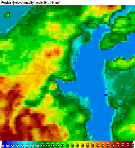
Below is the Elevation map of Powidz, which displays elevation range with different colors. Scale of the first map is from 86 to 134 m (282 to 440 ft) with average elevation of 105.9 meters (=347 ft) [note 1]
These maps also provides idea of topography and contour of this city, they are displayed at different zoom levels. More info about maps, scale and edge coordinates you can find below images.
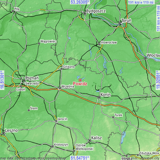
| \ | Map #1 | Topo.Map |
| Scale [m] | 86..134 m | × |
| Scale [ft] | 282..440 ft | × |
| Average | 105.9 m = 347 ft | × |
| Width | 5.96 km = 3.7 mi | 190.8 km = 118.6 mi |
| Height | 5.96 km = 3.7 mi | 190.7 km = 118.5 mi |
| ↑Max Latitude | 52.440417° | 53.26305° |
| Latitude at center | 52.41362° | 52.41362° |
| ↓Min Latitude | 52.386807° | 51.54751° |
| ← Min Longitude | 17.875315° | 16.51301° |
| Longitude center | 17.91926° | 17.91926° |
| →Max Longitude | 17.963205° | 19.32551° |
Nearby cities:
Cities around Powidz sort by population:
• Słupca elevation 94 m
14.4 km,  192°
192°
• Trzemeszno 107 m
17.7 km,  338°
338°
• Witkowo 120 m
10.4 km,  286°
286°
• Strzałkowo 100 m
13.7 km,  210°
210°
• Golina 94 m
22.3 km,  148°
148°
• Kazimierz Biskupi 94 m
20.3 km,  124°
124°
• Kleczew 96 m
18.1 km,  105°
105°
• Niechanowo 121 m
17.3 km, 289°
• Orchowo 110 m
12.5 km,  31°
31°
• Wilczyn 102 m
18.4 km,  63°
63°
• Wilczogóra 104 m
18.1 km,  68°
68°
• Ostrowite 107 m
9.2 km, 112°
Multilingual:
 En español:
Powidz elevación 106 m.
 En France:
Powidz élévation 106 m.


Sources and notes:
- [note 1] Map square and city borders are not equal. Map elevation data is calculated only from area inside that square.
- [src 1] Elevation data from geonames database provided with same terms of usage.
- [src 2] The elevation map of Powidz is generated using elevation data from NASA's 3 arcsec (90m) resolution SRTM data.
- [src 3] Base (background) map © OpenStreetMap contributors tiles are generated by Geofabrik and OpenTopoMap.
Copyright & License:
This Powidz Elevation Map is licensed under CC BY-SA. You may reuse any part from this page, if you give a proper credit by linking to this URL:
 More info on terms of use page.