Prabuty elevation
Prabuty (Pomerania, Powiat kwidzyński), Poland elevation is 95 meters and Prabuty elevation in feet is 312 ft above sea level [src 1]. Prabuty is a seat of a third-order administrative division (feature code) with elevation that is 96 meters (315 ft) smaller than average city elevation in Poland.
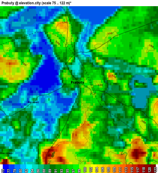
Below is the Elevation map of Prabuty, which displays elevation range with different colors. Scale of the first map is from 75 to 122 m (246 to 400 ft) with average elevation of 91.5 meters (=300 ft) [note 1]
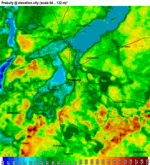
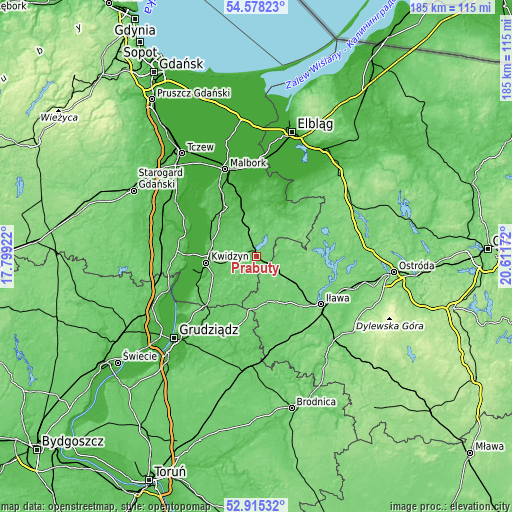
These maps also provides idea of topography and contour of this city, they are displayed at different zoom levels. More info about maps, scale and edge coordinates you can find below images.
| \ | Map #1 | Map #2 | Topo.Map |
| Scale [m] | 75..122 m | 64..132 m | × |
| Scale [ft] | 246..400 ft | 210..433 ft | × |
| Average | 91.5 m = 300 ft | 95 m = 312 ft | × |
| Width | 5.78 km = 3.6 mi | 11.56 km = 7.2 mi | 184.9 km = 114.9 mi |
| Height | 5.78 km = 3.6 mi | 11.56 km = 7.2 mi | 184.9 km = 114.9 mi |
| ↑Max Latitude | 53.780974° | 53.806932° | 54.57823° |
| Latitude at center | 53.755° | 53.755° | 53.755° |
| ↓Min Latitude | 53.72901° | 53.703003° | 52.91532° |
| ← Min Longitude | 19.161525° | 19.117579° | 17.79922° |
| Longitude center | 19.20547° | 19.20547° | 19.20547° |
| →Max Longitude | 19.249415° | 19.293361° | 20.61172° |
Nearby cities:
Cities around Prabuty sort by population:
• Kwidzyn elevation 64 m
18.3 km,  259°
259°
• Sztum 58 m
21.7 km,  328°
328°
• Gniew 35 m
26.7 km,  289°
289°
• Susz 111 m
9.6 km,  115°
115°
• Dzierzgoń 14 m
20.8 km,  26°
26°
• Łasin 92 m
27.5 km,  196°
196°
• Ryjewo 19 m
18.9 km,  301°
301°
• Gardeja 84 m
23.4 km,  226°
226°
• Kisielice 94 m
16.7 km,  166°
166°
• Sadlinki 16 m
24.3 km,  245°
245°
• Mikołajki Pomorskie 79 m
11 km,  346°
346°
• Stary Targ 49 m
18.9 km, 352°
Multilingual:
 En español:
Prabuty elevación 95 m.
 En France:
Prabuty élévation 95 m.


Sources and notes:
- [note 1] Map square and city borders are not equal. Map elevation data is calculated only from area inside that square.
- [src 1] Elevation data from geonames database provided with same terms of usage.
- [src 2] The elevation map of Prabuty is generated using elevation data from NASA's 3 arcsec (90m) resolution SRTM data.
- [src 3] Base (background) map © OpenStreetMap contributors tiles are generated by Geofabrik and OpenTopoMap.
Copyright & License:
This Prabuty Elevation Map is licensed under CC BY-SA. You may reuse any part from this page, if you give a proper credit by linking to this URL:
 More info on terms of use page.