Radomsko elevation
Radomsko (Łódź Voivodeship, Powiat radomszczański), Poland elevation is 223 meters and Radomsko elevation in feet is 732 ft above sea level [src 1]. Radomsko is a populated place (feature code) with elevation that is 32 meters (105 ft) bigger than average city elevation in Poland.
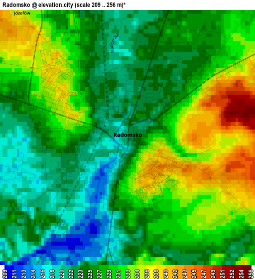
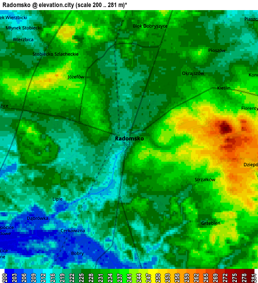
Below is the Elevation map of Radomsko, which displays elevation range with different colors. Scale of the first map is from 209 to 256 m (686 to 840 ft) with average elevation of 227.9 meters (=748 ft) [note 1]
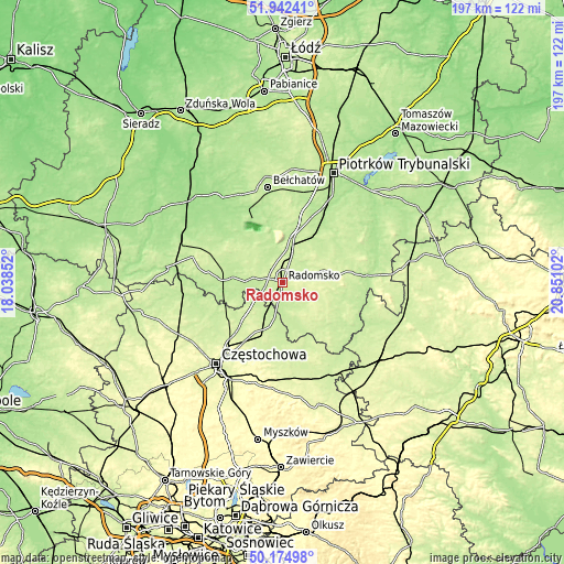
These maps also provides idea of topography and contour of this city, they are displayed at different zoom levels. More info about maps, scale and edge coordinates you can find below images.
| \ | Map #1 | Map #2 | Topo.Map |
| Scale [m] | 209..256 m | 200..281 m | × |
| Scale [ft] | 686..840 ft | 656..922 ft | × |
| Average | 227.9 m = 748 ft | 228.4 m = 749 ft | × |
| Width | 6.14 km = 3.8 mi | 12.28 km = 7.6 mi | 196.5 km = 122.1 mi |
| Height | 6.14 km = 3.8 mi | 12.28 km = 7.6 mi | 196.5 km = 122.1 mi |
| ↑Max Latitude | 51.094737° | 51.122328° | 51.94241° |
| Latitude at center | 51.06713° | 51.06713° | 51.06713° |
| ↓Min Latitude | 51.039506° | 51.011866° | 50.17498° |
| ← Min Longitude | 19.400825° | 19.356879° | 18.03852° |
| Longitude center | 19.44477° | 19.44477° | 19.44477° |
| →Max Longitude | 19.488715° | 19.532661° | 20.85102° |
Nearby cities:
Cities around Radomsko sort by population:
• Gorzkowice elevation 204 m
19.6 km,  32°
32°
• Kamieńsk 224 m
15.5 km,  13°
13°
• Kłomnice 230 m
17.3 km,  200°
200°
• Kleszczów 204 m
20 km,  330°
330°
• Gomunice 222 m
11.8 km,  16°
16°
• Gidle 214 m
11.8 km,  170°
170°
• Sulmierzyce 223 m
21.7 km,  306°
306°
• Borowno 241 m
19.2 km,  218°
218°
• Pławno 214 m
10 km,  175°
175°
• Strzelce Wielkie 217 m
22.4 km,  291°
291°
• Mykanów 240 m
23.4 km,  226°
226°
• Lgota Wielka 231 m
12.3 km,  318°
318°
Multilingual:
 En español:
Radomsko elevación 223 m.
 En France:
Radomsko élévation 223 m.
 Auf Deutsch:
Radomsko höhe über dem Meeresspiegel ist 223 m.

Sources and notes:
- [note 1] Map square and city borders are not equal. Map elevation data is calculated only from area inside that square.
- [src 1] Elevation data from geonames database provided with same terms of usage.
- [src 2] The elevation map of Radomsko is generated using elevation data from NASA's 3 arcsec (90m) resolution SRTM data.
- [src 3] Base (background) map © OpenStreetMap contributors tiles are generated by Geofabrik and OpenTopoMap.
Copyright & License:
This Radomsko Elevation Map is licensed under CC BY-SA. You may reuse any part from this page, if you give a proper credit by linking to this URL:
 More info on terms of use page.