Radziechowy elevation
Radziechowy (Silesia, Powiat żywiecki), Poland elevation is 437 meters and Radziechowy elevation in feet is 1434 ft above sea level [src 1]. Radziechowy is a populated place (feature code) with elevation that is 246 meters (807 ft) bigger than average city elevation in Poland.
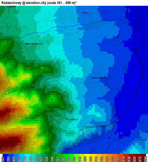
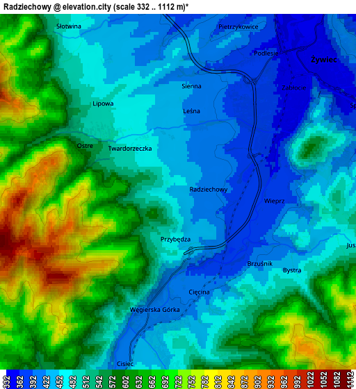
Below is the Elevation map of Radziechowy, which displays elevation range with different colors. Scale of the first map is from 361 to 896 m (1184 to 2940 ft) with average elevation of 476.1 meters (=1562 ft) [note 1]
These maps also provides idea of topography and contour of this city, they are displayed at different zoom levels. More info about maps, scale and edge coordinates you can find below images.
| \ | Map #1 | Map #2 | Topo.Map |
| Scale [m] | 361..896 m | 332..1112 m | × |
| Scale [ft] | 1184..2940 ft | 1089..3648 ft | × |
| Average | 476.1 m = 1562 ft | 535.5 m = 1757 ft | × |
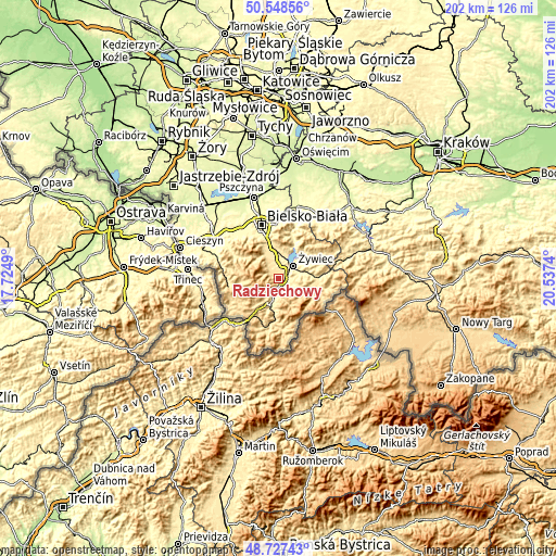
| Width | 6.33 km = 3.9 mi | 12.66 km = 7.9 mi | 202.5 km = 125.8 mi |
| Height | 6.33 km = 3.9 mi | 12.66 km = 7.9 mi | 202.5 km = 125.8 mi |
| ↑Max Latitude | 49.674956° | 49.703386° | 50.54856° |
| Latitude at center | 49.64651° | 49.64651° | 49.64651° |
| ↓Min Latitude | 49.618047° | 49.589567° | 48.72743° |
| ← Min Longitude | 19.087205° | 19.043259° | 17.7249° |
| Longitude center | 19.13115° | 19.13115° | 19.13115° |
| →Max Longitude | 19.175095° | 19.219041° | 20.5374° |
Nearby cities:
Cities around Radziechowy sort by population:
• Żywiec elevation 347 m
6.2 km,  45°
45°
• Cięcina 427 m
5 km,  171°
171°
• Lipowa 485 m
4.2 km,  320°
320°
• Pietrzykowice 423 m
5.9 km,  20°
20°
• Węgierska Górka 408 m
4.4 km,  193°
193°
• Wieprz 368 m
3.5 km,  88°
88°
• Cisiec 417 m
6.3 km,  197°
197°
• Żabnica 512 m
7.5 km, 165°
• Godziszka 473 m
8.4 km,  331°
331°
• Leśna 432 m
2.7 km,  354°
354°
• Trzebinia 427 m
6.6 km, 86°
• Juszczyna 474 m
6.7 km,  106°
106°
Multilingual:
 En español:
Radziechowy elevación 437 m.
 En France:
Radziechowy élévation 437 m.
 Auf Deutsch:
Radziechowy höhe über dem Meeresspiegel ist 437 m.

Sources and notes:
- [note 1] Map square and city borders are not equal. Map elevation data is calculated only from area inside that square.
- [src 1] Elevation data from geonames database provided with same terms of usage.
- [src 2] The elevation map of Radziechowy is generated using elevation data from NASA's 3 arcsec (90m) resolution SRTM data.
- [src 3] Base (background) map © OpenStreetMap contributors tiles are generated by Geofabrik and OpenTopoMap.
Copyright & License:
This Radziechowy Elevation Map is licensed under CC BY-SA. You may reuse any part from this page, if you give a proper credit by linking to this URL:
 More info on terms of use page.