Radziejów elevation
Radziejów (Kujawsko-Pomorskie, Powiat radziejowski), Poland elevation is 114 meters and Radziejów elevation in feet is 374 ft above sea level [src 1]. Radziejów is a seat of a second-order administrative division (feature code) with elevation that is 77 meters (253 ft) smaller than average city elevation in Poland.
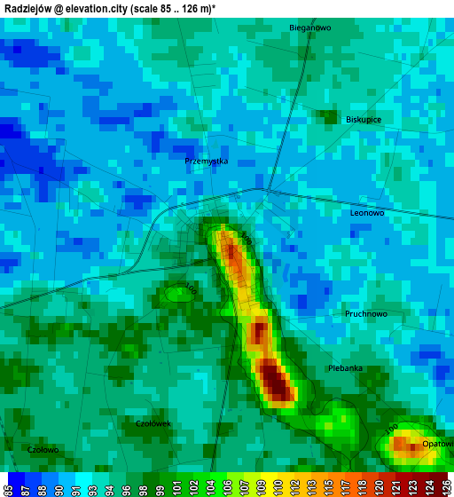
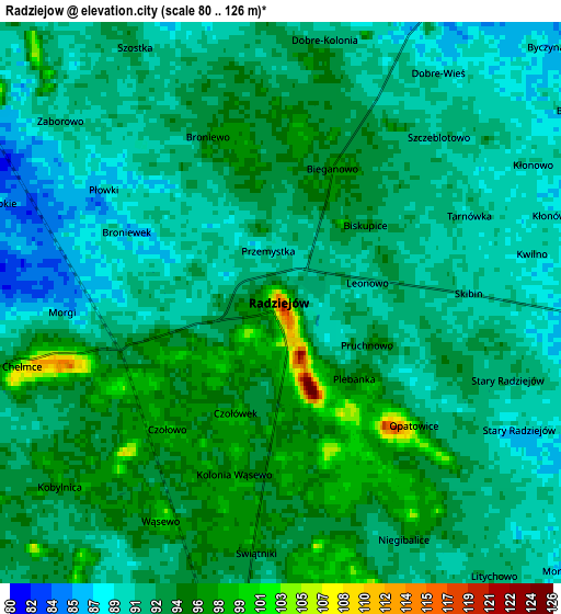
Below is the Elevation map of Radziejów, which displays elevation range with different colors. Scale of the first map is from 85 to 126 m (279 to 413 ft) with average elevation of 94.1 meters (=309 ft) [note 1]
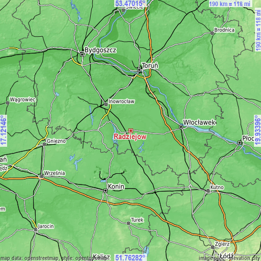
These maps also provides idea of topography and contour of this city, they are displayed at different zoom levels. More info about maps, scale and edge coordinates you can find below images.
| \ | Map #1 | Map #2 | Topo.Map |
| Scale [m] | 85..126 m | 80..126 m | × |
| Scale [ft] | 279..413 ft | 262..413 ft | × |
| Average | 94.1 m = 309 ft | 92.4 m = 303 ft | × |
| Width | 5.93 km = 3.7 mi | 11.86 km = 7.4 mi | 189.8 km = 117.9 mi |
| Height | 5.93 km = 3.7 mi | 11.86 km = 7.4 mi | 189.8 km = 117.9 mi |
| ↑Max Latitude | 52.651478° | 52.67813° | 53.47015° |
| Latitude at center | 52.62481° | 52.62481° | 52.62481° |
| ↓Min Latitude | 52.598126° | 52.571425° | 51.76282° |
| ← Min Longitude | 18.483765° | 18.439819° | 17.12146° |
| Longitude center | 18.52771° | 18.52771° | 18.52771° |
| →Max Longitude | 18.571655° | 18.615601° | 19.93396° |
Nearby cities:
Cities around Radziejów sort by population:
• Kruszwica elevation 83 m
14.4 km,  293°
293°
• Strzelno 106 m
24 km,  270°
270°
• Piotrków Kujawski 103 m
8.4 km,  193°
193°
• Brześć Kujawski 78 m
25.3 km,  94°
94°
• Lubraniec 81 m
22.6 km,  114°
114°
• Osięciny 93 m
13.1 km, 87°
• Dobre 88 m
7.4 km,  27°
27°
• Skulsk 88 m
20.7 km,  219°
219°
• Jeziora Wielkie 102 m
20.4 km,  239°
239°
• Topólka 86 m
18.4 km,  137°
137°
• Bytoń 97 m
8.8 km,  148°
148°
• Wierzbinek 92 m
20.6 km,  183°
183°
Multilingual:
 En español:
Radziejów elevación 114 m.
 En France:
Radziejów élévation 114 m.
 Auf Deutsch:
Radziejów höhe über dem Meeresspiegel ist 114 m.

Sources and notes:
- [note 1] Map square and city borders are not equal. Map elevation data is calculated only from area inside that square.
- [src 1] Elevation data from geonames database provided with same terms of usage.
- [src 2] The elevation map of Radziejów is generated using elevation data from NASA's 3 arcsec (90m) resolution SRTM data.
- [src 3] Base (background) map © OpenStreetMap contributors tiles are generated by Geofabrik and OpenTopoMap.
Copyright & License:
This Radziejów Elevation Map is licensed under CC BY-SA. You may reuse any part from this page, if you give a proper credit by linking to this URL:
 More info on terms of use page.