Sieroszewice elevation
Sieroszewice (Greater Poland, Powiat ostrowski), Poland elevation is 149 meters and Sieroszewice elevation in feet is 489 ft above sea level [src 1]. Sieroszewice is a seat of a third-order administrative division (feature code) with elevation that is 42 meters (138 ft) smaller than average city elevation in Poland.
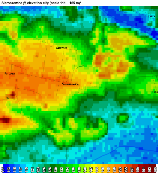
Below is the Elevation map of Sieroszewice, which displays elevation range with different colors. Scale of the first map is from 111 to 165 m (364 to 541 ft) with average elevation of 133.3 meters (=437 ft) [note 1]
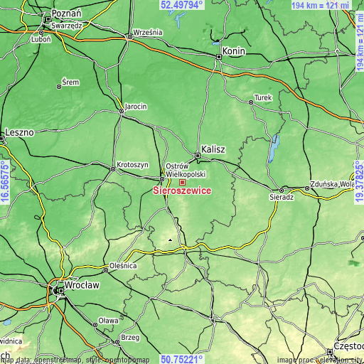
These maps also provides idea of topography and contour of this city, they are displayed at different zoom levels. More info about maps, scale and edge coordinates you can find below images.
| \ | Map #1 | Topo.Map |
| Scale [m] | 111..165 m | × |
| Scale [ft] | 364..541 ft | × |
| Average | 133.3 m = 437 ft | × |
| Width | 6.07 km = 3.8 mi | 194.1 km = 120.6 mi |
| Height | 6.07 km = 3.8 mi | 194.1 km = 120.6 mi |
| ↑Max Latitude | 51.660738° | 52.49794° |
| Latitude at center | 51.63347° | 51.63347° |
| ↓Min Latitude | 51.606185° | 50.75221° |
| ← Min Longitude | 17.928055° | 16.56575° |
| Longitude center | 17.972° | 17.972° |
| →Max Longitude | 18.015945° | 19.37825° |
Nearby cities:
Cities around Sieroszewice sort by population:
• Kalisz elevation 109 m
16.4 km,  30°
30°
• Ostrów Wielkopolski 130 m
11.6 km,  281°
281°
• Nowe Skalmierzyce 140 m
8.7 km,  9°
9°
• Opatówek 120 m
20.6 km,  54°
54°
• Przygodzice 143 m
11.2 km,  245°
245°
• Raszków 141 m
19.4 km,  299°
299°
• Gorzyce Wielkie 139 m
16.7 km,  271°
271°
• Grabów nad Prosną 130 m
17.5 km,  144°
144°
• Mikstat 197 m
11.2 km,  179°
179°
• Skalmierzyce 128 m
7.5 km,  355°
355°
• Janków Przygodzki 135 m
13.3 km, 252°
• Kraszewice 131 m
21.4 km,  126°
126°
Multilingual:
 En español:
Sieroszewice elevación 149 m.
 En France:
Sieroszewice élévation 149 m.
 Auf Deutsch:
Sieroszewice höhe über dem Meeresspiegel ist 149 m.

Sources and notes:
- [note 1] Map square and city borders are not equal. Map elevation data is calculated only from area inside that square.
- [src 1] Elevation data from geonames database provided with same terms of usage.
- [src 2] The elevation map of Sieroszewice is generated using elevation data from NASA's 3 arcsec (90m) resolution SRTM data.
- [src 3] Base (background) map © OpenStreetMap contributors tiles are generated by Geofabrik and OpenTopoMap.
Copyright & License:
This Sieroszewice Elevation Map is licensed under CC BY-SA. You may reuse any part from this page, if you give a proper credit by linking to this URL:
 More info on terms of use page.