Skała elevation
Skała (Lesser Poland, Powiat krakowski), Poland elevation is 417 meters and Skała elevation in feet is 1368 ft above sea level [src 1]. Skała is a seat of a third-order administrative division (feature code) with elevation that is 226 meters (741 ft) bigger than average city elevation in Poland.
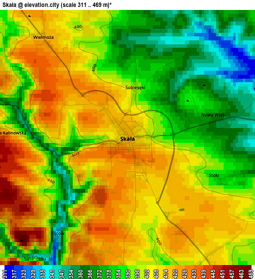
Below is the Elevation map of Skała, which displays elevation range with different colors. Scale of the first map is from 311 to 469 m (1020 to 1539 ft) with average elevation of 396.7 meters (=1302 ft) [note 1]
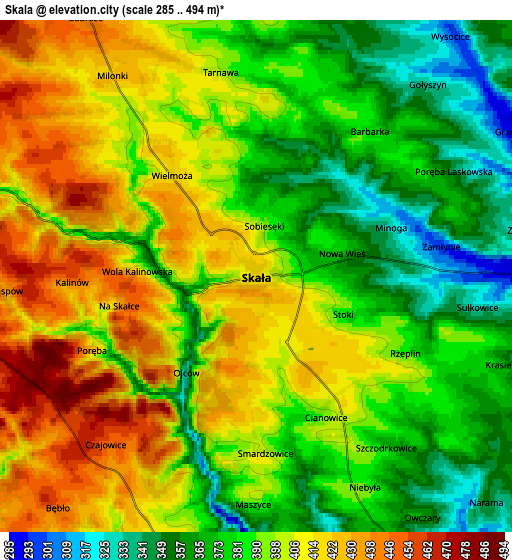
These maps also provides idea of topography and contour of this city, they are displayed at different zoom levels. More info about maps, scale and edge coordinates you can find below images.
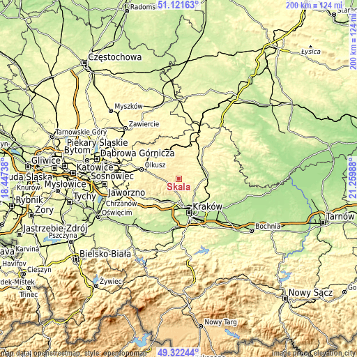
| \ | Map #1 | Map #2 | Topo.Map |
| Scale [m] | 311..469 m | 285..494 m | × |
| Scale [ft] | 1020..1539 ft | 935..1621 ft | × |
| Average | 396.7 m = 1302 ft | 393.2 m = 1290 ft | × |
| Width | 6.25 km = 3.9 mi | 12.5 km = 7.8 mi | 200.1 km = 124.3 mi |
| Height | 6.25 km = 3.9 mi | 12.5 km = 7.8 mi | 200 km = 124.3 mi |
| ↑Max Latitude | 50.258624° | 50.286711° | 51.12163° |
| Latitude at center | 50.23052° | 50.23052° | 50.23052° |
| ↓Min Latitude | 50.2024° | 50.174263° | 49.32244° |
| ← Min Longitude | 19.809685° | 19.765739° | 18.44738° |
| Longitude center | 19.85363° | 19.85363° | 19.85363° |
| →Max Longitude | 19.897575° | 19.941521° | 21.25988° |
Nearby cities:
Cities around Skała sort by population:
• Sułoszowa elevation 420 m
9.5 km,  295°
295°
• Zielonki 231 m
13.1 km,  158°
158°
• Jerzmanowice 430 m
7.9 km,  255°
255°
• Przeginia 446 m
11.8 km,  274°
274°
• Michałowice 247 m
12 km,  131°
131°
• Bolechowice 281 m
10.1 km,  205°
205°
• Sąspów 453 m
5.9 km, 268°
• Modlnica 291 m
11.3 km,  176°
176°
• Modlniczka 243 m
12.6 km, 179°
• Wielka Wieś 384 m
8.2 km, 184°
• Bębło 449 m
7.3 km,  220°
220°
• Giebułtów 322 m
9.6 km,  169°
169°
Multilingual:
 En español:
Skała elevación 417 m.
 En France:
Skała élévation 417 m.


Sources and notes:
- [note 1] Map square and city borders are not equal. Map elevation data is calculated only from area inside that square.
- [src 1] Elevation data from geonames database provided with same terms of usage.
- [src 2] The elevation map of Skała is generated using elevation data from NASA's 3 arcsec (90m) resolution SRTM data.
- [src 3] Base (background) map © OpenStreetMap contributors tiles are generated by Geofabrik and OpenTopoMap.
Copyright & License:
This Skała Elevation Map is licensed under CC BY-SA. You may reuse any part from this page, if you give a proper credit by linking to this URL:
 More info on terms of use page.