Sosnówka elevation
Sosnówka (Lower Silesia, Powiat jeleniogórski), Poland elevation is 399 meters and Sosnówka elevation in feet is 1309 ft above sea level [src 1]. Sosnówka is a populated place (feature code) with elevation that is 208 meters (682 ft) bigger than average city elevation in Poland.
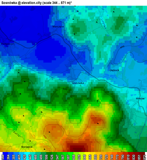
Below is the Elevation map of Sosnówka, which displays elevation range with different colors. Scale of the first map is from 344 to 871 m (1129 to 2858 ft) with average elevation of 491.4 meters (=1612 ft) [note 1]
These maps also provides idea of topography and contour of this city, they are displayed at different zoom levels. More info about maps, scale and edge coordinates you can find below images.
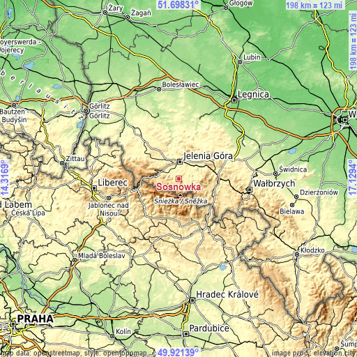
| \ | Map #1 | Topo.Map |
| Scale [m] | 344..871 m | × |
| Scale [ft] | 1129..2858 ft | × |
| Average | 491.4 m = 1612 ft | × |
| Width | 6.17 km = 3.8 mi | 197.6 km = 122.8 mi |
| Height | 6.17 km = 3.8 mi | 197.6 km = 122.8 mi |
| ↑Max Latitude | 50.846056° | 51.69831° |
| Latitude at center | 50.8183° | 50.8183° |
| ↓Min Latitude | 50.790528° | 49.92139° |
| ← Min Longitude | 15.679205° | 14.3169° |
| Longitude center | 15.72315° | 15.72315° |
| →Max Longitude | 15.767095° | 17.1294° |
Nearby cities:
Cities around Sosnówka sort by population:
• Jelenia Góra elevation 331 m
9.1 km,  2°
2°
• Cieplice Śląskie Zdrój 341 m
5.9 km,  332°
332°
• Kowary 463 m
8.4 km,  109°
109°
• Szklarska Poręba 647 m
14.1 km,  273°
273°
• Piechowice 380 m
9.4 km,  291°
291°
• Mysłakowice 382 m
4.7 km,  56°
56°
• Karpacz 599 m
5.2 km,  153°
153°
• Wojcieszów 342 m
20.4 km,  43°
43°
• Janowice Wielkie 401 m
15.4 km,  65°
65°
• Jeżów Sudecki 369 m
13.1 km,  6°
6°
• Podgórzyn 359 m
3.3 km,  298°
298°
• Stara Kamienica 373 m
15.1 km,  315°
315°
Multilingual:
 En español:
Sosnówka elevación 399 m.
 En France:
Sosnówka élévation 399 m.
 Auf Deutsch:
Sosnówka höhe über dem Meeresspiegel ist 399 m.

Sources and notes:
- [note 1] Map square and city borders are not equal. Map elevation data is calculated only from area inside that square.
- [src 1] Elevation data from geonames database provided with same terms of usage.
- [src 2] The elevation map of Sosnówka is generated using elevation data from NASA's 3 arcsec (90m) resolution SRTM data.
- [src 3] Base (background) map © OpenStreetMap contributors tiles are generated by Geofabrik and OpenTopoMap.
Copyright & License:
This Sosnówka Elevation Map is licensed under CC BY-SA. You may reuse any part from this page, if you give a proper credit by linking to this URL:
 More info on terms of use page.