Stargard elevation
Stargard (West Pomerania, Powiat stargardzki), Poland elevation is 21 meters and Stargard elevation in feet is 69 ft above sea level [src 1]. Stargard is a seat of a second-order administrative division (feature code) with elevation that is 170 meters (558 ft) smaller than average city elevation in Poland.
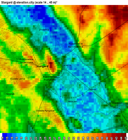
Below is the Elevation map of Stargard, which displays elevation range with different colors. Scale of the first map is from 14 to 45 m (46 to 148 ft) with average elevation of 27 meters (=89 ft) [note 1]
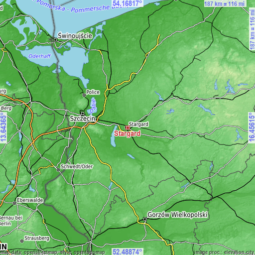
These maps also provides idea of topography and contour of this city, they are displayed at different zoom levels. More info about maps, scale and edge coordinates you can find below images.
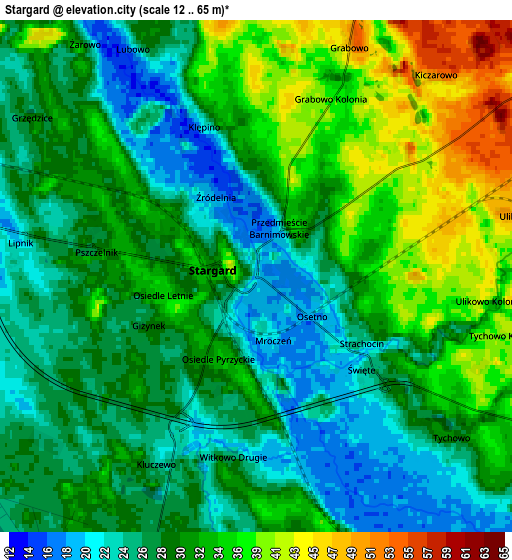
| \ | Map #1 | Map #2 | Topo.Map |
| Scale [m] | 14..45 m | 12..65 m | × |
| Scale [ft] | 46..148 ft | 39..213 ft | × |
| Average | 27 m = 89 ft | 30.6 m = 100 ft | × |
| Width | 5.84 km = 3.6 mi | 11.67 km = 7.3 mi | 186.7 km = 116 mi |
| Height | 5.84 km = 3.6 mi | 11.67 km = 7.3 mi | 186.7 km = 116 mi |
| ↑Max Latitude | 53.362952° | 53.389168° | 54.16817° |
| Latitude at center | 53.33672° | 53.33672° | 53.33672° |
| ↓Min Latitude | 53.310472° | 53.284207° | 52.48874° |
| ← Min Longitude | 15.005955° | 14.962009° | 13.64365° |
| Longitude center | 15.0499° | 15.0499° | 15.0499° |
| →Max Longitude | 15.093845° | 15.137791° | 16.45615° |
Nearby cities:
Cities around Stargard sort by population:
• Pyrzyce elevation 39 m
23.6 km,  206°
206°
• Chociwel 72 m
23.7 km,  52°
52°
• Maszewo 68 m
17.7 km,  2°
2°
• Dobrzany 78 m
25.3 km,  84°
84°
• Dolice 37 m
19.1 km,  147°
147°
• Suchań 43 m
19.4 km,  109°
109°
• Mosty 55 m
24.3 km,  345°
345°
• Marianowo 67 m
15.3 km,  70°
70°
• Kobylanka 28 m
11.9 km,  274°
274°
• Warnice 26 m
9.9 km,  201°
201°
• Stara Dąbrowa 60 m
11.3 km,  33°
33°
• Stare Czarnowo 39 m
19.1 km,  250°
250°
Multilingual:
 En español:
Stargard elevación 21 m.
 En France:
Stargard élévation 21 m.


Sources and notes:
- [note 1] Map square and city borders are not equal. Map elevation data is calculated only from area inside that square.
- [src 1] Elevation data from geonames database provided with same terms of usage.
- [src 2] The elevation map of Stargard is generated using elevation data from NASA's 3 arcsec (90m) resolution SRTM data.
- [src 3] Base (background) map © OpenStreetMap contributors tiles are generated by Geofabrik and OpenTopoMap.
Copyright & License:
This Stargard Elevation Map is licensed under CC BY-SA. You may reuse any part from this page, if you give a proper credit by linking to this URL:
 More info on terms of use page.