Staroźreby elevation
Staroźreby (Mazovia, Powiat płocki), Poland elevation is 137 meters and Staroźreby elevation in feet is 449 ft above sea level [src 1]. Staroźreby is a seat of a third-order administrative division (feature code) with elevation that is 54 meters (177 ft) smaller than average city elevation in Poland.
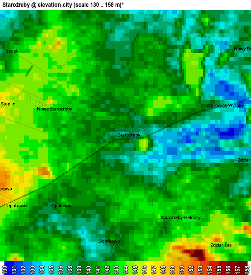
Below is the Elevation map of Staroźreby, which displays elevation range with different colors. Scale of the first map is from 130 to 158 m (427 to 518 ft) with average elevation of 140.3 meters (=460 ft) [note 1]
These maps also provides idea of topography and contour of this city, they are displayed at different zoom levels. More info about maps, scale and edge coordinates you can find below images.
| \ | Map #1 | Topo.Map |
| Scale [m] | 130..158 m | × |
| Scale [ft] | 427..518 ft | × |
| Average | 140.3 m = 460 ft | × |
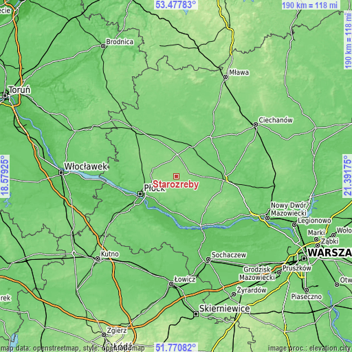
| Width | 5.93 km = 3.7 mi | 189.8 km = 117.9 mi |
| Height | 5.93 km = 3.7 mi | 189.8 km = 117.9 mi |
| ↑Max Latitude | 52.659313° | 53.47783° |
| Latitude at center | 52.63265° | 52.63265° |
| ↓Min Latitude | 52.60597° | 51.77082° |
| ← Min Longitude | 19.941555° | 18.57925° |
| Longitude center | 19.9855° | 19.9855° |
| →Max Longitude | 20.029445° | 21.39175° |
Nearby cities:
Cities around Staroźreby sort by population:
• Płock elevation 103 m
21.1 km,  243°
243°
• Raciąż 103 m
18.8 km,  28°
28°
• Drobin 129 m
11.7 km,  1°
1°
• Bielsk 134 m
12.9 km,  289°
289°
• Baboszewo 103 m
19 km,  73°
73°
• Gozdowo 130 m
22.7 km,  296°
296°
• Mała Wieś 116 m
21 km,  157°
157°
• Bodzanów 109 m
15.1 km,  168°
168°
• Radzanowo 140 m
9.2 km,  223°
223°
• Słupno 90 m
17.3 km, 215°
• Dzierzążnia 109 m
16.8 km,  91°
91°
• Bulkowo 125 m
13.6 km,  138°
138°
Multilingual:
 En español:
Staroźreby elevación 137 m.
 En France:
Staroźreby élévation 137 m.
 Auf Deutsch:
Staroźreby höhe über dem Meeresspiegel ist 137 m.

Sources and notes:
- [note 1] Map square and city borders are not equal. Map elevation data is calculated only from area inside that square.
- [src 1] Elevation data from geonames database provided with same terms of usage.
- [src 2] The elevation map of Staroźreby is generated using elevation data from NASA's 3 arcsec (90m) resolution SRTM data.
- [src 3] Base (background) map © OpenStreetMap contributors tiles are generated by Geofabrik and OpenTopoMap.
Copyright & License:
This Staroźreby Elevation Map is licensed under CC BY-SA. You may reuse any part from this page, if you give a proper credit by linking to this URL:
 More info on terms of use page.