Stryszawa elevation
Stryszawa (Lesser Poland, Powiat suski), Poland elevation is 435 meters and Stryszawa elevation in feet is 1427 ft above sea level [src 1]. Stryszawa is a seat of a third-order administrative division (feature code) with elevation that is 244 meters (801 ft) bigger than average city elevation in Poland.
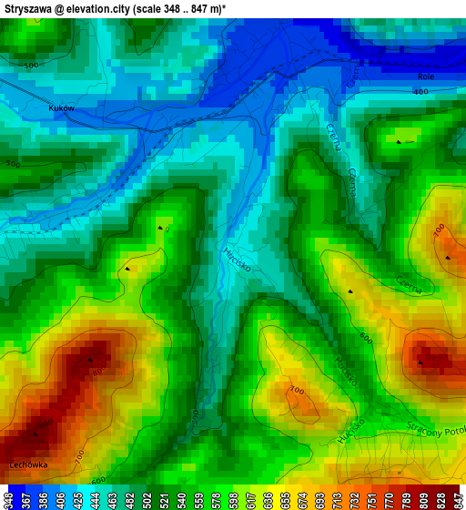
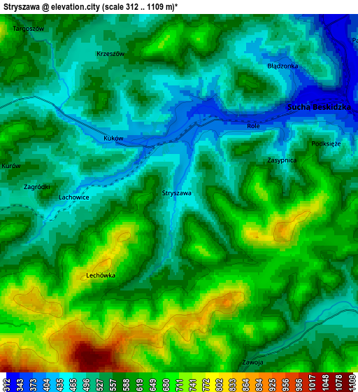
Below is the Elevation map of Stryszawa, which displays elevation range with different colors. Scale of the first map is from 348 to 847 m (1142 to 2779 ft) with average elevation of 537.3 meters (=1763 ft) [note 1]
These maps also provides idea of topography and contour of this city, they are displayed at different zoom levels. More info about maps, scale and edge coordinates you can find below images.
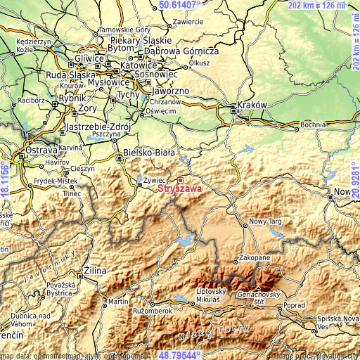
| \ | Map #1 | Map #2 | Topo.Map |
| Scale [m] | 348..847 m | 312..1109 m | × |
| Scale [ft] | 1142..2779 ft | 1024..3638 ft | × |
| Average | 537.3 m = 1763 ft | 574.3 m = 1884 ft | × |
| Width | 6.32 km = 3.9 mi | 12.64 km = 7.9 mi | 202.2 km = 125.6 mi |
| Height | 6.32 km = 3.9 mi | 12.64 km = 7.9 mi | 202.2 km = 125.6 mi |
| ↑Max Latitude | 49.741677° | 49.770068° | 50.61407° |
| Latitude at center | 49.71327° | 49.71327° | 49.71327° |
| ↓Min Latitude | 49.684846° | 49.656406° | 48.79544° |
| ← Min Longitude | 19.477905° | 19.433959° | 18.1156° |
| Longitude center | 19.52185° | 19.52185° | 19.52185° |
| →Max Longitude | 19.565795° | 19.609741° | 20.9281° |
Nearby cities:
Cities around Stryszawa sort by population:
• Sucha Beskidzka elevation 338 m
6.1 km,  58°
58°
• Zawoja 573 m
7.8 km,  169°
169°
• Maków Podhalański 361 m
11.3 km,  80°
80°
• Zembrzyce 316 m
8.9 km,  39°
39°
• Skawica 453 m
8.3 km,  118°
118°
• Białka 406 m
10.9 km,  101°
101°
• Grzechynia 413 m
8.9 km,  89°
89°
• Lachowice 428 m
3.4 km,  274°
274°
• Ślemień 444 m
11.1 km, 272°
• Krzeszów 504 m
5.6 km,  335°
335°
• Pewel Wielka 491 m
11.4 km,  247°
247°
• Kuków 419 m
3.4 km,  308°
308°
Multilingual:
 En español:
Stryszawa elevación 435 m.
 En France:
Stryszawa élévation 435 m.
 Auf Deutsch:
Stryszawa höhe über dem Meeresspiegel ist 435 m.

Sources and notes:
- [note 1] Map square and city borders are not equal. Map elevation data is calculated only from area inside that square.
- [src 1] Elevation data from geonames database provided with same terms of usage.
- [src 2] The elevation map of Stryszawa is generated using elevation data from NASA's 3 arcsec (90m) resolution SRTM data.
- [src 3] Base (background) map © OpenStreetMap contributors tiles are generated by Geofabrik and OpenTopoMap.
Copyright & License:
This Stryszawa Elevation Map is licensed under CC BY-SA. You may reuse any part from this page, if you give a proper credit by linking to this URL:
 More info on terms of use page.