Strzebiń elevation
Strzebiń (Silesia, Powiat lubliniecki), Poland elevation is 291 meters and Strzebiń elevation in feet is 955 ft above sea level [src 1]. Strzebiń is a populated place (feature code) with elevation that is 100 meters (328 ft) bigger than average city elevation in Poland.
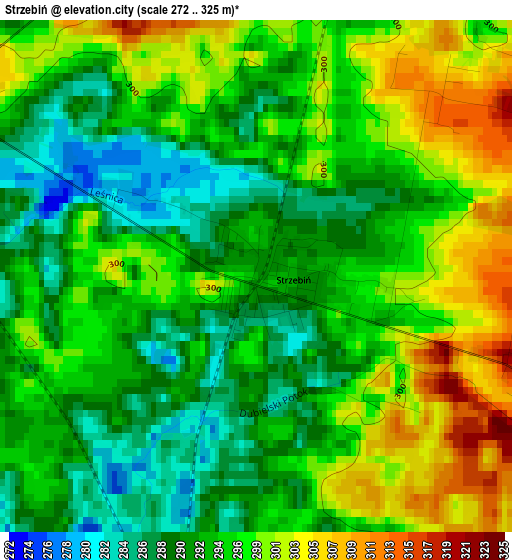
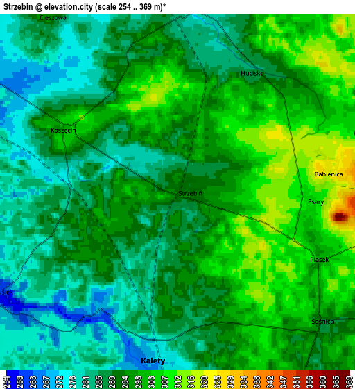
Below is the Elevation map of Strzebiń, which displays elevation range with different colors. Scale of the first map is from 272 to 325 m (892 to 1066 ft) with average elevation of 295.2 meters (=969 ft) [note 1]
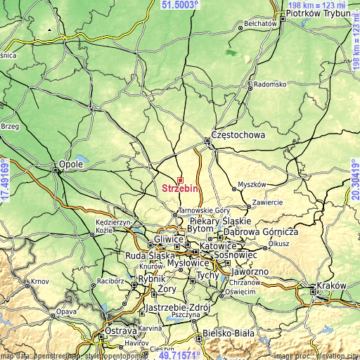
These maps also provides idea of topography and contour of this city, they are displayed at different zoom levels. More info about maps, scale and edge coordinates you can find below images.
| \ | Map #1 | Map #2 | Topo.Map |
| Scale [m] | 272..325 m | 254..369 m | × |
| Scale [ft] | 892..1066 ft | 833..1211 ft | × |
| Average | 295.2 m = 969 ft | 292.6 m = 960 ft | × |
| Width | 6.2 km = 3.9 mi | 12.4 km = 7.7 mi | 198.4 km = 123.3 mi |
| Height | 6.2 km = 3.9 mi | 12.4 km = 7.7 mi | 198.4 km = 123.3 mi |
| ↑Max Latitude | 50.644345° | 50.672204° | 51.5003° |
| Latitude at center | 50.61647° | 50.61647° | 50.61647° |
| ↓Min Latitude | 50.588578° | 50.56067° | 49.71571° |
| ← Min Longitude | 18.853995° | 18.810049° | 17.49169° |
| Longitude center | 18.89794° | 18.89794° | 18.89794° |
| →Max Longitude | 18.941885° | 18.985831° | 20.30419° |
Nearby cities:
Cities around Strzebiń sort by population:
• Kalety elevation 271 m
6 km,  183°
183°
• Miasteczko Śląskie 301 m
13 km,  166°
166°
• Wożniki 308 m
11.8 km,  104°
104°
• Koszęcin 304 m
4.5 km,  296°
296°
• Tworóg 248 m
16 km,  233°
233°
• Konopiska 279 m
14.5 km,  32°
32°
• Boronów 277 m
6.5 km,  5°
5°
• Herby 284 m
15.2 km,  357°
357°
• Kochanowice 275 m
14.4 km,  313°
313°
• Psary 311 m
5.1 km,  92°
92°
• Starcza 285 m
11.4 km,  62°
62°
• Gniazdów 333 m
15.2 km, 98°
Multilingual:
 En español:
Strzebiń elevación 291 m.
 En France:
Strzebiń élévation 291 m.
 Auf Deutsch:
Strzebiń höhe über dem Meeresspiegel ist 291 m.

Sources and notes:
- [note 1] Map square and city borders are not equal. Map elevation data is calculated only from area inside that square.
- [src 1] Elevation data from geonames database provided with same terms of usage.
- [src 2] The elevation map of Strzebiń is generated using elevation data from NASA's 3 arcsec (90m) resolution SRTM data.
- [src 3] Base (background) map © OpenStreetMap contributors tiles are generated by Geofabrik and OpenTopoMap.
Copyright & License:
This Strzebiń Elevation Map is licensed under CC BY-SA. You may reuse any part from this page, if you give a proper credit by linking to this URL:
 More info on terms of use page.