Strzeleczki elevation
Strzeleczki (Opole Voivodeship, Powiat krapkowicki), Poland elevation is 172 meters and Strzeleczki elevation in feet is 564 ft above sea level [src 1]. Strzeleczki is a seat of a third-order administrative division (feature code) with elevation that is 19 meters (62 ft) smaller than average city elevation in Poland.
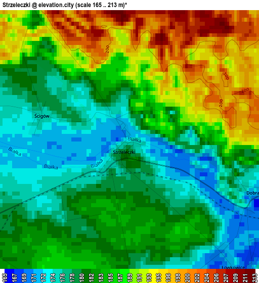
Below is the Elevation map of Strzeleczki, which displays elevation range with different colors. Scale of the first map is from 165 to 213 m (541 to 699 ft) with average elevation of 184 meters (=604 ft) [note 1]
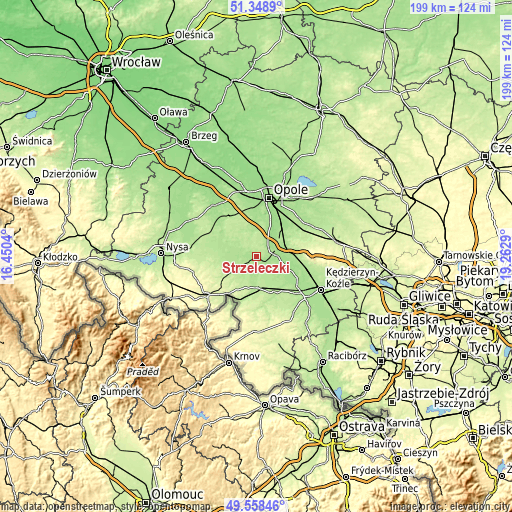
These maps also provides idea of topography and contour of this city, they are displayed at different zoom levels. More info about maps, scale and edge coordinates you can find below images.
| \ | Map #1 | Topo.Map |
| Scale [m] | 165..213 m | × |
| Scale [ft] | 541..699 ft | × |
| Average | 184 m = 604 ft | × |
| Width | 6.22 km = 3.9 mi | 199.1 km = 123.7 mi |
| Height | 6.22 km = 3.9 mi | 199.1 km = 123.7 mi |
| ↑Max Latitude | 50.490117° | 51.3489° |
| Latitude at center | 50.46215° | 50.46215° |
| ↓Min Latitude | 50.434167° | 49.55846° |
| ← Min Longitude | 17.812705° | 16.4504° |
| Longitude center | 17.85665° | 17.85665° |
| →Max Longitude | 17.900595° | 19.2629° |
Nearby cities:
Cities around Strzeleczki sort by population:
• Krapkowice elevation 176 m
7.8 km,  79°
79°
• Zdzieszowice 185 m
19.3 km,  102°
102°
• Gogolin 172 m
12 km,  73°
73°
• Głogówek 208 m
12.1 km,  177°
177°
• Prószków 184 m
12.8 km,  4°
4°
• Biała 234 m
16.3 km,  238°
238°
• Walce 182 m
14.4 km,  133°
133°
• Korfantów 200 m
18.5 km,  279°
279°
• Racławice Śląskie 205 m
17.7 km,  199°
199°
• Rozwadza 177 m
17.5 km, 99°
• Górażdże 170 m
13.2 km,  55°
55°
• Twardawa 193 m
16.3 km,  144°
144°
Multilingual:
 En español:
Strzeleczki elevación 172 m.
 En France:
Strzeleczki élévation 172 m.
 Auf Deutsch:
Strzeleczki höhe über dem Meeresspiegel ist 172 m.

Sources and notes:
- [note 1] Map square and city borders are not equal. Map elevation data is calculated only from area inside that square.
- [src 1] Elevation data from geonames database provided with same terms of usage.
- [src 2] The elevation map of Strzeleczki is generated using elevation data from NASA's 3 arcsec (90m) resolution SRTM data.
- [src 3] Base (background) map © OpenStreetMap contributors tiles are generated by Geofabrik and OpenTopoMap.
Copyright & License:
This Strzeleczki Elevation Map is licensed under CC BY-SA. You may reuse any part from this page, if you give a proper credit by linking to this URL:
 More info on terms of use page.