Twardogóra elevation
Twardogóra (Lower Silesia, Powiat oleśnicki), Poland elevation is 181 meters and Twardogóra elevation in feet is 594 ft above sea level [src 1]. Twardogóra is a populated place (feature code) with elevation that is 10 meters (33 ft) smaller than average city elevation in Poland.
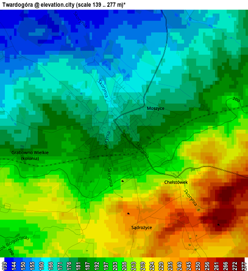
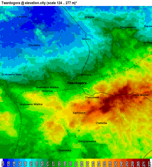
Below is the Elevation map of Twardogóra, which displays elevation range with different colors. Scale of the first map is from 139 to 277 m (456 to 909 ft) with average elevation of 192.3 meters (=631 ft) [note 1]
These maps also provides idea of topography and contour of this city, they are displayed at different zoom levels. More info about maps, scale and edge coordinates you can find below images.
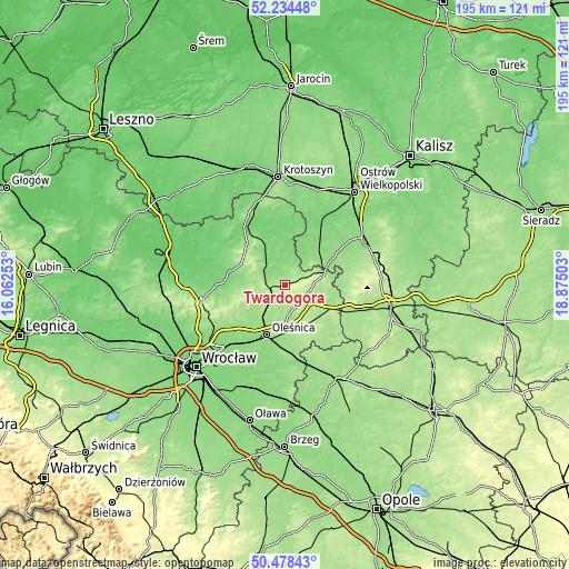
| \ | Map #1 | Map #2 | Topo.Map |
| Scale [m] | 139..277 m | 124..277 m | × |
| Scale [ft] | 456..909 ft | 407..909 ft | × |
| Average | 192.3 m = 631 ft | 184.4 m = 605 ft | × |
| Width | 6.1 km = 3.8 mi | 12.2 km = 7.6 mi | 195.3 km = 121.4 mi |
| Height | 6.1 km = 3.8 mi | 12.2 km = 7.6 mi | 195.2 km = 121.3 mi |
| ↑Max Latitude | 51.392299° | 51.419712° | 52.23448° |
| Latitude at center | 51.36487° | 51.36487° | 51.36487° |
| ↓Min Latitude | 51.337424° | 51.309962° | 50.47843° |
| ← Min Longitude | 17.424835° | 17.380889° | 16.06253° |
| Longitude center | 17.46878° | 17.46878° | 17.46878° |
| →Max Longitude | 17.512725° | 17.556671° | 18.87503° |
Nearby cities:
Cities around Twardogóra sort by population:
• Oleśnica elevation 153 m
17.7 km,  198°
198°
• Milicz 106 m
22.7 km,  322°
322°
• Syców 169 m
18.5 km,  109°
109°
• Sulmierzyce 126 m
27.1 km,  9°
9°
• Dobroszyce 162 m
13.9 km,  219°
219°
• Międzybórz 176 m
14.1 km,  75°
75°
• Kobyla Góra 201 m
25.7 km,  86°
86°
• Krośnice 137 m
14.5 km,  328°
328°
• Sułów 105 m
25.7 km,  305°
305°
• Sośnie 128 m
16.6 km,  43°
43°
• Dziadowa Kłoda 168 m
22.1 km,  130°
130°
• Perzów 177 m
25.7 km, 112°
Multilingual:
 En español:
Twardogóra elevación 181 m.
 En France:
Twardogóra élévation 181 m.
 Auf Deutsch:
Twardogóra höhe über dem Meeresspiegel ist 181 m.

Sources and notes:
- [note 1] Map square and city borders are not equal. Map elevation data is calculated only from area inside that square.
- [src 1] Elevation data from geonames database provided with same terms of usage.
- [src 2] The elevation map of Twardogóra is generated using elevation data from NASA's 3 arcsec (90m) resolution SRTM data.
- [src 3] Base (background) map © OpenStreetMap contributors tiles are generated by Geofabrik and OpenTopoMap.
Copyright & License:
This Twardogóra Elevation Map is licensed under CC BY-SA. You may reuse any part from this page, if you give a proper credit by linking to this URL:
 More info on terms of use page.