Tychy elevation
Tychy (Silesia), Poland elevation is 259 meters and Tychy elevation in feet is 850 ft above sea level [src 1]. Tychy is a seat of a third-order administrative division (feature code) with elevation that is 68 meters (223 ft) bigger than average city elevation in Poland.
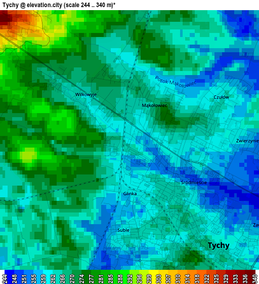
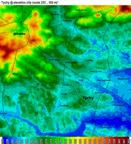
Below is the Elevation map of Tychy, which displays elevation range with different colors. Scale of the first map is from 244 to 340 m (801 to 1115 ft) with average elevation of 266.8 meters (=875 ft) [note 1]
These maps also provides idea of topography and contour of this city, they are displayed at different zoom levels. More info about maps, scale and edge coordinates you can find below images.
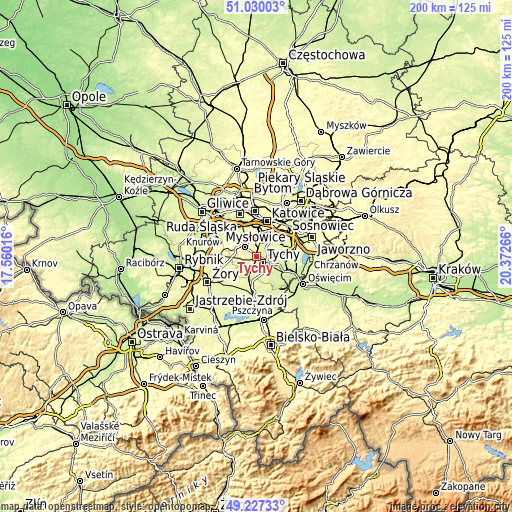
| \ | Map #1 | Map #2 | Topo.Map |
| Scale [m] | 244..340 m | 233..352 m | × |
| Scale [ft] | 801..1115 ft | 764..1155 ft | × |
| Average | 266.8 m = 875 ft | 268.4 m = 881 ft | × |
| Width | 6.26 km = 3.9 mi | 12.53 km = 7.8 mi | 200.4 km = 124.5 mi |
| Height | 6.26 km = 3.9 mi | 12.53 km = 7.8 mi | 200.4 km = 124.5 mi |
| ↑Max Latitude | 50.165329° | 50.19347° | 51.03003° |
| Latitude at center | 50.13717° | 50.13717° | 50.13717° |
| ↓Min Latitude | 50.108995° | 50.080803° | 49.22733° |
| ← Min Longitude | 18.922465° | 18.878519° | 17.56016° |
| Longitude center | 18.96641° | 18.96641° | 18.96641° |
| →Max Longitude | 19.010355° | 19.054301° | 20.37266° |
Nearby cities:
Cities around Tychy sort by population:
• Mikołów elevation 287 m
5.8 km,  310°
310°
• Łaziska Górne 349 m
9 km,  278°
278°
• Bieruń 239 m
10.4 km,  120°
120°
• Lędziny 263 m
11.8 km,  87°
87°
• Murcki 320 m
8.9 km,  38°
38°
• Kobiór 248 m
8.8 km,  194°
194°
• Wyry 282 m
4.7 km,  264°
264°
• Gostyń 254 m
7 km,  239°
239°
• Bojszowy 232 m
13.1 km,  132°
132°
• Gardawice 261 m
12.1 km, 259°
• Cielmice 248 m
6.6 km,  145°
145°
• Bojszowy Nowe 242 m
11.1 km, 147°
Multilingual:
 En español:
Tychy elevación 259 m.
 En France:
Tychy élévation 259 m.
 Auf Deutsch:
Tychy, Tichau höhe über dem Meeresspiegel ist 259 m.

Sources and notes:
- [note 1] Map square and city borders are not equal. Map elevation data is calculated only from area inside that square.
- [src 1] Elevation data from geonames database provided with same terms of usage.
- [src 2] The elevation map of Tychy is generated using elevation data from NASA's 3 arcsec (90m) resolution SRTM data.
- [src 3] Base (background) map © OpenStreetMap contributors tiles are generated by Geofabrik and OpenTopoMap.
Copyright & License:
This Tychy Elevation Map is licensed under CC BY-SA. You may reuse any part from this page, if you give a proper credit by linking to this URL:
 More info on terms of use page.