Wadowice elevation
Wadowice (Lesser Poland, Powiat wadowicki), Poland elevation is 271 meters and Wadowice elevation in feet is 889 ft above sea level [src 1]. Wadowice is a seat of a second-order administrative division (feature code) with elevation that is 80 meters (262 ft) bigger than average city elevation in Poland.
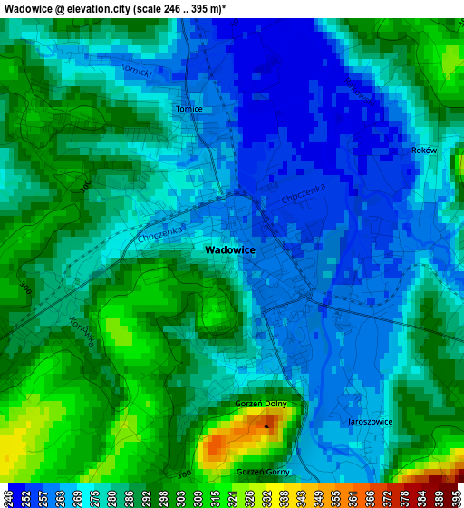
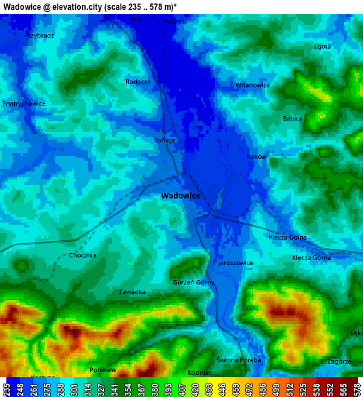
Below is the Elevation map of Wadowice, which displays elevation range with different colors. Scale of the first map is from 246 to 395 m (807 to 1296 ft) with average elevation of 281.4 meters (=923 ft) [note 1]
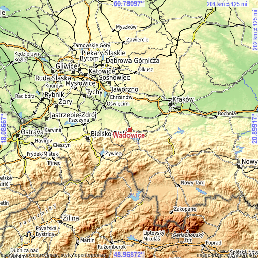
These maps also provides idea of topography and contour of this city, they are displayed at different zoom levels. More info about maps, scale and edge coordinates you can find below images.
| \ | Map #1 | Map #2 | Topo.Map |
| Scale [m] | 246..395 m | 235..578 m | × |
| Scale [ft] | 807..1296 ft | 771..1896 ft | × |
| Average | 281.4 m = 923 ft | 317.4 m = 1041 ft | × |
| Width | 6.3 km = 3.9 mi | 12.59 km = 7.8 mi | 201.5 km = 125.2 mi |
| Height | 6.3 km = 3.9 mi | 12.59 km = 7.8 mi | 201.5 km = 125.2 mi |
| ↑Max Latitude | 49.911658° | 49.939949° | 50.78097° |
| Latitude at center | 49.88335° | 49.88335° | 49.88335° |
| ↓Min Latitude | 49.855026° | 49.826685° | 48.96872° |
| ← Min Longitude | 19.448975° | 19.405029° | 18.08667° |
| Longitude center | 19.49292° | 19.49292° | 19.49292° |
| →Max Longitude | 19.536865° | 19.580811° | 20.89917° |
Nearby cities:
Cities around Wadowice sort by population:
• Chocznia elevation 288 m
2.9 km,  249°
249°
• Inwałd 319 m
7.5 km, 252°
• Frydrychowice 259 m
5.8 km,  294°
294°
• Bachowice 298 m
8.3 km,  0°
0°
• Klecza Dolna 288 m
3.2 km,  90°
90°
• Tomice 267 m
1.7 km,  337°
337°
• Radocza 265 m
4 km, 341°
• Jaroszowice 266 m
3 km,  140°
140°
• Barwałd Średni 334 m
7.5 km,  104°
104°
• Ponikiew 347 m
5.9 km,  199°
199°
• Woźniki 248 m
6 km,  358°
358°
• Witanowice 280 m
4.5 km,  31°
31°
Multilingual:
 En español:
Wadowice elevación 271 m.
 En France:
Wadowice élévation 271 m.
 Auf Deutsch:
Wadowice höhe über dem Meeresspiegel ist 271 m.

Sources and notes:
- [note 1] Map square and city borders are not equal. Map elevation data is calculated only from area inside that square.
- [src 1] Elevation data from geonames database provided with same terms of usage.
- [src 2] The elevation map of Wadowice is generated using elevation data from NASA's 3 arcsec (90m) resolution SRTM data.
- [src 3] Base (background) map © OpenStreetMap contributors tiles are generated by Geofabrik and OpenTopoMap.
Copyright & License:
This Wadowice Elevation Map is licensed under CC BY-SA. You may reuse any part from this page, if you give a proper credit by linking to this URL:
 More info on terms of use page.