Wieleń elevation
Wieleń (Greater Poland, Powiat czarnkowsko-trzcianecki), Poland elevation is 35 meters and Wieleń elevation in feet is 115 ft above sea level [src 1]. Wieleń is a seat of a third-order administrative division (feature code) with elevation that is 156 meters (512 ft) smaller than average city elevation in Poland.
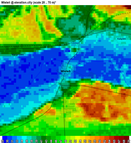
Below is the Elevation map of Wieleń, which displays elevation range with different colors. Scale of the first map is from 28 to 70 m (92 to 230 ft) with average elevation of 42.7 meters (=140 ft) [note 1]
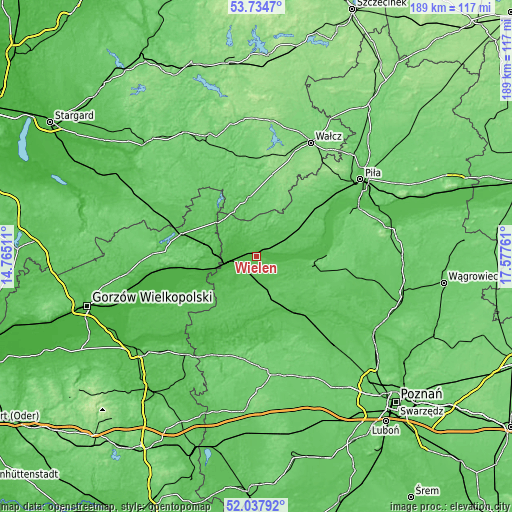
These maps also provides idea of topography and contour of this city, they are displayed at different zoom levels. More info about maps, scale and edge coordinates you can find below images.
| \ | Map #1 | Map #2 | Topo.Map |
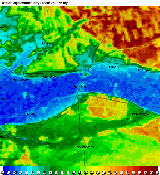
| Scale [m] | 28..70 m | 28..76 m | × |
| Scale [ft] | 92..230 ft | 92..249 ft | × |
| Average | 42.7 m = 140 ft | 47.5 m = 156 ft | × |
| Width | 5.9 km = 3.7 mi | 11.79 km = 7.3 mi | 188.7 km = 117.3 mi |
| Height | 5.9 km = 3.7 mi | 11.79 km = 7.3 mi | 188.6 km = 117.2 mi |
| ↑Max Latitude | 52.921113° | 52.9476° | 53.7347° |
| Latitude at center | 52.89461° | 52.89461° | 52.89461° |
| ↓Min Latitude | 52.86809° | 52.841555° | 52.03792° |
| ← Min Longitude | 16.127415° | 16.083469° | 14.76511° |
| Longitude center | 16.17136° | 16.17136° | 16.17136° |
| →Max Longitude | 16.215305° | 16.259251° | 17.57761° |
Nearby cities:
Cities around Wieleń sort by population:
• Trzcianka elevation 78 m
25.1 km,  49°
49°
• Czarnków 54 m
26.4 km,  88°
88°
• Wronki 47 m
24.8 km,  145°
145°
• Drezdenko 30 m
23.7 km,  254°
254°
• Krzyż Wielkopolski 32 m
10.9 km,  261°
261°
• Sieraków 42 m
27.7 km,  192°
192°
• Dobiegniew 66 m
29.2 km,  286°
286°
• Lubasz 80 m
24.1 km,  101°
101°
• Człopa 76 m
21.8 km,  351°
351°
• Obrzycko 47 m
32 km,  131°
131°
• Drawsko 45 m
10.4 km,  244°
244°
• Chrzypsko Wielkie 54 m
29.9 km,  172°
172°
Multilingual:
 En español:
Wieleń elevación 35 m.
 En France:
Wieleń élévation 35 m.


Sources and notes:
- [note 1] Map square and city borders are not equal. Map elevation data is calculated only from area inside that square.
- [src 1] Elevation data from geonames database provided with same terms of usage.
- [src 2] The elevation map of Wieleń is generated using elevation data from NASA's 3 arcsec (90m) resolution SRTM data.
- [src 3] Base (background) map © OpenStreetMap contributors tiles are generated by Geofabrik and OpenTopoMap.
Copyright & License:
This Wieleń Elevation Map is licensed under CC BY-SA. You may reuse any part from this page, if you give a proper credit by linking to this URL:
 More info on terms of use page.