Wierzchosławice elevation
Wierzchosławice (Kujawsko-Pomorskie, Powiat inowrocławski), Poland elevation is 81 meters and Wierzchosławice elevation in feet is 266 ft above sea level [src 1]. Wierzchosławice is a populated place (feature code) with elevation that is 110 meters (361 ft) smaller than average city elevation in Poland.
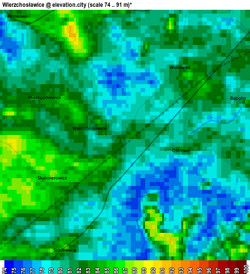
Below is the Elevation map of Wierzchosławice, which displays elevation range with different colors. Scale of the first map is from 74 to 91 m (243 to 299 ft) with average elevation of 80.6 meters (=264 ft) [note 1]
These maps also provides idea of topography and contour of this city, they are displayed at different zoom levels. More info about maps, scale and edge coordinates you can find below images.
| \ | Map #1 | Topo.Map |
| Scale [m] | 74..91 m | × |
| Scale [ft] | 243..299 ft | × |
| Average | 80.6 m = 264 ft | × |
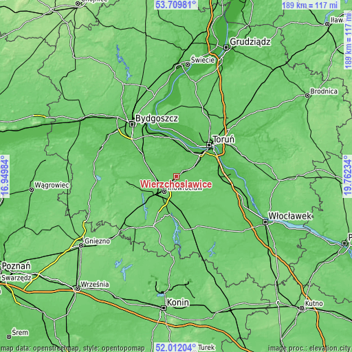
| Width | 5.9 km = 3.7 mi | 188.8 km = 117.3 mi |
| Height | 5.9 km = 3.7 mi | 188.8 km = 117.3 mi |
| ↑Max Latitude | 52.895749° | 53.70981° |
| Latitude at center | 52.86923° | 52.86923° |
| ↓Min Latitude | 52.842695° | 52.01204° |
| ← Min Longitude | 18.312145° | 16.94984° |
| Longitude center | 18.35609° | 18.35609° |
| →Max Longitude | 18.400035° | 19.76234° |
Nearby cities:
Cities around Wierzchosławice sort by population:
• Toruń elevation 51 m
22.8 km,  45°
45°
• Inowrocław 98 m
10 km,  218°
218°
• Aleksandrów Kujawski 72 m
22.7 km,  87°
87°
• Kruszwica 83 m
21.6 km,  184°
184°
• Janikowo 92 m
20.8 km,  231°
231°
• Gniewkowo 79 m
4.5 km, 50°
• Pakość 80 m
19.7 km,  247°
247°
• Dobre 88 m
25.4 km,  144°
144°
• Złotniki Kujawskie 83 m
14.5 km,  283°
283°
• Nowa Wieś Wielka 71 m
21.1 km,  302°
302°
• Zławieś Wielka 34 m
25.2 km,  355°
355°
• Wielka Nieszawka 37 m
17.5 km,  36°
36°
Multilingual:
 En español:
Wierzchosławice elevación 81 m.
 En France:
Wierzchosławice élévation 81 m.
 Auf Deutsch:
Wierzchosławice höhe über dem Meeresspiegel ist 81 m.

Sources and notes:
- [note 1] Map square and city borders are not equal. Map elevation data is calculated only from area inside that square.
- [src 1] Elevation data from geonames database provided with same terms of usage.
- [src 2] The elevation map of Wierzchosławice is generated using elevation data from NASA's 3 arcsec (90m) resolution SRTM data.
- [src 3] Base (background) map © OpenStreetMap contributors tiles are generated by Geofabrik and OpenTopoMap.
Copyright & License:
This Wierzchosławice Elevation Map is licensed under CC BY-SA. You may reuse any part from this page, if you give a proper credit by linking to this URL:
 More info on terms of use page.