Wola elevation
Wola (Silesia, Powiat pszczyński), Poland elevation is 239 meters and Wola elevation in feet is 784 ft above sea level [src 1]. Wola is a populated place (feature code) with elevation that is 48 meters (157 ft) bigger than average city elevation in Poland.
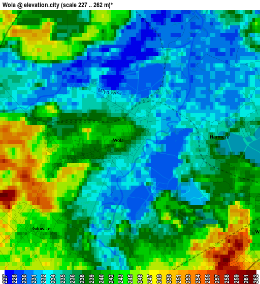
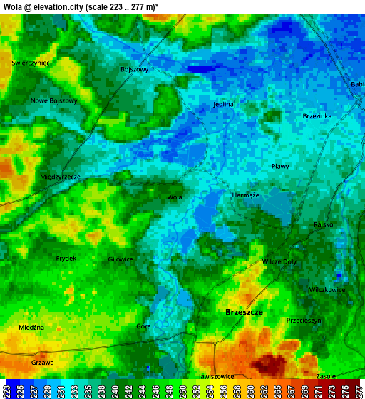
Below is the Elevation map of Wola, which displays elevation range with different colors. Scale of the first map is from 227 to 262 m (745 to 860 ft) with average elevation of 237.9 meters (=781 ft) [note 1]
These maps also provides idea of topography and contour of this city, they are displayed at different zoom levels. More info about maps, scale and edge coordinates you can find below images.
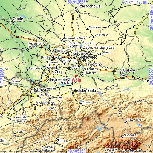
| \ | Map #1 | Map #2 | Topo.Map |
| Scale [m] | 227..262 m | 223..277 m | × |
| Scale [ft] | 745..860 ft | 732..909 ft | × |
| Average | 237.9 m = 781 ft | 241.2 m = 791 ft | × |
| Width | 6.28 km = 3.9 mi | 12.56 km = 7.8 mi | 200.9 km = 124.8 mi |
| Height | 6.28 km = 3.9 mi | 12.56 km = 7.8 mi | 200.9 km = 124.8 mi |
| ↑Max Latitude | 50.045679° | 50.073891° | 50.91256° |
| Latitude at center | 50.01745° | 50.01745° | 50.01745° |
| ↓Min Latitude | 49.989204° | 49.960942° | 49.10535° |
| ← Min Longitude | 19.079385° | 19.035439° | 17.71708° |
| Longitude center | 19.12333° | 19.12333° | 19.12333° |
| →Max Longitude | 19.167275° | 19.211221° | 20.52958° |
Nearby cities:
Cities around Wola sort by population:
• Oświęcim elevation 232 m
6.5 km,  73°
73°
• Brzeszcze 252 m
4.4 km,  152°
152°
• Bojszowy 232 m
4.8 km,  340°
340°
• Góra 242 m
4.4 km,  197°
197°
• Brzezinka 232 m
5.5 km,  59°
59°
• Miedźna 250 m
6.6 km,  233°
233°
• Babice 230 m
6.9 km,  52°
52°
• Rajsko 239 m
5 km,  97°
97°
• Gilowice 243 m
3.2 km,  217°
217°
• Bojszowy Nowe 242 m
6.5 km,  306°
306°
• Przecieszyn 252 m
5.5 km,  142°
142°
• Frydek 248 m
4.3 km,  236°
236°
Multilingual:
 En español:
Wola elevación 239 m.
 En France:
Wola élévation 239 m.


Sources and notes:
- [note 1] Map square and city borders are not equal. Map elevation data is calculated only from area inside that square.
- [src 1] Elevation data from geonames database provided with same terms of usage.
- [src 2] The elevation map of Wola is generated using elevation data from NASA's 3 arcsec (90m) resolution SRTM data.
- [src 3] Base (background) map © OpenStreetMap contributors tiles are generated by Geofabrik and OpenTopoMap.
Copyright & License:
This Wola Elevation Map is licensed under CC BY-SA. You may reuse any part from this page, if you give a proper credit by linking to this URL:
 More info on terms of use page.