Żarów elevation
Żarów (Lower Silesia, Powiat świdnicki), Poland elevation is 205 meters and Żarów elevation in feet is 673 ft above sea level [src 1]. Żarów is a populated place (feature code) with elevation that is 14 meters (46 ft) bigger than average city elevation in Poland.
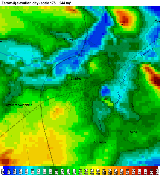
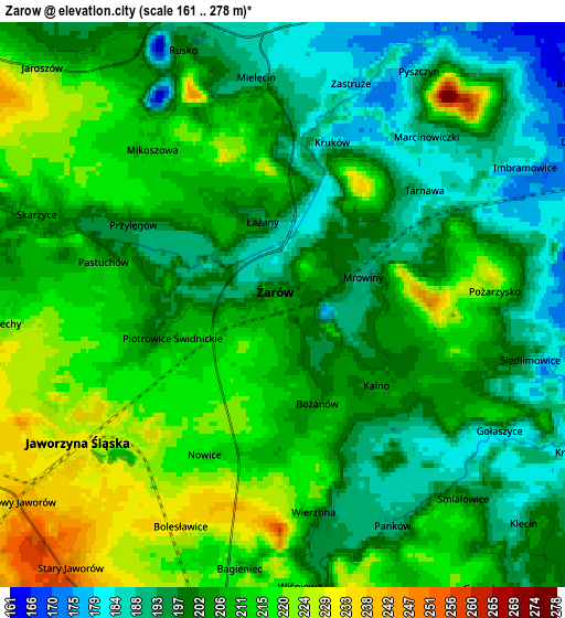
Below is the Elevation map of Żarów, which displays elevation range with different colors. Scale of the first map is from 178 to 244 m (584 to 801 ft) with average elevation of 203.1 meters (=666 ft) [note 1]
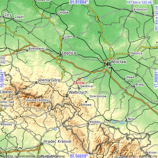
These maps also provides idea of topography and contour of this city, they are displayed at different zoom levels. More info about maps, scale and edge coordinates you can find below images.
| \ | Map #1 | Map #2 | Topo.Map |
| Scale [m] | 178..244 m | 161..278 m | × |
| Scale [ft] | 584..801 ft | 528..912 ft | × |
| Average | 203.1 m = 666 ft | 205.1 m = 673 ft | × |
| Width | 6.16 km = 3.8 mi | 12.32 km = 7.7 mi | 197.1 km = 122.5 mi |
| Height | 6.16 km = 3.8 mi | 12.32 km = 7.7 mi | 197 km = 122.4 mi |
| ↑Max Latitude | 50.968842° | 50.996508° | 51.81884° |
| Latitude at center | 50.94116° | 50.94116° | 50.94116° |
| ↓Min Latitude | 50.913461° | 50.885746° | 50.04659° |
| ← Min Longitude | 16.450715° | 16.406769° | 15.08841° |
| Longitude center | 16.49466° | 16.49466° | 16.49466° |
| →Max Longitude | 16.538605° | 16.582551° | 17.90091° |
Nearby cities:
Cities around Żarów sort by population:
• Świdnica elevation 241 m
10.8 km,  182°
182°
• Świebodzice 281 m
14.8 km,  232°
232°
• Strzegom 229 m
10.4 km,  283°
283°
• Sobótka 183 m
18.1 km,  104°
104°
• Szczawno-Zdrój 413 m
22.7 km, 227°
• Kąty Wrocławskie 136 m
21.6 km,  62°
62°
• Jaworzyna Śląska 232 m
5.3 km, 234°
• Ciechów 142 m
21.8 km,  13°
13°
• Stare Bogaczowice 367 m
23.6 km,  243°
243°
• Stanowice 224 m
8.5 km,  262°
262°
• Dziećmorowice 425 m
21.6 km,  207°
207°
• Udanin 178 m
11.1 km,  345°
345°
Multilingual:
 En español:
Żarów elevación 205 m.
 En France:
Żarów élévation 205 m.


Sources and notes:
- [note 1] Map square and city borders are not equal. Map elevation data is calculated only from area inside that square.
- [src 1] Elevation data from geonames database provided with same terms of usage.
- [src 2] The elevation map of Żarów is generated using elevation data from NASA's 3 arcsec (90m) resolution SRTM data.
- [src 3] Base (background) map © OpenStreetMap contributors tiles are generated by Geofabrik and OpenTopoMap.
Copyright & License:
This Żarów Elevation Map is licensed under CC BY-SA. You may reuse any part from this page, if you give a proper credit by linking to this URL:
 More info on terms of use page.