Zbąszynek elevation
Zbąszynek (Lubusz, Powiat świebodziński), Poland elevation is 77 meters and Zbąszynek elevation in feet is 253 ft above sea level [src 1]. Zbąszynek is a seat of a third-order administrative division (feature code) with elevation that is 114 meters (374 ft) smaller than average city elevation in Poland.
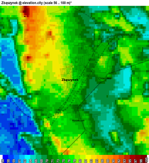
Below is the Elevation map of Zbąszynek, which displays elevation range with different colors. Scale of the first map is from 56 to 100 m (184 to 328 ft) with average elevation of 72.9 meters (=239 ft) [note 1]
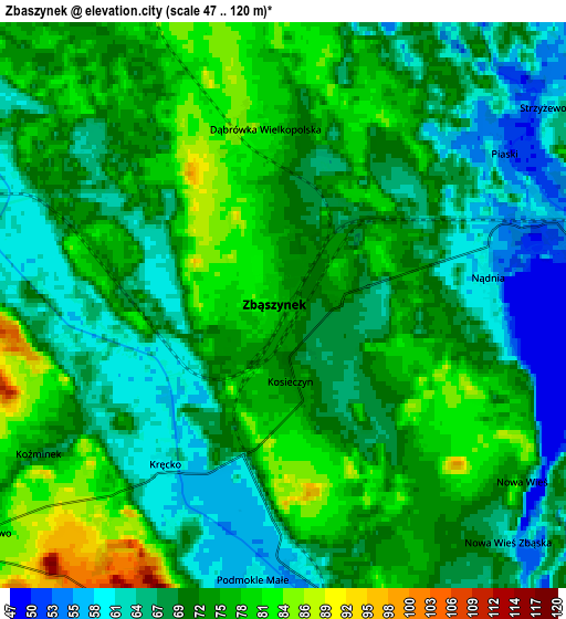
These maps also provides idea of topography and contour of this city, they are displayed at different zoom levels. More info about maps, scale and edge coordinates you can find below images.
| \ | Map #1 | Map #2 | Topo.Map |
| Scale [m] | 56..100 m | 47..120 m | × |
| Scale [ft] | 184..328 ft | 154..394 ft | × |
| Average | 72.9 m = 239 ft | 71.5 m = 235 ft | × |
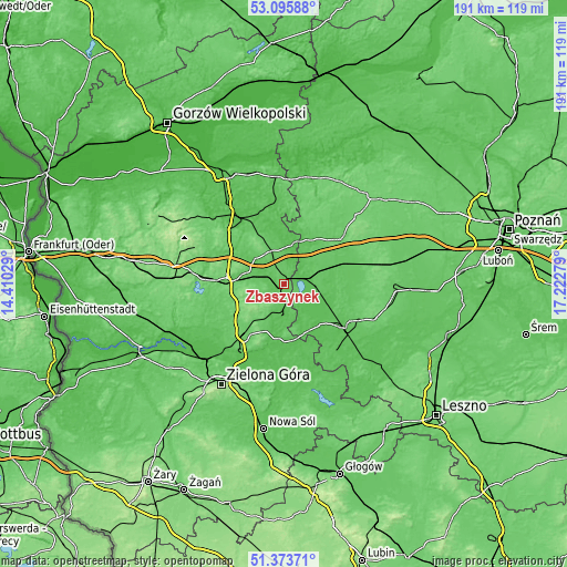
| Width | 5.98 km = 3.7 mi | 11.97 km = 7.4 mi | 191.5 km = 119 mi |
| Height | 5.98 km = 3.7 mi | 11.97 km = 7.4 mi | 191.5 km = 119 mi |
| ↑Max Latitude | 52.27005° | 52.296934° | 53.09588° |
| Latitude at center | 52.24315° | 52.24315° | 52.24315° |
| ↓Min Latitude | 52.216234° | 52.189301° | 51.37371° |
| ← Min Longitude | 15.772595° | 15.728649° | 14.41029° |
| Longitude center | 15.81654° | 15.81654° | 15.81654° |
| →Max Longitude | 15.860485° | 15.904431° | 17.22279° |
Nearby cities:
Cities around Zbąszynek sort by population:
• Świebodzin elevation 81 m
19.3 km,  271°
271°
• Sulechów 85 m
22 km,  216°
216°
• Nowy Tomyśl 74 m
22.9 km,  68°
68°
• Wolsztyn 63 m
24.9 km,  124°
124°
• Zbąszyń 59 m
7.4 km,  83°
83°
• Babimost 57 m
8.7 km,  175°
175°
• Kargowa 59 m
19.3 km,  170°
170°
• Trzciel 56 m
14.1 km,  15°
15°
• Szczaniec 70 m
9.6 km,  287°
287°
• Siedlec 61 m
17.3 km,  132°
132°
• Brójce 67 m
12.7 km,  310°
310°
• Miedzichowo 67 m
17.6 km,  33°
33°
Multilingual:
 En español:
Zbąszynek elevación 77 m.
 En France:
Zbąszynek élévation 77 m.
 Auf Deutsch:
Zbąszynek höhe über dem Meeresspiegel ist 77 m.

Sources and notes:
- [note 1] Map square and city borders are not equal. Map elevation data is calculated only from area inside that square.
- [src 1] Elevation data from geonames database provided with same terms of usage.
- [src 2] The elevation map of Zbąszynek is generated using elevation data from NASA's 3 arcsec (90m) resolution SRTM data.
- [src 3] Base (background) map © OpenStreetMap contributors tiles are generated by Geofabrik and OpenTopoMap.
Copyright & License:
This Zbąszynek Elevation Map is licensed under CC BY-SA. You may reuse any part from this page, if you give a proper credit by linking to this URL:
 More info on terms of use page.