Agupit elevation
Agupit (Bicol, Province of Camarines Sur), Philippines elevation is 13 meters and Agupit elevation in feet is 43 ft above sea level [src 1]. Agupit is a populated place (feature code) with elevation that is 75 meters (246 ft) smaller than average city elevation in Philippines.
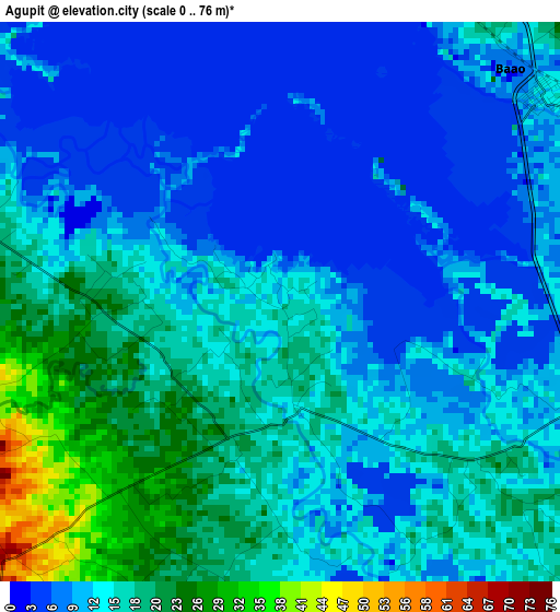
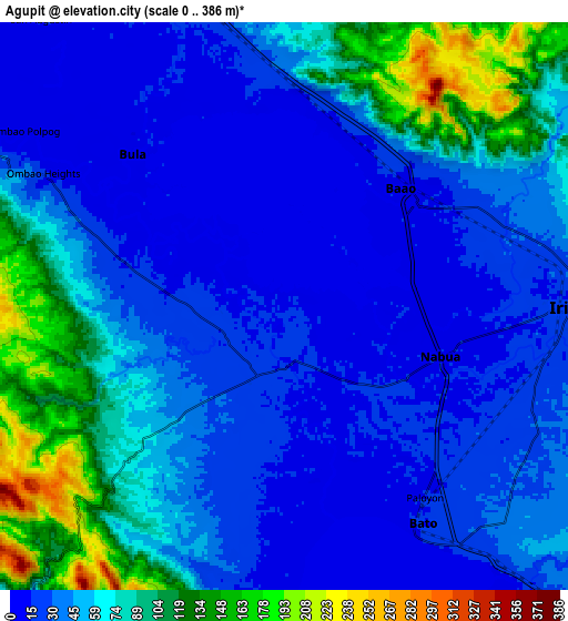
Below is the Elevation map of Agupit, which displays elevation range with different colors. Scale of the first map is from 0 to 76 m (0 to 249 ft) with average elevation of 13 meters (=43 ft) [note 1]
These maps also provides idea of topography and contour of this city, they are displayed at different zoom levels. More info about maps, scale and edge coordinates you can find below images.
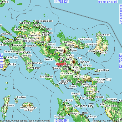
| \ | Map #1 | Map #2 | Topo.Map |
| Scale [m] | 0..76 m | 0..386 m | × |
| Scale [ft] | 0..249 ft | 0..1266 ft | × |
| Average | 13 m = 43 ft | 51.8 m = 170 ft | × |
| Width | 9.51 km = 5.9 mi | 19.01 km = 11.8 mi | 304.2 km = 189 mi |
| Height | 9.51 km = 5.9 mi | 19.01 km = 11.8 mi | 304.2 km = 189 mi |
| ↑Max Latitude | 13.465241° | 13.507975° | 14.78632° |
| Latitude at center | 13.4225° | 13.4225° | 13.4225° |
| ↓Min Latitude | 13.379751° | 13.336995° | 12.05089° |
| ← Min Longitude | 123.280775° | 123.236829° | 121.91847° |
| Longitude center | 123.32472° | 123.32472° | 123.32472° |
| →Max Longitude | 123.368665° | 123.412611° | 124.73097° |
Nearby cities:
Cities around Agupit sort by population:
• Nabua elevation 13 m
5.4 km,  107°
107°
• Baao 12 m
5.7 km,  50°
50°
• Bula 12 m
7.3 km,  316°
316°
• Palsong 18 m
3.1 km,  274°
274°
• Lourdes 16 m
6.4 km,  124°
124°
• Fabrica 12 m
8.2 km,  336°
336°
• San Vicente 16 m
6.2 km,  57°
57°
• Malawag 70 m
6.2 km,  225°
225°
• Balaogan 18 m
4.8 km,  283°
283°
• Inapatan 17 m
2.9 km,  184°
184°
• Salvacion 30 m
7.2 km, 50°
• Bagumbayan 58 m
8.5 km, 55°
Multilingual:
 En español:
Agupit elevación 13 m.
 En France:
Agupit élévation 13 m.


Sources and notes:
- [note 1] Map square and city borders are not equal. Map elevation data is calculated only from area inside that square.
- [src 1] Elevation data from geonames database provided with same terms of usage.
- [src 2] The elevation map of Agupit is generated using elevation data from NASA's 3 arcsec (90m) resolution SRTM data.
- [src 3] Base (background) map © OpenStreetMap contributors tiles are generated by Geofabrik and OpenTopoMap.
Copyright & License:
This Agupit Elevation Map is licensed under CC BY-SA. You may reuse any part from this page, if you give a proper credit by linking to this URL:
 More info on terms of use page.