Alimodian elevation
Alimodian (Western Visayas, Province of Iloilo), Philippines elevation is 69 meters and Alimodian elevation in feet is 226 ft above sea level [src 1]. Alimodian is a seat of a third-order administrative division (feature code) with elevation that is 19 meters (62 ft) smaller than average city elevation in Philippines.
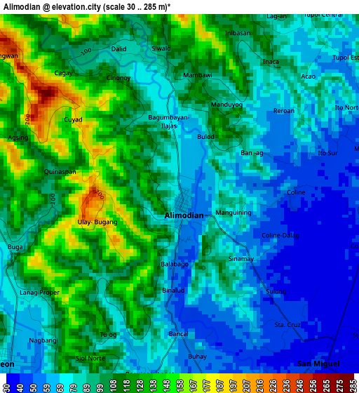
Below is the Elevation map of Alimodian, which displays elevation range with different colors. Scale of the first map is from 30 to 285 m (98 to 935 ft) with average elevation of 94.3 meters (=309 ft) [note 1]
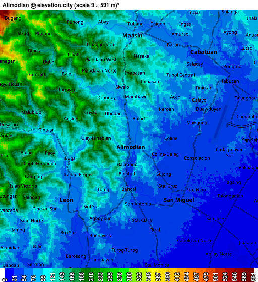
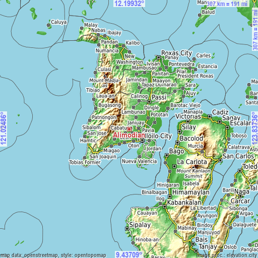
These maps also provides idea of topography and contour of this city, they are displayed at different zoom levels. More info about maps, scale and edge coordinates you can find below images.
| \ | Map #1 | Map #2 | Topo.Map |
| Scale [m] | 30..285 m | 9..591 m | × |
| Scale [ft] | 98..935 ft | 30..1939 ft | × |
| Average | 94.3 m = 309 ft | 100 m = 328 ft | × |
| Width | 9.6 km = 6 mi | 19.2 km = 11.9 mi | 307.1 km = 190.8 mi |
| Height | 9.6 km = 6 mi | 19.2 km = 11.9 mi | 307.2 km = 190.9 mi |
| ↑Max Latitude | 10.864551° | 10.907705° | 12.19932° |
| Latitude at center | 10.82139° | 10.82139° | 10.82139° |
| ↓Min Latitude | 10.778223° | 10.73505° | 9.43709° |
| ← Min Longitude | 122.387165° | 122.343219° | 121.02486° |
| Longitude center | 122.43111° | 122.43111° | 122.43111° |
| →Max Longitude | 122.475055° | 122.519001° | 123.83736° |
Nearby cities:
Cities around Alimodian sort by population:
• San Miguel elevation 40 m
5.9 km,  140°
140°
• Cabatuan 60 m
8.8 km,  42°
42°
• Leon 68 m
6.4 km,  225°
225°
• Maasin 84 m
7.9 km,  2°
2°
• Balabag 22 m
9.4 km,  133°
133°
• Bolong 28 m
9.4 km,  93°
93°
• Jibao-an 28 m
8.6 km,  119°
119°
• San Antonio 48 m
3.1 km, 139°
• Santa Monica 32 m
9.8 km,  165°
165°
• Balibagan Oeste 26 m
9.6 km,  104°
104°
• Tiring 46 m
8.8 km,  68°
68°
• Cadagmayan Norte 60 m
7.5 km, 93°
Multilingual:
 En español:
Alimodian elevación 69 m.
 En France:
Alimodian élévation 69 m.
 Auf Deutsch:
Alimodian höhe über dem Meeresspiegel ist 69 m.

Sources and notes:
- [note 1] Map square and city borders are not equal. Map elevation data is calculated only from area inside that square.
- [src 1] Elevation data from geonames database provided with same terms of usage.
- [src 2] The elevation map of Alimodian is generated using elevation data from NASA's 3 arcsec (90m) resolution SRTM data.
- [src 3] Base (background) map © OpenStreetMap contributors tiles are generated by Geofabrik and OpenTopoMap.
Copyright & License:
This Alimodian Elevation Map is licensed under CC BY-SA. You may reuse any part from this page, if you give a proper credit by linking to this URL:
 More info on terms of use page.