Anakan elevation
Anakan (Northern Mindanao, Province of Misamis Oriental), Philippines elevation is 26 meters and Anakan elevation in feet is 85 ft above sea level [src 1]. Anakan is a populated place (feature code) with elevation that is 62 meters (203 ft) smaller than average city elevation in Philippines.
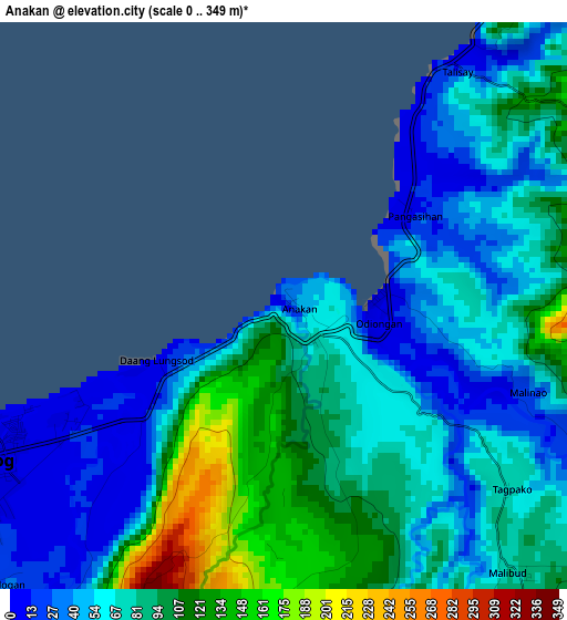
Below is the Elevation map of Anakan, which displays elevation range with different colors. Scale of the first map is from 0 to 349 m (0 to 1145 ft) with average elevation of 74.6 meters (=245 ft) [note 1]
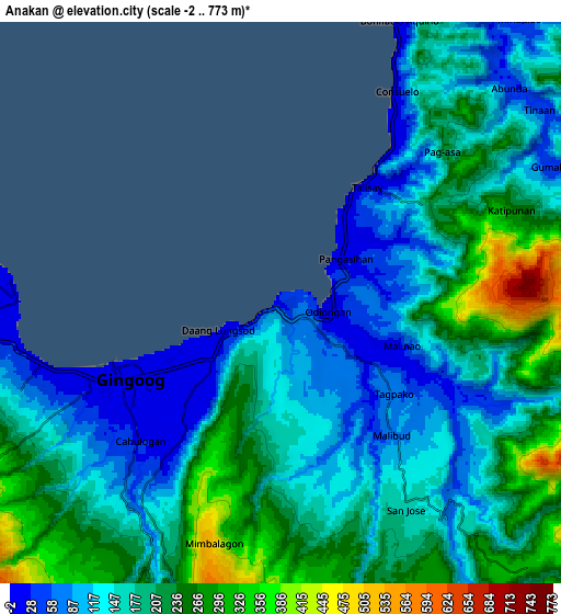
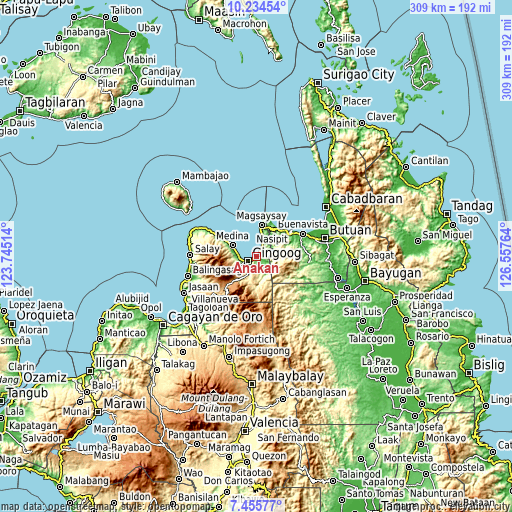
These maps also provides idea of topography and contour of this city, they are displayed at different zoom levels. More info about maps, scale and edge coordinates you can find below images.
| \ | Map #1 | Map #2 | Topo.Map |
| Scale [m] | 0..349 m | -2..773 m | × |
| Scale [ft] | 0..1145 ft | -7..2536 ft | × |
| Average | 74.6 m = 245 ft | 178.4 m = 585 ft | × |
| Width | 9.66 km = 6 mi | 19.31 km = 12 mi | 309 km = 192 mi |
| Height | 9.66 km = 6 mi | 19.31 km = 12 mi | 309 km = 192 mi |
| ↑Max Latitude | 8.8912° | 8.934614° | 10.23454° |
| Latitude at center | 8.84778° | 8.84778° | 8.84778° |
| ↓Min Latitude | 8.804355° | 8.760925° | 7.45577° |
| ← Min Longitude | 125.107445° | 125.063499° | 123.74514° |
| Longitude center | 125.15139° | 125.15139° | 125.15139° |
| →Max Longitude | 125.195335° | 125.239281° | 126.55764° |
Nearby cities:
Cities around Anakan sort by population:
• Mariano elevation 3 m
4.1 km,  247°
247°
• Medina 8 m
15.7 km,  297°
297°
• Lunao 10 m
10.4 km,  271°
271°
• Minlagas 8 m
12.8 km,  285°
285°
• Odiongan 5 m
1.7 km,  97°
97°
• Maanas 9 m
14.2 km, 291°
• Malinaw 24 m
5.2 km,  118°
118°
• Consuelo 20 m
7.2 km,  33°
33°
• Tagcatong 34 m
20.7 km, 34°
• Kibonsod 17 m
18.8 km,  19°
19°
• Candiis 10 m
14.1 km,  14°
14°
• Magsaysay 17 m
19.5 km, 10°
Multilingual:
 En español:
Anakan elevación 26 m.
 En France:
Anakan élévation 26 m.


Sources and notes:
- [note 1] Map square and city borders are not equal. Map elevation data is calculated only from area inside that square.
- [src 1] Elevation data from geonames database provided with same terms of usage.
- [src 2] The elevation map of Anakan is generated using elevation data from NASA's 3 arcsec (90m) resolution SRTM data.
- [src 3] Base (background) map © OpenStreetMap contributors tiles are generated by Geofabrik and OpenTopoMap.
Copyright & License:
This Anakan Elevation Map is licensed under CC BY-SA. You may reuse any part from this page, if you give a proper credit by linking to this URL:
 More info on terms of use page.