Atipuluhan elevation
Atipuluhan (Western Visayas, Province of Negros Occidental), Philippines elevation is 39 meters and Atipuluhan elevation in feet is 128 ft above sea level [src 1]. Atipuluhan is a populated place (feature code) with elevation that is 49 meters (161 ft) smaller than average city elevation in Philippines.
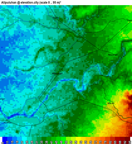
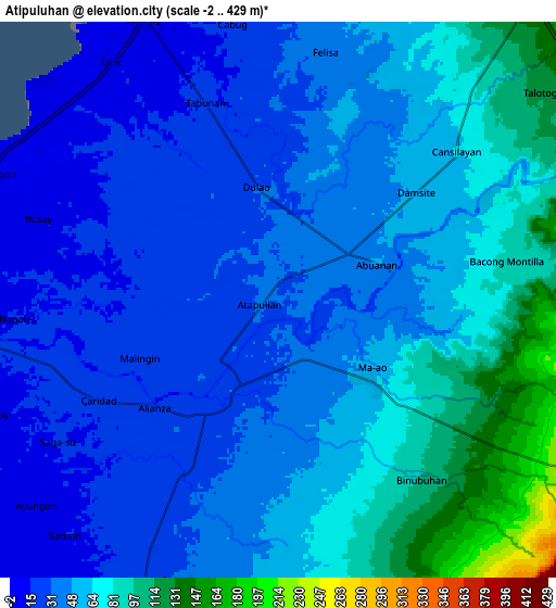
Below is the Elevation map of Atipuluhan, which displays elevation range with different colors. Scale of the first map is from 8 to 95 m (26 to 312 ft) with average elevation of 34.3 meters (=113 ft) [note 1]
These maps also provides idea of topography and contour of this city, they are displayed at different zoom levels. More info about maps, scale and edge coordinates you can find below images.
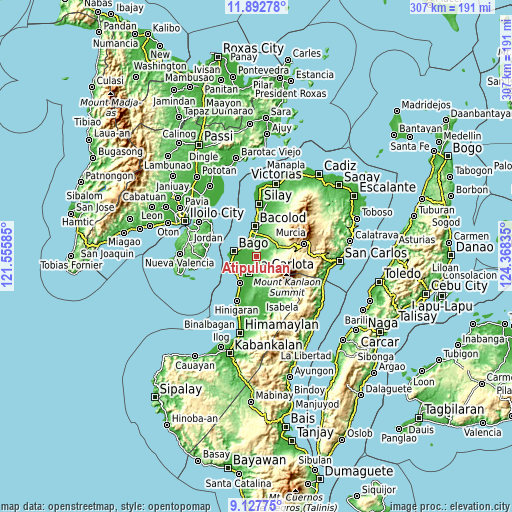
| \ | Map #1 | Map #2 | Topo.Map |
| Scale [m] | 8..95 m | -2..429 m | × |
| Scale [ft] | 26..312 ft | -7..1407 ft | × |
| Average | 34.3 m = 113 ft | 52.3 m = 172 ft | × |
| Width | 9.61 km = 6 mi | 19.22 km = 11.9 mi | 307.4 km = 191 mi |
| Height | 9.61 km = 6 mi | 19.22 km = 11.9 mi | 307.5 km = 191.1 mi |
| ↑Max Latitude | 10.556565° | 10.599763° | 11.89278° |
| Latitude at center | 10.51336° | 10.51336° | 10.51336° |
| ↓Min Latitude | 10.470149° | 10.426933° | 9.12775° |
| ← Min Longitude | 122.918155° | 122.874209° | 121.55585° |
| Longitude center | 122.9621° | 122.9621° | 122.9621° |
| →Max Longitude | 123.006045° | 123.049991° | 124.36835° |
Nearby cities:
Cities around Atipuluhan sort by population:
• La Carlota elevation 27 m
10.9 km,  204°
204°
• Maao 59 m
4.1 km,  130°
130°
• Taloc 8 m
10 km,  313°
313°
• Sumag 6 m
10.9 km,  334°
334°
• Dulao 27 m
4.1 km,  320°
320°
• Busay 12 m
8.8 km,  288°
288°
• Napoles 23 m
7.1 km,  261°
261°
• La Granja 117 m
12.1 km,  165°
165°
• Sagasa 21 m
9 km,  235°
235°
• Cansilayan 68 m
8 km,  50°
50°
• San Miguel 239 m
12.7 km,  149°
149°
• Caridad 20 m
7.3 km, 255°
Multilingual:
 En español:
Atipuluhan elevación 39 m.
 En France:
Atipuluhan élévation 39 m.
 Auf Deutsch:
Atipuluhan höhe über dem Meeresspiegel ist 39 m.

Sources and notes:
- [note 1] Map square and city borders are not equal. Map elevation data is calculated only from area inside that square.
- [src 1] Elevation data from geonames database provided with same terms of usage.
- [src 2] The elevation map of Atipuluhan is generated using elevation data from NASA's 3 arcsec (90m) resolution SRTM data.
- [src 3] Base (background) map © OpenStreetMap contributors tiles are generated by Geofabrik and OpenTopoMap.
Copyright & License:
This Atipuluhan Elevation Map is licensed under CC BY-SA. You may reuse any part from this page, if you give a proper credit by linking to this URL:
 More info on terms of use page.