Bacong elevation
Bacong (Central Visayas, Province of Negros Oriental), Philippines elevation is 14 meters and Bacong elevation in feet is 46 ft above sea level [src 1]. Bacong is a seat of a third-order administrative division (feature code) with elevation that is 74 meters (243 ft) smaller than average city elevation in Philippines.
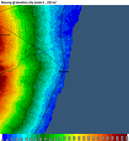
Below is the Elevation map of Bacong, which displays elevation range with different colors. Scale of the first map is from 0 to 225 m (0 to 738 ft) with average elevation of 80.3 meters (=263 ft) [note 1]
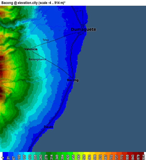
These maps also provides idea of topography and contour of this city, they are displayed at different zoom levels. More info about maps, scale and edge coordinates you can find below images.
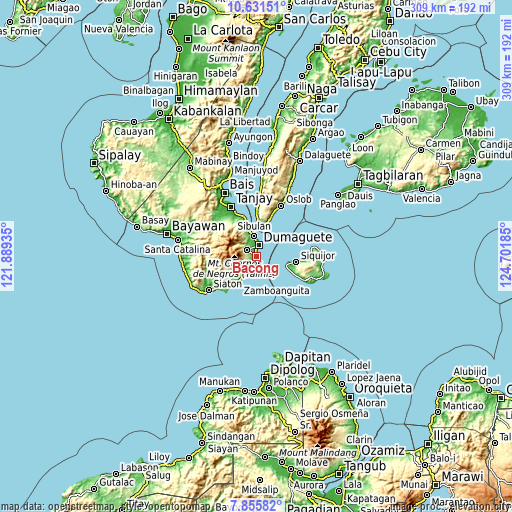
| \ | Map #1 | Map #2 | Topo.Map |
| Scale [m] | 0..225 m | -4..914 m | × |
| Scale [ft] | 0..738 ft | -13..2999 ft | × |
| Average | 80.3 m = 263 ft | 190.9 m = 626 ft | × |
| Width | 9.65 km = 6 mi | 19.29 km = 12 mi | 308.6 km = 191.8 mi |
| Height | 9.65 km = 6 mi | 19.29 km = 12 mi | 308.7 km = 191.8 mi |
| ↑Max Latitude | 9.289772° | 9.333138° | 10.63151° |
| Latitude at center | 9.2464° | 9.2464° | 9.2464° |
| ↓Min Latitude | 9.203023° | 9.159641° | 7.85582° |
| ← Min Longitude | 123.251655° | 123.207709° | 121.88935° |
| Longitude center | 123.2956° | 123.2956° | 123.2956° |
| →Max Longitude | 123.339545° | 123.383491° | 124.70185° |
Nearby cities:
Cities around Bacong sort by population:
• Dumaguete elevation 15 m
6.8 km,  6°
6°
• Sibulan 10 m
12.5 km,  354°
354°
• Mayabon 14 m
21.4 km,  218°
218°
• Zamboanguita 11 m
19.2 km,  213°
213°
• Maayong Tubig 13 m
10.3 km, 211°
• Dauin 23 m
7 km, 208°
• Malway 19 m
15.2 km, 212°
• San Miguel 18 m
2.7 km,  204°
204°
• Banilad 17 m
3.6 km,  356°
356°
• Santander Poblacion 74 m
20.4 km, 13°
• San Jose 35 m
19.5 km,  341°
341°
• Valencia 203 m
6.7 km,  305°
305°
Multilingual:
 En español:
Bacong elevación 14 m.
 En France:
Bacong élévation 14 m.


Sources and notes:
- [note 1] Map square and city borders are not equal. Map elevation data is calculated only from area inside that square.
- [src 1] Elevation data from geonames database provided with same terms of usage.
- [src 2] The elevation map of Bacong is generated using elevation data from NASA's 3 arcsec (90m) resolution SRTM data.
- [src 3] Base (background) map © OpenStreetMap contributors tiles are generated by Geofabrik and OpenTopoMap.
Copyright & License:
This Bacong Elevation Map is licensed under CC BY-SA. You may reuse any part from this page, if you give a proper credit by linking to this URL:
 More info on terms of use page.