Bacungan elevation
Bacungan (Mimaropa, Province of Palawan), Philippines elevation is 9 meters and Bacungan elevation in feet is 30 ft above sea level [src 1]. Bacungan is a populated place (feature code) with elevation that is 79 meters (259 ft) smaller than average city elevation in Philippines.
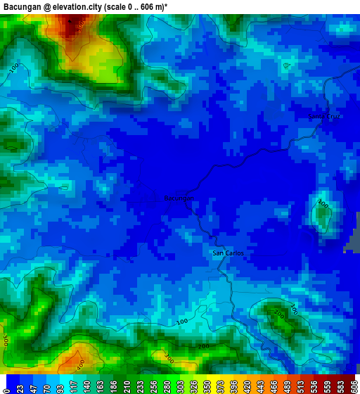
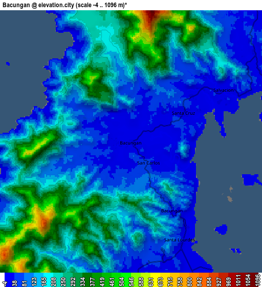
Below is the Elevation map of Bacungan, which displays elevation range with different colors. Scale of the first map is from 0 to 606 m (0 to 1988 ft) with average elevation of 91.5 meters (=300 ft) [note 1]
These maps also provides idea of topography and contour of this city, they are displayed at different zoom levels. More info about maps, scale and edge coordinates you can find below images.
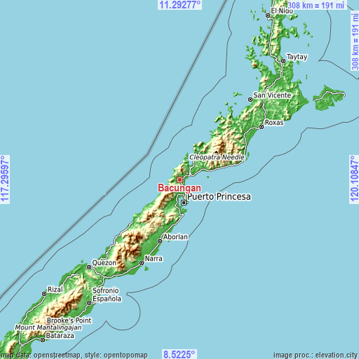
| \ | Map #1 | Map #2 | Topo.Map |
| Scale [m] | 0..606 m | -4..1096 m | × |
| Scale [ft] | 0..1988 ft | -13..3596 ft | × |
| Average | 91.5 m = 300 ft | 176.5 m = 579 ft | × |
| Width | 9.63 km = 6 mi | 19.25 km = 12 mi | 308 km = 191.4 mi |
| Height | 9.63 km = 6 mi | 19.25 km = 12 mi | 308.1 km = 191.4 mi |
| ↑Max Latitude | 9.953847° | 9.997128° | 11.29277° |
| Latitude at center | 9.91056° | 9.91056° | 9.91056° |
| ↓Min Latitude | 9.867268° | 9.82397° | 8.5225° |
| ← Min Longitude | 118.658275° | 118.614329° | 117.29597° |
| Longitude center | 118.70222° | 118.70222° | 118.70222° |
| →Max Longitude | 118.746165° | 118.790111° | 120.10847° |
Nearby cities:
Cities around Bacungan sort by population:
• Puerto Princesa elevation 20 m
19.4 km,  169°
169°
• Narra 8 m
78.5 km,  204°
204°
• Panacan 7 m
80.6 km, 203°
• San Jose 9 m
13.6 km,  153°
153°
• Aborlan 11 m
55.6 km, 197°
• Tagburos 51 m
9.7 km,  160°
160°
• Irahuan 14 m
11.5 km,  185°
185°
• Caruray 6 m
55.9 km,  37°
37°
• Apurawan 9 m
51.9 km,  228°
228°
• Plaridel 22 m
63.1 km, 200°
• Caramay 6 m
65.7 km,  62°
62°
• Baheli 5 m
13.8 km,  34°
34°
Multilingual:
 En español:
Bacungan elevación 9 m.
 En France:
Bacungan élévation 9 m.


Sources and notes:
- [note 1] Map square and city borders are not equal. Map elevation data is calculated only from area inside that square.
- [src 1] Elevation data from geonames database provided with same terms of usage.
- [src 2] The elevation map of Bacungan is generated using elevation data from NASA's 3 arcsec (90m) resolution SRTM data.
- [src 3] Base (background) map © OpenStreetMap contributors tiles are generated by Geofabrik and OpenTopoMap.
Copyright & License:
This Bacungan Elevation Map is licensed under CC BY-SA. You may reuse any part from this page, if you give a proper credit by linking to this URL:
 More info on terms of use page.