Balayan elevation
Balayan (Calabarzon, Province of Batangas), Philippines elevation is 8 meters and Balayan elevation in feet is 26 ft above sea level [src 1]. Balayan is a seat of a third-order administrative division (feature code) with elevation that is 80 meters (262 ft) smaller than average city elevation in Philippines.
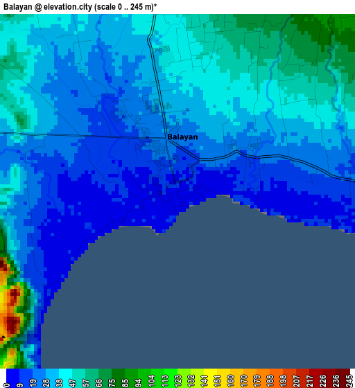
Below is the Elevation map of Balayan, which displays elevation range with different colors. Scale of the first map is from 0 to 245 m (0 to 804 ft) with average elevation of 33.8 meters (=111 ft) [note 1]
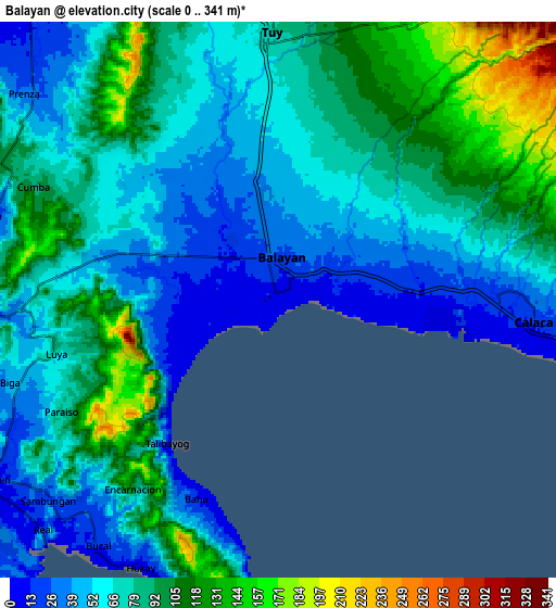
These maps also provides idea of topography and contour of this city, they are displayed at different zoom levels. More info about maps, scale and edge coordinates you can find below images.
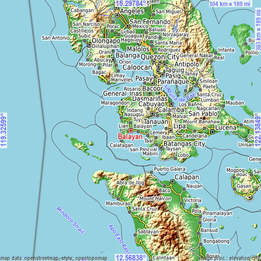
| \ | Map #1 | Map #2 | Topo.Map |
| Scale [m] | 0..245 m | 0..341 m | × |
| Scale [ft] | 0..804 ft | 0..1119 ft | × |
| Average | 33.8 m = 111 ft | 75.7 m = 248 ft | × |
| Width | 9.48 km = 5.9 mi | 18.97 km = 11.8 mi | 303.5 km = 188.6 mi |
| Height | 9.48 km = 5.9 mi | 18.97 km = 11.8 mi | 303.5 km = 188.6 mi |
| ↑Max Latitude | 13.979788° | 14.022427° | 15.29784° |
| Latitude at center | 13.93714° | 13.93714° | 13.93714° |
| ↓Min Latitude | 13.894484° | 13.851821° | 12.56838° |
| ← Min Longitude | 120.688295° | 120.644349° | 119.32599° |
| Longitude center | 120.73224° | 120.73224° | 120.73224° |
| →Max Longitude | 120.776185° | 120.820131° | 122.13849° |
Nearby cities:
Cities around Balayan sort by population:
• Calaca elevation 24 m
8.8 km,  93°
93°
• Tuy 78 m
9 km,  358°
358°
• Binubusan 13 m
11 km,  289°
289°
• Putol 55 m
6.1 km, 355°
• Prinza 37 m
10.7 km,  308°
308°
• Bungahan 52 m
7.6 km,  274°
274°
• Biga 33 m
9.7 km,  247°
247°
• Luntal 68 m
10.4 km,  351°
351°
• Calantas 79 m
6 km,  49°
49°
• Bolboc 122 m
9.6 km,  15°
15°
• Mataywanac 84 m
10.5 km, 358°
• Hukay 11 m
10.7 km,  197°
197°
Multilingual:
 En español:
Balayan elevación 8 m.
 En France:
Balayan élévation 8 m.


Sources and notes:
- [note 1] Map square and city borders are not equal. Map elevation data is calculated only from area inside that square.
- [src 1] Elevation data from geonames database provided with same terms of usage.
- [src 2] The elevation map of Balayan is generated using elevation data from NASA's 3 arcsec (90m) resolution SRTM data.
- [src 3] Base (background) map © OpenStreetMap contributors tiles are generated by Geofabrik and OpenTopoMap.
Copyright & License:
This Balayan Elevation Map is licensed under CC BY-SA. You may reuse any part from this page, if you give a proper credit by linking to this URL:
 More info on terms of use page.