Batan elevation
Batan (Western Visayas, Province of Aklan), Philippines elevation is 9 meters and Batan elevation in feet is 30 ft above sea level [src 1]. Batan is a seat of a third-order administrative division (feature code) with elevation that is 79 meters (259 ft) smaller than average city elevation in Philippines.
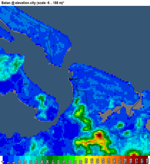
Below is the Elevation map of Batan, which displays elevation range with different colors. Scale of the first map is from -6 to 188 m (-20 to 617 ft) with average elevation of 15.8 meters (=52 ft) [note 1]
These maps also provides idea of topography and contour of this city, they are displayed at different zoom levels. More info about maps, scale and edge coordinates you can find below images.
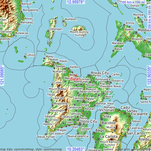
| \ | Map #1 | Map #2 | Topo.Map |
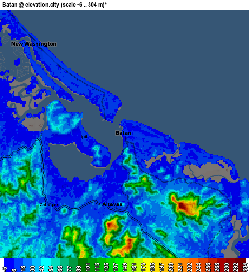
| Scale [m] | -6..188 m | -6..304 m | × |
| Scale [ft] | -20..617 ft | -20..997 ft | × |
| Average | 15.8 m = 52 ft | 33 m = 108 ft | × |
| Width | 9.57 km = 5.9 mi | 19.15 km = 11.9 mi | 306.3 km = 190.3 mi |
| Height | 9.57 km = 5.9 mi | 19.15 km = 11.9 mi | 306.3 km = 190.3 mi |
| ↑Max Latitude | 11.628747° | 11.671787° | 12.95978° |
| Latitude at center | 11.5857° | 11.5857° | 11.5857° |
| ↓Min Latitude | 11.542647° | 11.499587° | 10.20483° |
| ← Min Longitude | 122.453155° | 122.409209° | 121.09085° |
| Longitude center | 122.4971° | 122.4971° | 122.4971° |
| →Max Longitude | 122.541045° | 122.584991° | 123.90335° |
Nearby cities:
Cities around Batan sort by population:
• New Washington elevation 9 m
10.1 km,  315°
315°
• Aranas Sur 35 m
11.9 km,  258°
258°
• Cawayan 10 m
5.5 km, 320°
• Lonoy 17 m
10.2 km,  143°
143°
• Odiong 16 m
6.5 km,  210°
210°
• Altavas 11 m
5.4 km,  191°
191°
• Ochanado 10 m
3.5 km,  334°
334°
• Lalab 12 m
7.6 km, 260°
• Manup 23 m
6 km,  179°
179°
• Damayan 21 m
11.9 km,  149°
149°
• Lupo 22 m
8.9 km, 192°
• Ambulong 8 m
0.7 km,  166°
166°
Multilingual:
 En español:
Batan elevación 9 m.
 En France:
Batan élévation 9 m.


Sources and notes:
- [note 1] Map square and city borders are not equal. Map elevation data is calculated only from area inside that square.
- [src 1] Elevation data from geonames database provided with same terms of usage.
- [src 2] The elevation map of Batan is generated using elevation data from NASA's 3 arcsec (90m) resolution SRTM data.
- [src 3] Base (background) map © OpenStreetMap contributors tiles are generated by Geofabrik and OpenTopoMap.
Copyright & License:
This Batan Elevation Map is licensed under CC BY-SA. You may reuse any part from this page, if you give a proper credit by linking to this URL:
 More info on terms of use page.