Bayambang elevation
Bayambang (Ilocos, Province of Pangasinan), Philippines elevation is 25 meters and Bayambang elevation in feet is 82 ft above sea level [src 1]. Bayambang is a seat of a third-order administrative division (feature code) with elevation that is 63 meters (207 ft) smaller than average city elevation in Philippines.
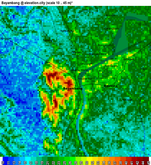
Below is the Elevation map of Bayambang, which displays elevation range with different colors. Scale of the first map is from 10 to 45 m (33 to 148 ft) with average elevation of 20.2 meters (=66 ft) [note 1]
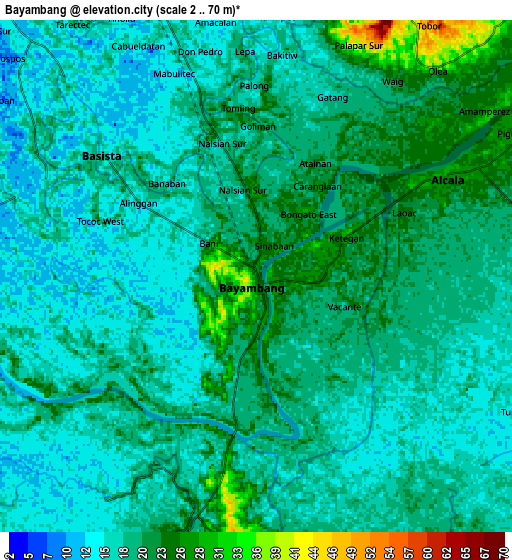
These maps also provides idea of topography and contour of this city, they are displayed at different zoom levels. More info about maps, scale and edge coordinates you can find below images.
| \ | Map #1 | Map #2 | Topo.Map |
| Scale [m] | 10..45 m | 2..70 m | × |
| Scale [ft] | 33..148 ft | 7..230 ft | × |
| Average | 20.2 m = 66 ft | 18.8 m = 62 ft | × |
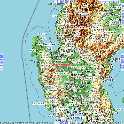
| Width | 9.4 km = 5.8 mi | 18.81 km = 11.7 mi | 300.9 km = 187 mi |
| Height | 9.4 km = 5.8 mi | 18.81 km = 11.7 mi | 300.9 km = 187 mi |
| ↑Max Latitude | 15.854978° | 15.897247° | 17.16109° |
| Latitude at center | 15.8127° | 15.8127° | 15.8127° |
| ↓Min Latitude | 15.770413° | 15.728118° | 14.45526° |
| ← Min Longitude | 120.411755° | 120.367809° | 119.04945° |
| Longitude center | 120.4557° | 120.4557° | 120.4557° |
| →Max Longitude | 120.499645° | 120.543591° | 121.86195° |
Nearby cities:
Cities around Bayambang sort by population:
• Lepa elevation 21 m
8 km,  356°
356°
• Bical Norte 23 m
2.2 km,  275°
275°
• Baluyot 25 m
2 km,  163°
163°
• Nalsian Norte 22 m
3.6 km,  351°
351°
• Bautista 18 m
5.6 km,  125°
125°
• San Gabriel First 20 m
5.1 km,  178°
178°
• Basista 18 m
7.6 km,  305°
305°
• Tanolong 17 m
4.6 km,  257°
257°
• Olea 24 m
6.9 km,  36°
36°
• Buenlag 22 m
6.3 km,  72°
72°
• Tococ East 18 m
3.5 km,  293°
293°
• Anulid 26 m
3.8 km, 67°
Multilingual:
 En español:
Bayambang elevación 25 m.
 En France:
Bayambang élévation 25 m.
 Auf Deutsch:
Bayambang höhe über dem Meeresspiegel ist 25 m.

Sources and notes:
- [note 1] Map square and city borders are not equal. Map elevation data is calculated only from area inside that square.
- [src 1] Elevation data from geonames database provided with same terms of usage.
- [src 2] The elevation map of Bayambang is generated using elevation data from NASA's 3 arcsec (90m) resolution SRTM data.
- [src 3] Base (background) map © OpenStreetMap contributors tiles are generated by Geofabrik and OpenTopoMap.
Copyright & License:
This Bayambang Elevation Map is licensed under CC BY-SA. You may reuse any part from this page, if you give a proper credit by linking to this URL:
 More info on terms of use page.