Bayang elevation
Bayang (Autonomous Region in Muslim Mindanao, Province of Lanao del Sur), Philippines elevation is 735 meters and Bayang elevation in feet is 2411 ft above sea level [src 1]. Bayang is a seat of a third-order administrative division (feature code) with elevation that is 647 meters (2123 ft) bigger than average city elevation in Philippines.
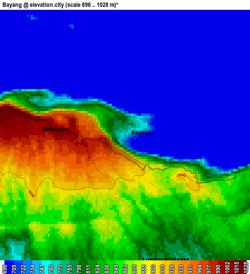
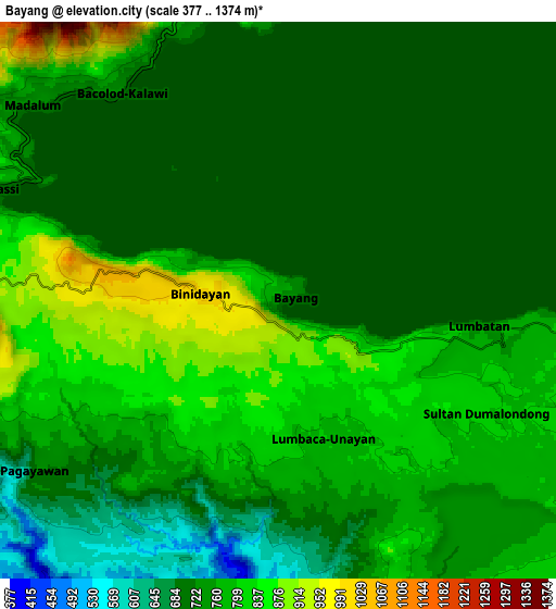
Below is the Elevation map of Bayang, which displays elevation range with different colors. Scale of the first map is from 696 to 1028 m (2283 to 3373 ft) with average elevation of 789.3 meters (=2590 ft) [note 1]
These maps also provides idea of topography and contour of this city, they are displayed at different zoom levels. More info about maps, scale and edge coordinates you can find below images.
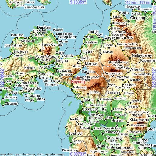
| \ | Map #1 | Map #2 | Topo.Map |
| Scale [m] | 696..1028 m | 377..1374 m | × |
| Scale [ft] | 2283..3373 ft | 1237..4508 ft | × |
| Average | 789.3 m = 2590 ft | 751.2 m = 2465 ft | × |
| Width | 9.68 km = 6 mi | 19.36 km = 12 mi | 309.8 km = 192.5 mi |
| Height | 9.68 km = 6 mi | 19.36 km = 12 mi | 309.8 km = 192.5 mi |
| ↑Max Latitude | 7.836317° | 7.87985° | 9.18359° |
| Latitude at center | 7.79278° | 7.79278° | 7.79278° |
| ↓Min Latitude | 7.749238° | 7.705692° | 6.39733° |
| ← Min Longitude | 124.147725° | 124.103779° | 122.78542° |
| Longitude center | 124.19167° | 124.19167° | 124.19167° |
| →Max Longitude | 124.235615° | 124.279561° | 125.59792° |
Nearby cities:
Cities around Bayang sort by population:
• Binidayan elevation 718 m
3 km,  301°
301°
• Bualan 791 m
9.5 km,  119°
119°
• Bacayawan 831 m
5.4 km, 122°
• Tugaya 705 m
10.2 km,  348°
348°
• Lumbac 744 m
9.4 km,  134°
134°
• Ganassi 704 m
10.4 km,  291°
291°
• Calanogas 745 m
11.2 km,  244°
244°
• Madalum 712 m
10.4 km,  311°
311°
• Madamba 733 m
10.3 km, 299°
• Lumbayanague 802 m
9.8 km,  96°
96°
• Lumbatan 737 m
7.2 km, 96°
• Tubaran 859 m
4 km,  223°
223°
Multilingual:
 En español:
Bayang elevación 735 m.
 En France:
Bayang élévation 735 m.


Sources and notes:
- [note 1] Map square and city borders are not equal. Map elevation data is calculated only from area inside that square.
- [src 1] Elevation data from geonames database provided with same terms of usage.
- [src 2] The elevation map of Bayang is generated using elevation data from NASA's 3 arcsec (90m) resolution SRTM data.
- [src 3] Base (background) map © OpenStreetMap contributors tiles are generated by Geofabrik and OpenTopoMap.
Copyright & License:
This Bayang Elevation Map is licensed under CC BY-SA. You may reuse any part from this page, if you give a proper credit by linking to this URL:
 More info on terms of use page.