Bilao elevation
Bilao (Western Visayas, Province of Capiz), Philippines elevation is 8 meters and Bilao elevation in feet is 26 ft above sea level [src 1]. Bilao is a populated place (feature code) with elevation that is 80 meters (262 ft) smaller than average city elevation in Philippines.
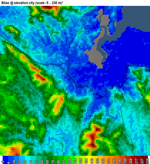
Below is the Elevation map of Bilao, which displays elevation range with different colors. Scale of the first map is from -5 to 236 m (-16 to 774 ft) with average elevation of 49.7 meters (=163 ft) [note 1]
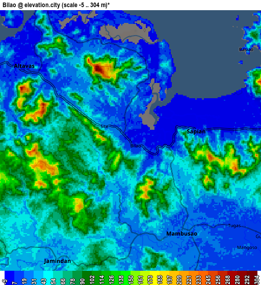
These maps also provides idea of topography and contour of this city, they are displayed at different zoom levels. More info about maps, scale and edge coordinates you can find below images.
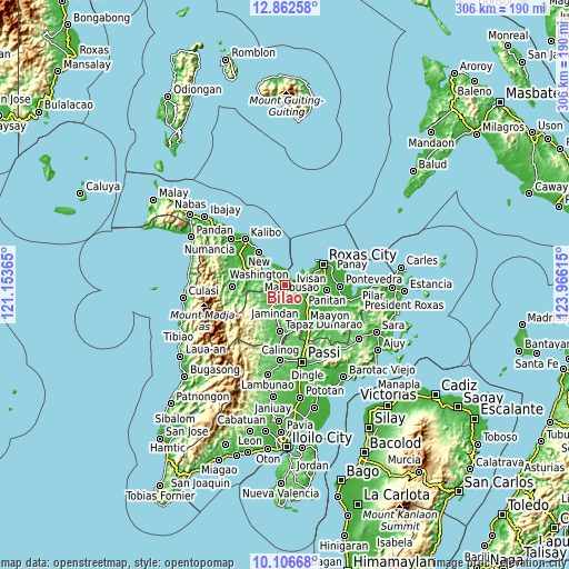
| \ | Map #1 | Map #2 | Topo.Map |
| Scale [m] | -5..236 m | -5..304 m | × |
| Scale [ft] | -16..774 ft | -16..997 ft | × |
| Average | 49.7 m = 163 ft | 50.5 m = 166 ft | × |
| Width | 9.58 km = 6 mi | 19.15 km = 11.9 mi | 306.4 km = 190.4 mi |
| Height | 9.58 km = 6 mi | 19.15 km = 11.9 mi | 306.5 km = 190.4 mi |
| ↑Max Latitude | 11.531062° | 11.574117° | 12.86258° |
| Latitude at center | 11.488° | 11.488° | 11.488° |
| ↓Min Latitude | 11.444932° | 11.401857° | 10.10668° |
| ← Min Longitude | 122.515955° | 122.472009° | 121.15365° |
| Longitude center | 122.5599° | 122.5599° | 122.5599° |
| →Max Longitude | 122.603845° | 122.647791° | 123.96615° |
Nearby cities:
Cities around Bilao sort by population:
• Mambusao elevation 21 m
7.4 km,  145°
145°
• Sapian 9 m
4.7 km,  81°
81°
• Burias 37 m
4.8 km,  193°
193°
• Lonoy 17 m
2.8 km,  345°
345°
• Bula 145 m
4.5 km,  168°
168°
• Dapdapan 23 m
7.8 km, 84°
• Altavas 11 m
9.7 km,  304°
304°
• Basiao 15 m
10.8 km,  51°
51°
• Manup 23 m
8.3 km,  305°
305°
• Damayan 21 m
1 km, 310°
• Lupo 22 m
9.1 km,  283°
283°
• Lucero 69 m
11.1 km,  250°
250°
Multilingual:
 En español:
Bilao elevación 8 m.
 En France:
Bilao élévation 8 m.


Sources and notes:
- [note 1] Map square and city borders are not equal. Map elevation data is calculated only from area inside that square.
- [src 1] Elevation data from geonames database provided with same terms of usage.
- [src 2] The elevation map of Bilao is generated using elevation data from NASA's 3 arcsec (90m) resolution SRTM data.
- [src 3] Base (background) map © OpenStreetMap contributors tiles are generated by Geofabrik and OpenTopoMap.
Copyright & License:
This Bilao Elevation Map is licensed under CC BY-SA. You may reuse any part from this page, if you give a proper credit by linking to this URL:
 More info on terms of use page.