Bogo elevation
Bogo (Central Visayas, Province of Cebu), Philippines elevation is 9 meters and Bogo elevation in feet is 30 ft above sea level [src 1]. Bogo is a seat of a third-order administrative division (feature code) with elevation that is 79 meters (259 ft) smaller than average city elevation in Philippines.
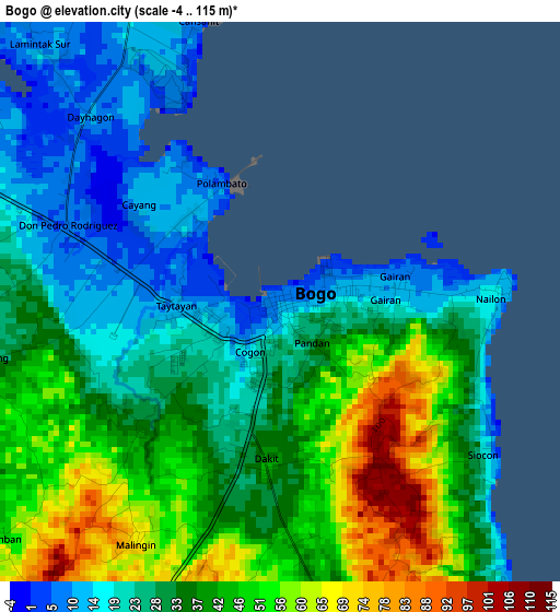
Below is the Elevation map of Bogo, which displays elevation range with different colors. Scale of the first map is from -4 to 115 m (-13 to 377 ft) with average elevation of 35.3 meters (=116 ft) [note 1]
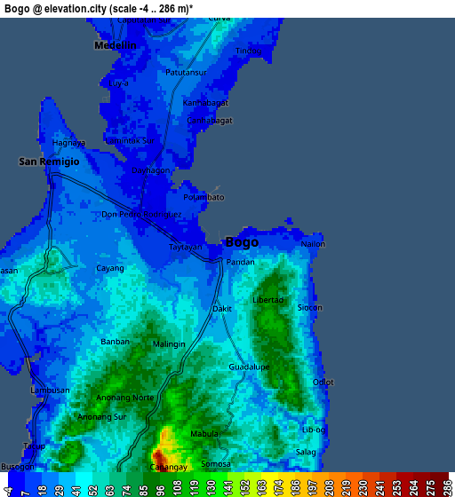
These maps also provides idea of topography and contour of this city, they are displayed at different zoom levels. More info about maps, scale and edge coordinates you can find below images.
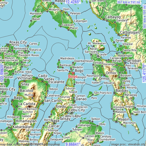
| \ | Map #1 | Map #2 | Topo.Map |
| Scale [m] | -4..115 m | -4..286 m | × |
| Scale [ft] | -13..377 ft | -13..938 ft | × |
| Average | 35.3 m = 116 ft | 40.2 m = 132 ft | × |
| Width | 9.59 km = 6 mi | 19.18 km = 11.9 mi | 306.9 km = 190.7 mi |
| Height | 9.59 km = 6 mi | 19.18 km = 11.9 mi | 306.9 km = 190.7 mi |
| ↑Max Latitude | 11.094827° | 11.137948° | 12.4285° |
| Latitude at center | 11.0517° | 11.0517° | 11.0517° |
| ↓Min Latitude | 11.008567° | 10.965427° | 9.66841° |
| ← Min Longitude | 123.961555° | 123.917609° | 122.59925° |
| Longitude center | 124.0055° | 124.0055° | 124.0055° |
| →Max Longitude | 124.049445° | 124.093391° | 125.41175° |
Nearby cities:
Cities around Bogo sort by population:
• Medellin elevation 10 m
9.8 km,  331°
331°
• Cayang 11 m
2.9 km,  304°
304°
• Anonang 74 m
6.5 km,  152°
152°
• Nailong 15 m
3.6 km,  86°
86°
• Guadalupe 37 m
5.3 km,  170°
170°
• San Remigio 10 m
8 km,  293°
293°
• Libertad 104 m
2.9 km,  143°
143°
• Hagnaya 19 m
8.1 km, 303°
• Tindog 9 m
8.1 km,  4°
4°
• Lapaz 93 m
7.5 km,  201°
201°
• Maño 31 m
6.7 km,  260°
260°
• Malingin 10 m
2.4 km,  265°
265°
Multilingual:
 En español:
Bogo elevación 9 m.
 En France:
Bogo élévation 9 m.


Sources and notes:
- [note 1] Map square and city borders are not equal. Map elevation data is calculated only from area inside that square.
- [src 1] Elevation data from geonames database provided with same terms of usage.
- [src 2] The elevation map of Bogo is generated using elevation data from NASA's 3 arcsec (90m) resolution SRTM data.
- [src 3] Base (background) map © OpenStreetMap contributors tiles are generated by Geofabrik and OpenTopoMap.
Copyright & License:
This Bogo Elevation Map is licensed under CC BY-SA. You may reuse any part from this page, if you give a proper credit by linking to this URL:
 More info on terms of use page.