Bonawon elevation
Bonawon (Central Visayas, Province of Negros Oriental), Philippines elevation is 24 meters and Bonawon elevation in feet is 79 ft above sea level [src 1]. Bonawon is a populated place (feature code) with elevation that is 64 meters (210 ft) smaller than average city elevation in Philippines.
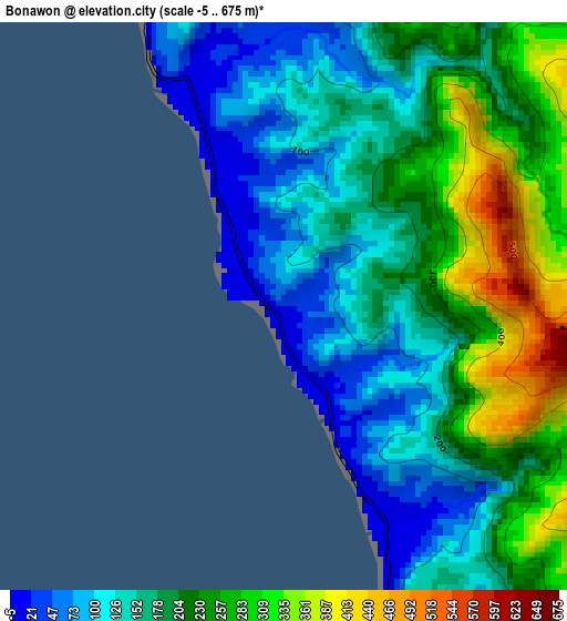
Below is the Elevation map of Bonawon, which displays elevation range with different colors. Scale of the first map is from -5 to 675 m (-16 to 2215 ft) with average elevation of 192 meters (=630 ft) [note 1]
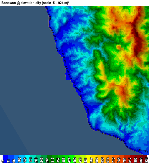
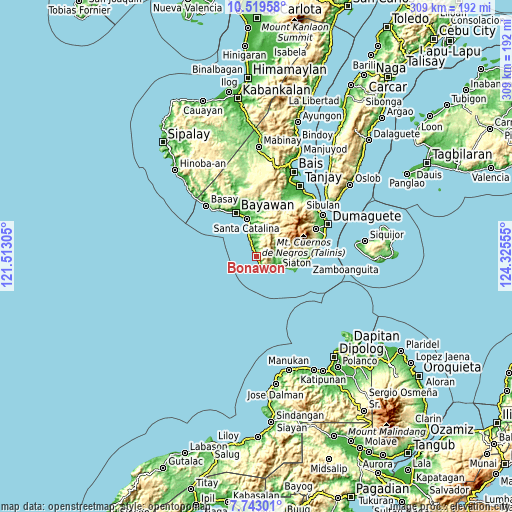
These maps also provides idea of topography and contour of this city, they are displayed at different zoom levels. More info about maps, scale and edge coordinates you can find below images.
| \ | Map #1 | Map #2 | Topo.Map |
| Scale [m] | -5..675 m | -5..924 m | × |
| Scale [ft] | -16..2215 ft | -16..3031 ft | × |
| Average | 192 m = 630 ft | 304.3 m = 998 ft | × |
| Width | 9.65 km = 6 mi | 19.3 km = 12 mi | 308.7 km = 191.8 mi |
| Height | 9.65 km = 6 mi | 19.3 km = 12 mi | 308.8 km = 191.9 mi |
| ↑Max Latitude | 9.177385° | 9.220766° | 10.51958° |
| Latitude at center | 9.134° | 9.134° | 9.134° |
| ↓Min Latitude | 9.090609° | 9.047213° | 7.74301° |
| ← Min Longitude | 122.875355° | 122.831409° | 121.51305° |
| Longitude center | 122.9193° | 122.9193° | 122.9193° |
| →Max Longitude | 122.963245° | 123.007191° | 124.32555° |
Nearby cities:
Cities around Bonawon sort by population:
• Manalongon elevation 16 m
10.3 km,  339°
339°
• Siaton 16 m
14.7 km,  121°
121°
• Nagbalaye 24 m
13.7 km, 339°
• Maloh 30 m
11.3 km,  140°
140°
• Alangilan 14 m
16.8 km, 344°
• Cabangahan 23 m
6.9 km,  154°
154°
• Canauay 13 m
16.5 km, 117°
• Sandolot 26 m
11.5 km,  106°
106°
• Casala-an 156 m
14.5 km,  97°
97°
• Caticugan 216 m
9.6 km, 113°
• Mantiquil 298 m
14.8 km,  75°
75°
• Apoya 123 m
9.8 km,  350°
350°
Multilingual:
 En español:
Bonawon elevación 24 m.
 En France:
Bonawon élévation 24 m.


Sources and notes:
- [note 1] Map square and city borders are not equal. Map elevation data is calculated only from area inside that square.
- [src 1] Elevation data from geonames database provided with same terms of usage.
- [src 2] The elevation map of Bonawon is generated using elevation data from NASA's 3 arcsec (90m) resolution SRTM data.
- [src 3] Base (background) map © OpenStreetMap contributors tiles are generated by Geofabrik and OpenTopoMap.
Copyright & License:
This Bonawon Elevation Map is licensed under CC BY-SA. You may reuse any part from this page, if you give a proper credit by linking to this URL:
 More info on terms of use page.