Butuan elevation
Butuan (Caraga, Province of Agusan del Norte), Philippines elevation is 9 meters and Butuan elevation in feet is 30 ft above sea level [src 1]. Butuan is a seat of a first-order administrative division (feature code) with elevation that is 79 meters (259 ft) smaller than average city elevation in Philippines.
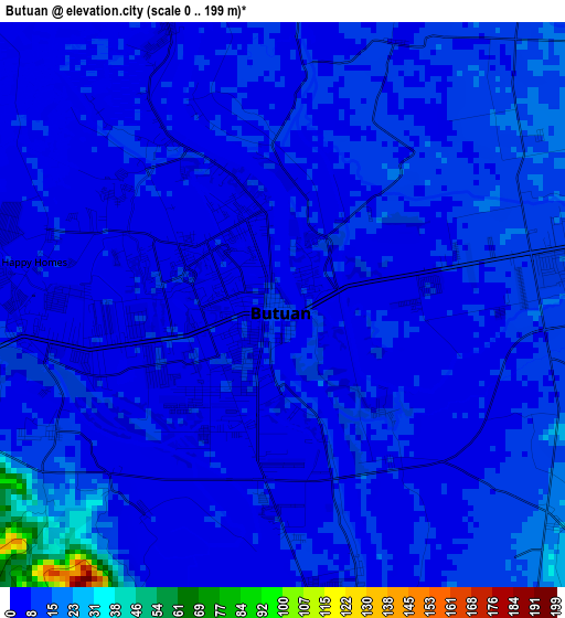
Below is the Elevation map of Butuan, which displays elevation range with different colors. Scale of the first map is from 0 to 199 m (0 to 653 ft) with average elevation of 9.2 meters (=30 ft) [note 1]
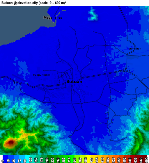
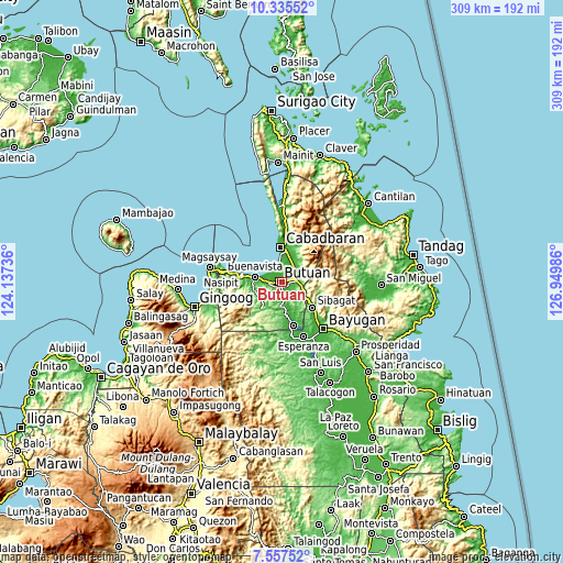
These maps also provides idea of topography and contour of this city, they are displayed at different zoom levels. More info about maps, scale and edge coordinates you can find below images.
| \ | Map #1 | Map #2 | Topo.Map |
| Scale [m] | 0..199 m | -9..690 m | × |
| Scale [ft] | 0..653 ft | -30..2264 ft | × |
| Average | 9.2 m = 30 ft | 50.2 m = 165 ft | × |
| Width | 9.65 km = 6 mi | 19.31 km = 12 mi | 308.9 km = 191.9 mi |
| Height | 9.65 km = 6 mi | 19.31 km = 12 mi | 308.9 km = 191.9 mi |
| ↑Max Latitude | 8.992578° | 9.03598° | 10.33552° |
| Latitude at center | 8.94917° | 8.94917° | 8.94917° |
| ↓Min Latitude | 8.905757° | 8.862339° | 7.55752° |
| ← Min Longitude | 125.499665° | 125.455719° | 124.13736° |
| Longitude center | 125.54361° | 125.54361° | 125.54361° |
| →Max Longitude | 125.587555° | 125.631501° | 126.94986° |
Nearby cities:
Cities around Butuan sort by population:
• Libertad elevation 8 m
4.6 km,  263°
263°
• Taligaman 199 m
13.3 km,  111°
111°
• Magallanes 6 m
8.4 km,  339°
339°
• Lombocan 6 m
7.7 km,  327°
327°
• Los Angeles 16 m
10 km,  45°
45°
• Agay 14 m
12.5 km,  22°
22°
• Manapa 8 m
11.9 km,  285°
285°
• Bancasi 3 m
8.7 km,  282°
282°
• Caloc-an 8 m
11 km,  352°
352°
• Anticala 70 m
12.7 km,  61°
61°
• Basag 67 m
9 km, 107°
• Alubijid 6 m
13 km, 276°
Multilingual:
 En español:
Butuan elevación 9 m.
 En France:
Butuan élévation 9 m.
 Auf Deutsch:
Butuan City höhe über dem Meeresspiegel ist 9 m.

Sources and notes:
- [note 1] Map square and city borders are not equal. Map elevation data is calculated only from area inside that square.
- [src 1] Elevation data from geonames database provided with same terms of usage.
- [src 2] The elevation map of Butuan is generated using elevation data from NASA's 3 arcsec (90m) resolution SRTM data.
- [src 3] Base (background) map © OpenStreetMap contributors tiles are generated by Geofabrik and OpenTopoMap.
Copyright & License:
This Butuan Elevation Map is licensed under CC BY-SA. You may reuse any part from this page, if you give a proper credit by linking to this URL:
 More info on terms of use page.