Cabagan elevation
Cabagan (Cagayan Valley, Province of Isabela), Philippines elevation is 30 meters and Cabagan elevation in feet is 98 ft above sea level [src 1]. Cabagan is a seat of a third-order administrative division (feature code) with elevation that is 58 meters (190 ft) smaller than average city elevation in Philippines.
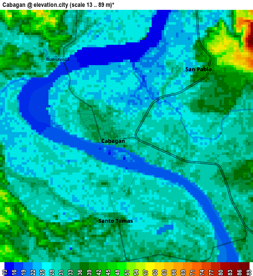
Below is the Elevation map of Cabagan, which displays elevation range with different colors. Scale of the first map is from 13 to 89 m (43 to 292 ft) with average elevation of 30 meters (=98 ft) [note 1]
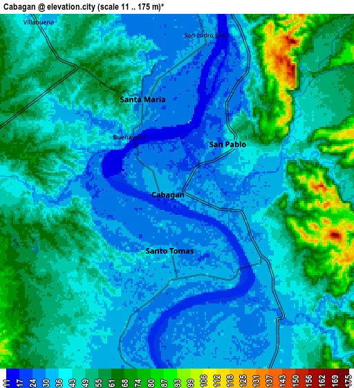
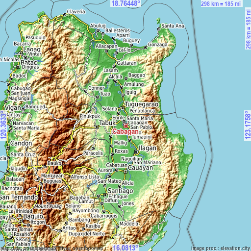
These maps also provides idea of topography and contour of this city, they are displayed at different zoom levels. More info about maps, scale and edge coordinates you can find below images.
| \ | Map #1 | Map #2 | Topo.Map |
| Scale [m] | 13..89 m | 11..175 m | × |
| Scale [ft] | 43..292 ft | 36..574 ft | × |
| Average | 30 m = 98 ft | 45.1 m = 148 ft | × |
| Width | 9.32 km = 5.8 mi | 18.65 km = 11.6 mi | 298.3 km = 185.4 mi |
| Height | 9.32 km = 5.8 mi | 18.65 km = 11.6 mi | 298.4 km = 185.4 mi |
| ↑Max Latitude | 17.469743° | 17.511657° | 18.76448° |
| Latitude at center | 17.42782° | 17.42782° | 17.42782° |
| ↓Min Latitude | 17.385887° | 17.343945° | 16.0813° |
| ← Min Longitude | 121.725605° | 121.681659° | 120.3633° |
| Longitude center | 121.76955° | 121.76955° | 121.76955° |
| →Max Longitude | 121.813495° | 121.857441° | 123.1758° |
Nearby cities:
Cities around Cabagan sort by population:
• Santa Maria elevation 33 m
4.7 km,  336°
336°
• Masipi West 45 m
9.1 km,  126°
126°
• Santo Tomas 33 m
3.2 km,  189°
189°
• Calamagui East 31 m
6.7 km,  359°
359°
• Simanu Sur 47 m
9.4 km,  47°
47°
• Mozzozzin Sur 42 m
4.1 km,  322°
322°
• San Juan 34 m
3.4 km,  223°
223°
• San Bernardo 25 m
3.2 km, 216°
• Bangad 30 m
7.6 km,  6°
6°
• Minanga Norte 29 m
3.2 km,  31°
31°
• Calinaoan Malasin 30 m
9 km,  199°
199°
• Binguang 36 m
4.4 km,  38°
38°
Multilingual:
 En español:
Cabagán elevación 30 m.
 En France:
Cabagan élévation 30 m.


Sources and notes:
- [note 1] Map square and city borders are not equal. Map elevation data is calculated only from area inside that square.
- [src 1] Elevation data from geonames database provided with same terms of usage.
- [src 2] The elevation map of Cabagan is generated using elevation data from NASA's 3 arcsec (90m) resolution SRTM data.
- [src 3] Base (background) map © OpenStreetMap contributors tiles are generated by Geofabrik and OpenTopoMap.
Copyright & License:
This Cabagan Elevation Map is licensed under CC BY-SA. You may reuse any part from this page, if you give a proper credit by linking to this URL:
 More info on terms of use page.