San Isidro elevation
San Isidro (Central Luzon, Province of Tarlac), Philippines elevation is 22 meters and San Isidro elevation in feet is 72 ft above sea level [src 1]. San Isidro is a populated place (feature code) with elevation that is 66 meters (217 ft) smaller than average city elevation in Philippines.
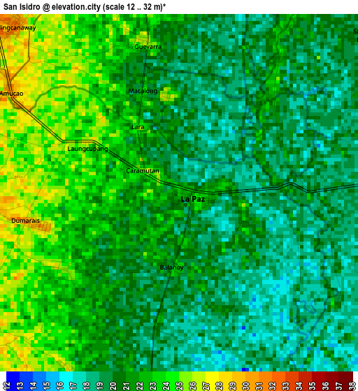
Below is the Elevation map of San Isidro, which displays elevation range with different colors. Scale of the first map is from 12 to 32 m (39 to 105 ft) with average elevation of 20.8 meters (=68 ft) [note 1]
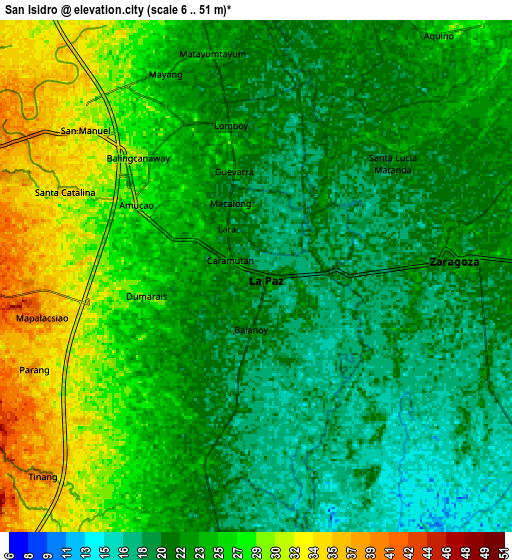
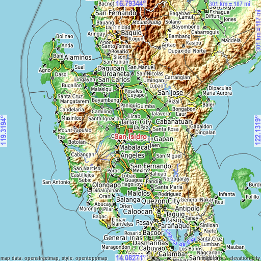
These maps also provides idea of topography and contour of this city, they are displayed at different zoom levels. More info about maps, scale and edge coordinates you can find below images.
| \ | Map #1 | Map #2 | Topo.Map |
| Scale [m] | 12..32 m | 6..51 m | × |
| Scale [ft] | 39..105 ft | 20..167 ft | × |
| Average | 20.8 m = 68 ft | 23.6 m = 77 ft | × |
| Width | 9.42 km = 5.9 mi | 18.84 km = 11.7 mi | 301.4 km = 187.3 mi |
| Height | 9.42 km = 5.9 mi | 18.84 km = 11.7 mi | 301.4 km = 187.3 mi |
| ↑Max Latitude | 15.484854° | 15.5272° | 16.79344° |
| Latitude at center | 15.4425° | 15.4425° | 15.4425° |
| ↓Min Latitude | 15.400137° | 15.357765° | 14.08271° |
| ← Min Longitude | 120.681705° | 120.637759° | 119.3194° |
| Longitude center | 120.72565° | 120.72565° | 120.72565° |
| →Max Longitude | 120.769595° | 120.813541° | 122.1319° |
Nearby cities:
Cities around San Isidro sort by population:
• La Paz elevation 22 m
0.3 km,  113°
113°
• Balingcanaway 31 m
6.2 km,  315°
315°
• Comillas 23 m
5.6 km,  208°
208°
• Bundoc 28 m
4.9 km,  349°
349°
• Santa Lucia 23 m
6.8 km,  50°
50°
• Dumarais 29 m
3.7 km,  256°
256°
• Lomboy 25 m
5.6 km, 350°
• Motrico 30 m
6.2 km,  238°
238°
• Pando 28 m
7 km,  219°
219°
• Amucao 27 m
4.8 km,  299°
299°
• Cama Juan 20 m
7.2 km,  140°
140°
• Macarse 24 m
5.6 km, 110°
Multilingual:
 En español:
San Isidro elevación 22 m.
 En France:
San Isidro élévation 22 m.
 Auf Deutsch:
San Isidro höhe über dem Meeresspiegel ist 22 m.

Sources and notes:
- [note 1] Map square and city borders are not equal. Map elevation data is calculated only from area inside that square.
- [src 1] Elevation data from geonames database provided with same terms of usage.
- [src 2] The elevation map of San Isidro is generated using elevation data from NASA's 3 arcsec (90m) resolution SRTM data.
- [src 3] Base (background) map © OpenStreetMap contributors tiles are generated by Geofabrik and OpenTopoMap.
Copyright & License:
This San Isidro Elevation Map is licensed under CC BY-SA. You may reuse any part from this page, if you give a proper credit by linking to this URL:
 More info on terms of use page.