Camindangan elevation
Camindangan (Western Visayas, Province of Negros Occidental), Philippines elevation is 217 meters and Camindangan elevation in feet is 712 ft above sea level [src 1]. Camindangan is a populated place (feature code) with elevation that is 129 meters (423 ft) bigger than average city elevation in Philippines.
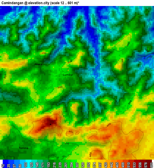
Below is the Elevation map of Camindangan, which displays elevation range with different colors. Scale of the first map is from 12 to 601 m (39 to 1972 ft) with average elevation of 245.5 meters (=805 ft) [note 1]
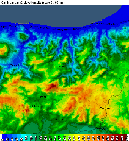
These maps also provides idea of topography and contour of this city, they are displayed at different zoom levels. More info about maps, scale and edge coordinates you can find below images.
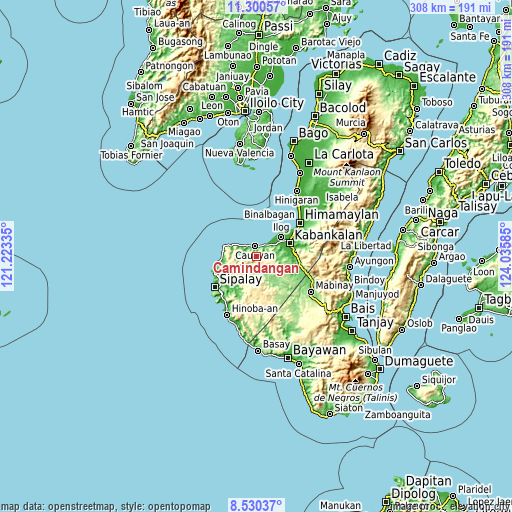
| \ | Map #1 | Map #2 | Topo.Map |
| Scale [m] | 12..601 m | 0..601 m | × |
| Scale [ft] | 39..1972 ft | 0..1972 ft | × |
| Average | 245.5 m = 805 ft | 223.2 m = 732 ft | × |
| Width | 9.63 km = 6 mi | 19.25 km = 12 mi | 308 km = 191.4 mi |
| Height | 9.63 km = 6 mi | 19.25 km = 12 mi | 308 km = 191.4 mi |
| ↑Max Latitude | 9.961686° | 10.004966° | 11.30057° |
| Latitude at center | 9.9184° | 9.9184° | 9.9184° |
| ↓Min Latitude | 9.875109° | 9.831812° | 8.53037° |
| ← Min Longitude | 122.585655° | 122.541709° | 121.22335° |
| Longitude center | 122.6296° | 122.6296° | 122.6296° |
| →Max Longitude | 122.673545° | 122.717491° | 124.03585° |
Nearby cities:
Cities around Camindangan sort by population:
• Guiljungan elevation 13 m
8.5 km,  35°
35°
• Tuyum 11 m
10.2 km,  309°
309°
• Dancalan 10 m
13.9 km,  59°
59°
• Cawayan 13 m
6 km,  355°
355°
• Candoni 181 m
11.6 km,  193°
193°
• Tabu 311 m
9.3 km,  108°
108°
• Consuelo 8 m
16.7 km, 57°
• Bocana 8 m
14.5 km, 44°
• Masaling 11 m
12.4 km,  304°
304°
• Tiling 10 m
6.7 km,  23°
23°
• Caningay 165 m
10 km,  170°
170°
• Daliciasao 13 m
16.3 km, 62°
Multilingual:
 En español:
Camindangan elevación 217 m.
 En France:
Camindangan élévation 217 m.
 Auf Deutsch:
Camindangan höhe über dem Meeresspiegel ist 217 m.

Sources and notes:
- [note 1] Map square and city borders are not equal. Map elevation data is calculated only from area inside that square.
- [src 1] Elevation data from geonames database provided with same terms of usage.
- [src 2] The elevation map of Camindangan is generated using elevation data from NASA's 3 arcsec (90m) resolution SRTM data.
- [src 3] Base (background) map © OpenStreetMap contributors tiles are generated by Geofabrik and OpenTopoMap.
Copyright & License:
This Camindangan Elevation Map is licensed under CC BY-SA. You may reuse any part from this page, if you give a proper credit by linking to this URL:
 More info on terms of use page.