Canubing No 2 elevation
Canubing No 2 (Mimaropa, Province of Mindoro Oriental), Philippines elevation is 13 meters and Canubing No 2 elevation in feet is 43 ft above sea level [src 1]. Canubing No 2 is a populated place (feature code) with elevation that is 75 meters (246 ft) smaller than average city elevation in Philippines.
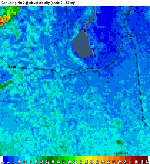
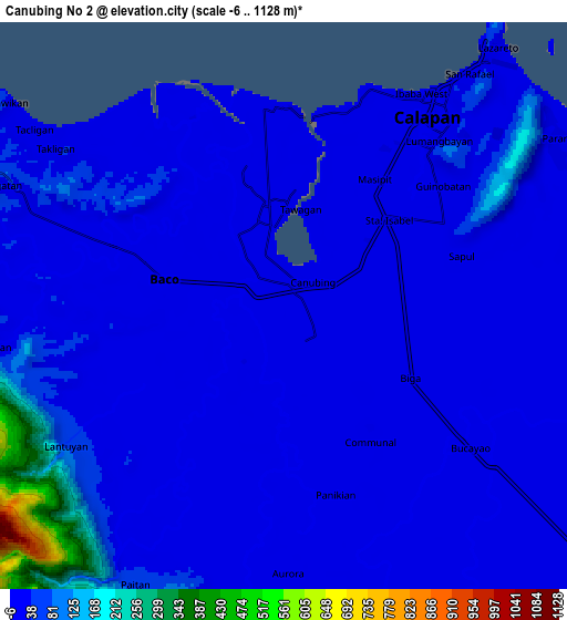
Below is the Elevation map of Canubing No 2, which displays elevation range with different colors. Scale of the first map is from 0 to 87 m (0 to 285 ft) with average elevation of 11.2 meters (=37 ft) [note 1]
These maps also provides idea of topography and contour of this city, they are displayed at different zoom levels. More info about maps, scale and edge coordinates you can find below images.
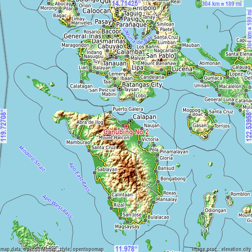
| \ | Map #1 | Map #2 | Topo.Map |
| Scale [m] | 0..87 m | -6..1128 m | × |
| Scale [ft] | 0..285 ft | -20..3701 ft | × |
| Average | 11.2 m = 37 ft | 41.6 m = 136 ft | × |
| Width | 9.51 km = 5.9 mi | 19.02 km = 11.8 mi | 304.2 km = 189 mi |
| Height | 9.51 km = 5.9 mi | 19.02 km = 11.8 mi | 304.3 km = 189.1 mi |
| ↑Max Latitude | 13.392754° | 13.4355° | 14.71425° |
| Latitude at center | 13.35° | 13.35° | 13.35° |
| ↓Min Latitude | 13.307238° | 13.264469° | 11.978° |
| ← Min Longitude | 121.089385° | 121.045439° | 119.72708° |
| Longitude center | 121.13333° | 121.13333° | 121.13333° |
| →Max Longitude | 121.177275° | 121.221221° | 122.53958° |
Nearby cities:
Cities around Canubing No 2 sort by population:
• Calapan elevation 8 m
8.5 km,  36°
36°
• Dulangan 15 m
5.5 km,  203°
203°
• Bayanan 11 m
4.1 km,  75°
75°
• Baco 12 m
3.9 km,  282°
282°
• Sapol 13 m
6.3 km,  74°
74°
• Communal 29 m
10.6 km,  178°
178°
• San Vincente 8 m
7.8 km, 35°
• Manogpi 15 m
8.8 km,  119°
119°
• Tacligan 9 m
9.3 km,  304°
304°
• Evangelista 15 m
4.3 km,  244°
244°
• Biga 17 m
5.3 km,  145°
145°
• Lumangbayan 9 m
13.1 km,  305°
305°
Multilingual:
 En español:
Canubing No 2 elevación 13 m.
 En France:
Canubing No 2 élévation 13 m.
 Auf Deutsch:
Canubing No 2 höhe über dem Meeresspiegel ist 13 m.

Sources and notes:
- [note 1] Map square and city borders are not equal. Map elevation data is calculated only from area inside that square.
- [src 1] Elevation data from geonames database provided with same terms of usage.
- [src 2] The elevation map of Canubing No 2 is generated using elevation data from NASA's 3 arcsec (90m) resolution SRTM data.
- [src 3] Base (background) map © OpenStreetMap contributors tiles are generated by Geofabrik and OpenTopoMap.
Copyright & License:
This Canubing No 2 Elevation Map is licensed under CC BY-SA. You may reuse any part from this page, if you give a proper credit by linking to this URL:
 More info on terms of use page.