Catabangan elevation
Catabangan (Bicol, Province of Camarines Sur), Philippines elevation is 70 meters and Catabangan elevation in feet is 230 ft above sea level [src 1]. Catabangan is a populated place (feature code) with elevation that is 18 meters (59 ft) smaller than average city elevation in Philippines.
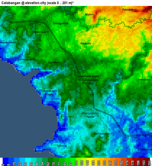
Below is the Elevation map of Catabangan, which displays elevation range with different colors. Scale of the first map is from 0 to 201 m (0 to 659 ft) with average elevation of 68.6 meters (=225 ft) [note 1]
These maps also provides idea of topography and contour of this city, they are displayed at different zoom levels. More info about maps, scale and edge coordinates you can find below images.
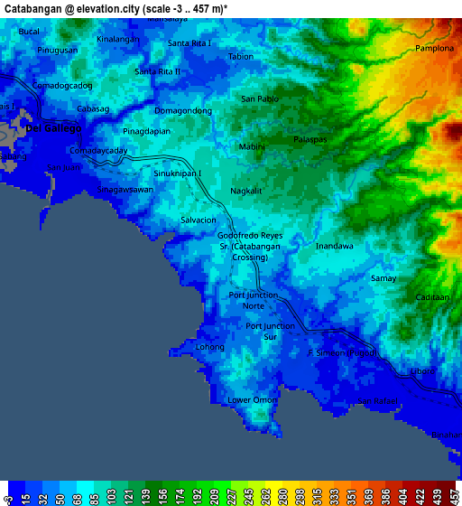
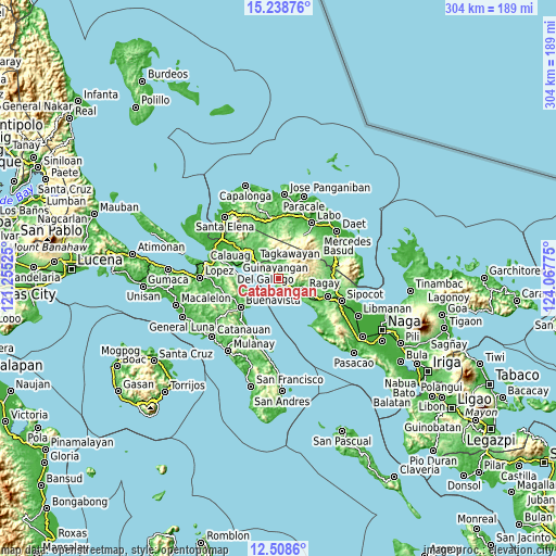
| \ | Map #1 | Map #2 | Topo.Map |
| Scale [m] | 0..201 m | -3..457 m | × |
| Scale [ft] | 0..659 ft | -10..1499 ft | × |
| Average | 68.6 m = 225 ft | 98.2 m = 322 ft | × |
| Width | 9.49 km = 5.9 mi | 18.97 km = 11.8 mi | 303.6 km = 188.6 mi |
| Height | 9.49 km = 5.9 mi | 18.97 km = 11.8 mi | 303.6 km = 188.6 mi |
| ↑Max Latitude | 13.920359° | 13.963009° | 15.23876° |
| Latitude at center | 13.8777° | 13.8777° | 13.8777° |
| ↓Min Latitude | 13.835034° | 13.792359° | 12.5086° |
| ← Min Longitude | 122.617555° | 122.573609° | 121.25525° |
| Longitude center | 122.6615° | 122.6615° | 122.6615° |
| →Max Longitude | 122.705445° | 122.749391° | 124.06775° |
Nearby cities:
Cities around Catabangan sort by population:
• Ragay elevation 11 m
15.6 km,  115°
115°
• Tagkawayan Sabang 119 m
19 km,  311°
311°
• Liboro 4 m
9.4 km,  128°
128°
• Tulay na Lupa 196 m
27.5 km,  29°
29°
• Del Gallego 8 m
8.7 km,  304°
304°
• Culacling 32 m
25.6 km,  114°
114°
• Apad 7 m
13.3 km, 121°
• Guinayangan, Fourth District of Quezon 45 m
23.2 km,  276°
276°
• Kinatakutan 25 m
22.6 km,  292°
292°
• Mapulot 72 m
21.7 km,  322°
322°
• Sinuknipan 65 m
2.9 km, 296°
• Capuluan 8 m
17.2 km,  246°
246°
Multilingual:
 En español:
Catabangan elevación 70 m.
 En France:
Catabangan élévation 70 m.
 Auf Deutsch:
Catabangan höhe über dem Meeresspiegel ist 70 m.

Sources and notes:
- [note 1] Map square and city borders are not equal. Map elevation data is calculated only from area inside that square.
- [src 1] Elevation data from geonames database provided with same terms of usage.
- [src 2] The elevation map of Catabangan is generated using elevation data from NASA's 3 arcsec (90m) resolution SRTM data.
- [src 3] Base (background) map © OpenStreetMap contributors tiles are generated by Geofabrik and OpenTopoMap.
Copyright & License:
This Catabangan Elevation Map is licensed under CC BY-SA. You may reuse any part from this page, if you give a proper credit by linking to this URL:
 More info on terms of use page.