Kotkot elevation
Kotkot (Central Visayas, Province of Cebu), Philippines elevation is 5 meters and Kotkot elevation in feet is 16 ft above sea level [src 1]. Kotkot is a populated place (feature code) with elevation that is 83 meters (272 ft) smaller than average city elevation in Philippines.
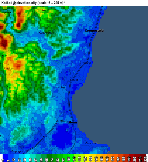
Below is the Elevation map of Kotkot, which displays elevation range with different colors. Scale of the first map is from -6 to 225 m (-20 to 738 ft) with average elevation of 47.1 meters (=155 ft) [note 1]
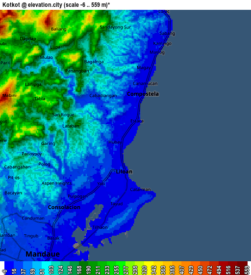
These maps also provides idea of topography and contour of this city, they are displayed at different zoom levels. More info about maps, scale and edge coordinates you can find below images.
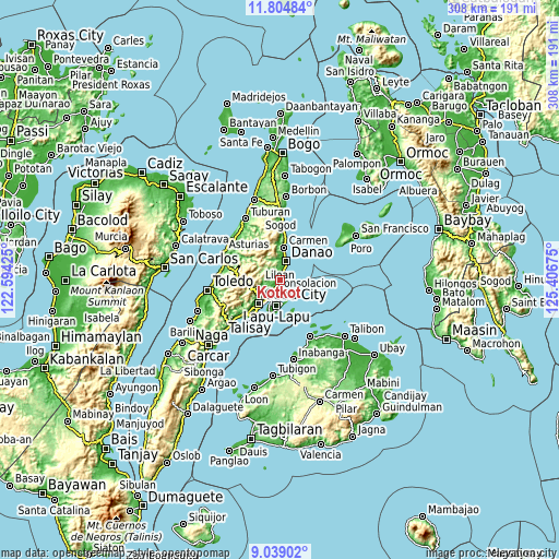
| \ | Map #1 | Map #2 | Topo.Map |
| Scale [m] | -6..225 m | -6..559 m | × |
| Scale [ft] | -20..738 ft | -20..1834 ft | × |
| Average | 47.1 m = 155 ft | 103.1 m = 338 ft | × |
| Width | 9.61 km = 6 mi | 19.22 km = 11.9 mi | 307.5 km = 191.1 mi |
| Height | 9.61 km = 6 mi | 19.22 km = 11.9 mi | 307.6 km = 191.1 mi |
| ↑Max Latitude | 10.468217° | 10.511428° | 11.80484° |
| Latitude at center | 10.425° | 10.425° | 10.425° |
| ↓Min Latitude | 10.381777° | 10.338548° | 9.03902° |
| ← Min Longitude | 123.956555° | 123.912609° | 122.59425° |
| Longitude center | 124.0005° | 124.0005° | 124.0005° |
| →Max Longitude | 124.044445° | 124.088391° | 125.40675° |
Nearby cities:
Cities around Kotkot sort by population:
• Danao elevation 7 m
11 km,  15°
15°
• Liloan 8 m
2.9 km,  182°
182°
• Consolacion 11 m
7.2 km,  221°
221°
• Compostela 11 m
3.5 km, 18°
• Tayud 12 m
5 km,  174°
174°
• Sandayong Sur 75 m
7.9 km,  358°
358°
• Calero 8 m
5.8 km, 182°
• Cogon Cruz 260 m
10 km,  340°
340°
• Masaba 150 m
12.6 km, 342°
• Kabungahan 258 m
10.4 km,  349°
349°
• Magay 7 m
5.4 km,  14°
14°
• Agsungot 282 m
10.4 km,  275°
275°
Multilingual:
 En español:
Kotkot elevación 5 m.
 En France:
Kotkot élévation 5 m.


Sources and notes:
- [note 1] Map square and city borders are not equal. Map elevation data is calculated only from area inside that square.
- [src 1] Elevation data from geonames database provided with same terms of usage.
- [src 2] The elevation map of Kotkot is generated using elevation data from NASA's 3 arcsec (90m) resolution SRTM data.
- [src 3] Base (background) map © OpenStreetMap contributors tiles are generated by Geofabrik and OpenTopoMap.
Copyright & License:
This Kotkot Elevation Map is licensed under CC BY-SA. You may reuse any part from this page, if you give a proper credit by linking to this URL:
 More info on terms of use page.