Culasi elevation
Culasi (Western Visayas, Province of Antique), Philippines elevation is 5 meters and Culasi elevation in feet is 16 ft above sea level [src 1]. Culasi is a seat of a third-order administrative division (feature code) with elevation that is 83 meters (272 ft) smaller than average city elevation in Philippines.
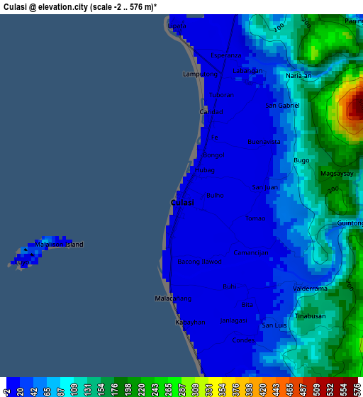
Below is the Elevation map of Culasi, which displays elevation range with different colors. Scale of the first map is from -2 to 576 m (-7 to 1890 ft) with average elevation of 79.3 meters (=260 ft) [note 1]
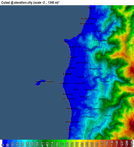
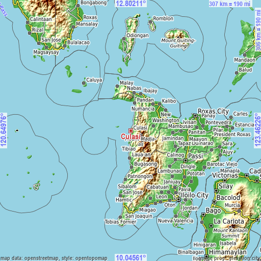
These maps also provides idea of topography and contour of this city, they are displayed at different zoom levels. More info about maps, scale and edge coordinates you can find below images.
| \ | Map #1 | Map #2 | Topo.Map |
| Scale [m] | -2..576 m | -2..1340 m | × |
| Scale [ft] | -7..1890 ft | -7..4396 ft | × |
| Average | 79.3 m = 260 ft | 333 m = 1093 ft | × |
| Width | 9.58 km = 6 mi | 19.16 km = 11.9 mi | 306.5 km = 190.4 mi |
| Height | 9.58 km = 6 mi | 19.16 km = 11.9 mi | 306.5 km = 190.4 mi |
| ↑Max Latitude | 11.470281° | 11.513345° | 12.80211° |
| Latitude at center | 11.42721° | 11.42721° | 11.42721° |
| ↓Min Latitude | 11.384133° | 11.341049° | 10.04561° |
| ← Min Longitude | 122.012065° | 121.968119° | 120.64976° |
| Longitude center | 122.05601° | 122.05601° | 122.05601° |
| →Max Longitude | 122.099955° | 122.143901° | 123.46226° |
Nearby cities:
Cities around Culasi sort by population:
• Valderrama elevation 31 m
3.8 km,  128°
128°
• Tibiao 8 m
15.3 km,  188°
188°
• Sebaste 8 m
18.6 km,  13°
13°
• Manika 105 m
24.7 km,  100°
100°
• Bitadtun 7 m
8.4 km,  22°
22°
• San Francisco 24 m
12 km,  182°
182°
• Libacao 60 m
27.7 km,  77°
77°
• Malabor 10 m
17.2 km, 183°
• Abiera 17 m
16.8 km, 12°
• Idio 8 m
22.3 km, 11°
• Bacalan 19 m
13.6 km, 13°
• Barbaza 13 m
25.8 km, 184°
Multilingual:
 En español:
Culasi elevación 5 m.
 En France:
Culasi élévation 5 m.


Sources and notes:
- [note 1] Map square and city borders are not equal. Map elevation data is calculated only from area inside that square.
- [src 1] Elevation data from geonames database provided with same terms of usage.
- [src 2] The elevation map of Culasi is generated using elevation data from NASA's 3 arcsec (90m) resolution SRTM data.
- [src 3] Base (background) map © OpenStreetMap contributors tiles are generated by Geofabrik and OpenTopoMap.
Copyright & License:
This Culasi Elevation Map is licensed under CC BY-SA. You may reuse any part from this page, if you give a proper credit by linking to this URL:
 More info on terms of use page.