Culianan elevation
Culianan (Zamboanga Peninsula, Province of Zamboanga del Sur), Philippines elevation is 35 meters and Culianan elevation in feet is 115 ft above sea level [src 1]. Culianan is a populated place (feature code) with elevation that is 53 meters (174 ft) smaller than average city elevation in Philippines.
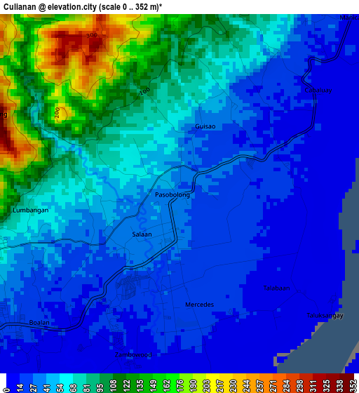
Below is the Elevation map of Culianan, which displays elevation range with different colors. Scale of the first map is from 0 to 352 m (0 to 1155 ft) with average elevation of 55.5 meters (=182 ft) [note 1]
These maps also provides idea of topography and contour of this city, they are displayed at different zoom levels. More info about maps, scale and edge coordinates you can find below images.
| \ | Map #1 | Map #2 | Topo.Map |
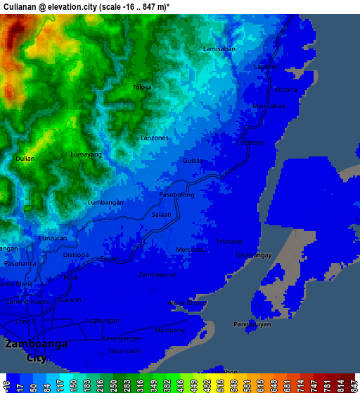
| Scale [m] | 0..352 m | -16..847 m | × |
| Scale [ft] | 0..1155 ft | -52..2779 ft | × |
| Average | 55.5 m = 182 ft | 117 m = 384 ft | × |
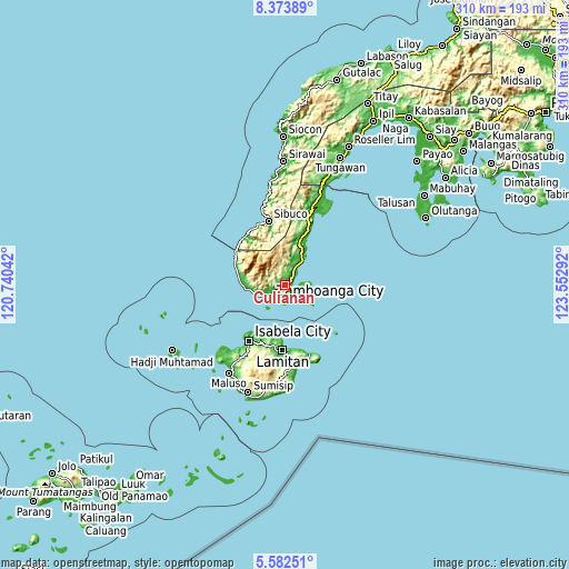
| Width | 9.7 km = 6 mi | 19.4 km = 12.1 mi | 310.4 km = 192.9 mi |
| Height | 9.7 km = 6 mi | 19.4 km = 12.1 mi | 310.4 km = 192.9 mi |
| ↑Max Latitude | 7.023898° | 7.067511° | 8.37389° |
| Latitude at center | 6.98028° | 6.98028° | 6.98028° |
| ↓Min Latitude | 6.936658° | 6.893033° | 5.58251° |
| ← Min Longitude | 122.102725° | 122.058779° | 120.74042° |
| Longitude center | 122.14667° | 122.14667° | 122.14667° |
| →Max Longitude | 122.190615° | 122.234561° | 123.55292° |
Nearby cities:
Cities around Culianan sort by population:
• Zamboanga elevation 9 m
11.2 km,  225°
225°
• Sangali 8 m
11.6 km,  31°
31°
• Mercedes 23 m
2.4 km,  175°
175°
• Manicahan 8 m
7.4 km,  54°
54°
• Taluksangay 5 m
5 km,  125°
125°
• Cabaluay 7 m
4.4 km,  57°
57°
• Talabaan 5 m
5.2 km,  147°
147°
• Tigtabon 6 m
9.7 km,  166°
166°
• Landang Laum 24 m
11.4 km,  96°
96°
• Lamisahan 85 m
10.2 km,  7°
7°
• Tolosa 108 m
6 km,  15°
15°
• Lumbayan 15 m
3.7 km,  189°
189°
Multilingual:
 En español:
Culianan elevación 35 m.
 En France:
Culianan élévation 35 m.


Sources and notes:
- [note 1] Map square and city borders are not equal. Map elevation data is calculated only from area inside that square.
- [src 1] Elevation data from geonames database provided with same terms of usage.
- [src 2] The elevation map of Culianan is generated using elevation data from NASA's 3 arcsec (90m) resolution SRTM data.
- [src 3] Base (background) map © OpenStreetMap contributors tiles are generated by Geofabrik and OpenTopoMap.
Copyright & License:
This Culianan Elevation Map is licensed under CC BY-SA. You may reuse any part from this page, if you give a proper credit by linking to this URL:
 More info on terms of use page.