Gabaldon elevation
Gabaldon (Central Luzon, Province of Nueva Ecija), Philippines elevation is 137 meters and Gabaldon elevation in feet is 449 ft above sea level [src 1]. Gabaldon is a seat of a third-order administrative division (feature code) with elevation that is 49 meters (161 ft) bigger than average city elevation in Philippines.
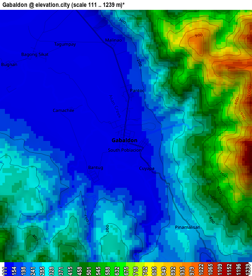
Below is the Elevation map of Gabaldon, which displays elevation range with different colors. Scale of the first map is from 111 to 1239 m (364 to 4065 ft) with average elevation of 325.4 meters (=1068 ft) [note 1]
These maps also provides idea of topography and contour of this city, they are displayed at different zoom levels. More info about maps, scale and edge coordinates you can find below images.
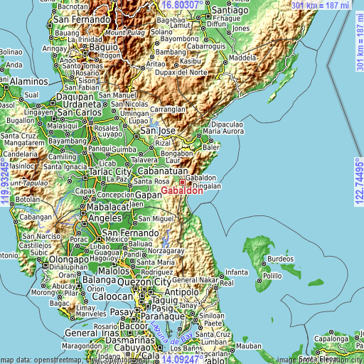
| \ | Map #1 | Map #2 | Topo.Map |
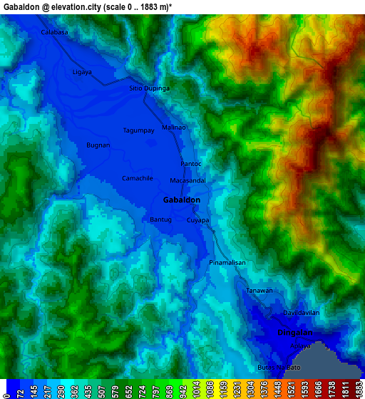
| Scale [m] | 111..1239 m | 0..1883 m | × |
| Scale [ft] | 364..4065 ft | 0..6178 ft | × |
| Average | 325.4 m = 1068 ft | 532.1 m = 1746 ft | × |
| Width | 9.42 km = 5.9 mi | 18.84 km = 11.7 mi | 301.4 km = 187.3 mi |
| Height | 9.42 km = 5.9 mi | 18.84 km = 11.7 mi | 301.4 km = 187.3 mi |
| ↑Max Latitude | 15.494552° | 15.536896° | 16.80307° |
| Latitude at center | 15.4522° | 15.4522° | 15.4522° |
| ↓Min Latitude | 15.409839° | 15.367469° | 14.09247° |
| ← Min Longitude | 121.294755° | 121.250809° | 119.93245° |
| Longitude center | 121.3387° | 121.3387° | 121.3387° |
| →Max Longitude | 121.382645° | 121.426591° | 122.74495° |
Nearby cities:
Cities around Gabaldon sort by population:
• Laur elevation 73 m
22.4 km,  311°
311°
• Dingalan 34 m
9.1 km,  140°
140°
• Ligaya 113 m
8.4 km,  318°
318°
• Umiray 7 m
26.9 km,  163°
163°
• Antipolo 87 m
24.4 km, 319°
• Mapalad 91 m
27.3 km,  269°
269°
• Sapang Buho 75 m
27.6 km,  303°
303°
• Cabog 14 m
15.6 km,  167°
167°
• Macatbong 69 m
28.4 km,  281°
281°
• Siclong 102 m
18.9 km, 319°
• Bagong-Sikat 123 m
4.6 km, 312°
• Sagana 68 m
23.8 km, 302°
Multilingual:
 En español:
Gabaldon elevación 137 m.
 En France:
Gabaldon élévation 137 m.
 Auf Deutsch:
Gabaldon höhe über dem Meeresspiegel ist 137 m.

Sources and notes:
- [note 1] Map square and city borders are not equal. Map elevation data is calculated only from area inside that square.
- [src 1] Elevation data from geonames database provided with same terms of usage.
- [src 2] The elevation map of Gabaldon is generated using elevation data from NASA's 3 arcsec (90m) resolution SRTM data.
- [src 3] Base (background) map © OpenStreetMap contributors tiles are generated by Geofabrik and OpenTopoMap.
Copyright & License:
This Gabaldon Elevation Map is licensed under CC BY-SA. You may reuse any part from this page, if you give a proper credit by linking to this URL:
 More info on terms of use page.