Gabao elevation
Gabao (Bicol, Province of Sorsogon), Philippines elevation is 33 meters and Gabao elevation in feet is 108 ft above sea level [src 1]. Gabao is a populated place (feature code) with elevation that is 55 meters (180 ft) smaller than average city elevation in Philippines.
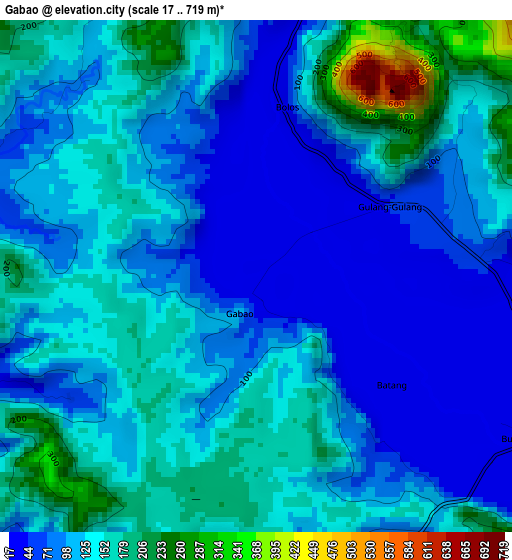
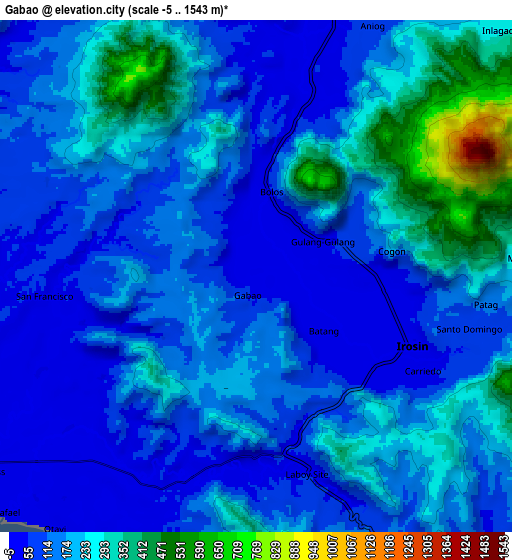
Below is the Elevation map of Gabao, which displays elevation range with different colors. Scale of the first map is from 17 to 719 m (56 to 2359 ft) with average elevation of 120 meters (=394 ft) [note 1]
These maps also provides idea of topography and contour of this city, they are displayed at different zoom levels. More info about maps, scale and edge coordinates you can find below images.
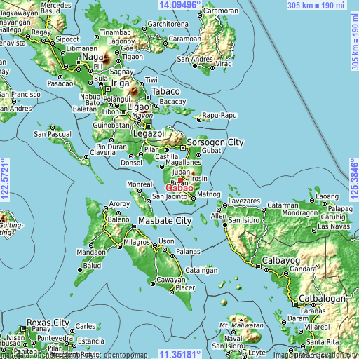
| \ | Map #1 | Map #2 | Topo.Map |
| Scale [m] | 17..719 m | -5..1543 m | × |
| Scale [ft] | 56..2359 ft | -16..5062 ft | × |
| Average | 120 m = 394 ft | 175.4 m = 575 ft | × |
| Width | 9.53 km = 5.9 mi | 19.06 km = 11.8 mi | 305 km = 189.5 mi |
| Height | 9.53 km = 5.9 mi | 19.06 km = 11.8 mi | 305 km = 189.5 mi |
| ↑Max Latitude | 12.769952° | 12.812807° | 14.09496° |
| Latitude at center | 12.72709° | 12.72709° | 12.72709° |
| ↓Min Latitude | 12.684221° | 12.641344° | 11.35181° |
| ← Min Longitude | 123.934405° | 123.890459° | 122.5721° |
| Longitude center | 123.97835° | 123.97835° | 123.97835° |
| →Max Longitude | 124.022295° | 124.066241° | 125.3846° |
Nearby cities:
Cities around Gabao sort by population:
• Bulan elevation 5 m
12.8 km,  241°
241°
• Irosin 33 m
6.6 km,  117°
117°
• Sabang 110 m
4.9 km,  278°
278°
• Juban 4 m
13.5 km,  4°
4°
• Monbon 52 m
4.4 km,  84°
84°
• Utabi 6 m
12.1 km,  218°
218°
• Butag 6 m
11.9 km,  204°
204°
• Guruyan 98 m
4.4 km,  287°
287°
• San Francisco 42 m
7.8 km,  268°
268°
• Lajong 30 m
11.9 km,  353°
353°
• San Roque 289 m
11.5 km, 83°
• Quezon 16 m
14.5 km,  192°
192°
Multilingual:
 En español:
Gabao elevación 33 m.
 En France:
Gabao élévation 33 m.


Sources and notes:
- [note 1] Map square and city borders are not equal. Map elevation data is calculated only from area inside that square.
- [src 1] Elevation data from geonames database provided with same terms of usage.
- [src 2] The elevation map of Gabao is generated using elevation data from NASA's 3 arcsec (90m) resolution SRTM data.
- [src 3] Base (background) map © OpenStreetMap contributors tiles are generated by Geofabrik and OpenTopoMap.
Copyright & License:
This Gabao Elevation Map is licensed under CC BY-SA. You may reuse any part from this page, if you give a proper credit by linking to this URL:
 More info on terms of use page.