Gabi elevation
Gabi (Davao, Compostela Valley), Philippines elevation is 89 meters and Gabi elevation in feet is 292 ft above sea level [src 1]. Gabi is a populated place (feature code) with elevation that is 1 meters (3 ft) bigger than average city elevation in Philippines.
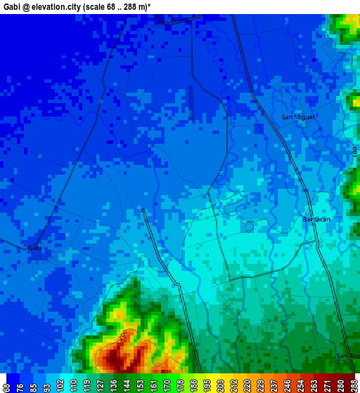
Below is the Elevation map of Gabi, which displays elevation range with different colors. Scale of the first map is from 68 to 288 m (223 to 945 ft) with average elevation of 99.3 meters (=326 ft) [note 1]
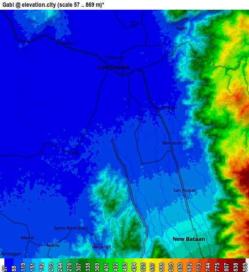
These maps also provides idea of topography and contour of this city, they are displayed at different zoom levels. More info about maps, scale and edge coordinates you can find below images.
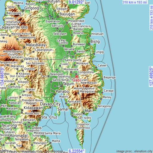
| \ | Map #1 | Map #2 | Topo.Map |
| Scale [m] | 68..288 m | 57..869 m | × |
| Scale [ft] | 223..945 ft | 187..2851 ft | × |
| Average | 99.3 m = 326 ft | 173.8 m = 570 ft | × |
| Width | 9.69 km = 6 mi | 19.37 km = 12 mi | 309.9 km = 192.6 mi |
| Height | 9.69 km = 6 mi | 19.37 km = 12 mi | 310 km = 192.6 mi |
| ↑Max Latitude | 7.665055° | 7.708605° | 9.01292° |
| Latitude at center | 7.6215° | 7.6215° | 7.6215° |
| ↓Min Latitude | 7.577941° | 7.534377° | 6.22554° |
| ← Min Longitude | 126.048055° | 126.004109° | 124.68575° |
| Longitude center | 126.092° | 126.092° | 126.092° |
| →Max Longitude | 126.135945° | 126.179891° | 127.49825° |
Nearby cities:
Cities around Gabi sort by population:
• Compostela elevation 74 m
5.7 km,  356°
356°
• San Mariano 224 m
16.9 km,  216°
216°
• Nabunturan 87 m
13.9 km,  263°
263°
• Cabinuangan 67 m
9.4 km,  316°
316°
• Montevista 73 m
13.9 km,  305°
305°
• Manat 126 m
12.9 km, 219°
• Bantacan 112 m
4.6 km,  115°
115°
• Babag 68 m
12.6 km,  349°
349°
• Linoan 90 m
13 km,  272°
272°
• Tapia 72 m
17.2 km,  329°
329°
• Manat 99 m
10.3 km,  231°
231°
• Mawab 111 m
13.4 km,  243°
243°
Multilingual:
 En español:
Gabi elevación 89 m.
 En France:
Gabi élévation 89 m.


Sources and notes:
- [note 1] Map square and city borders are not equal. Map elevation data is calculated only from area inside that square.
- [src 1] Elevation data from geonames database provided with same terms of usage.
- [src 2] The elevation map of Gabi is generated using elevation data from NASA's 3 arcsec (90m) resolution SRTM data.
- [src 3] Base (background) map © OpenStreetMap contributors tiles are generated by Geofabrik and OpenTopoMap.
Copyright & License:
This Gabi Elevation Map is licensed under CC BY-SA. You may reuse any part from this page, if you give a proper credit by linking to this URL:
 More info on terms of use page.