Glan elevation
Glan (Soccsksargen, Province of Sarangani), Philippines elevation is 9 meters and Glan elevation in feet is 30 ft above sea level [src 1]. Glan is a populated place (feature code) with elevation that is 79 meters (259 ft) smaller than average city elevation in Philippines.
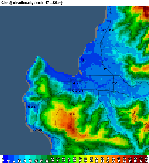
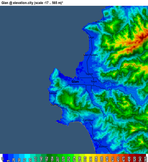
Below is the Elevation map of Glan, which displays elevation range with different colors. Scale of the first map is from -17 to 326 m (-56 to 1070 ft) with average elevation of 79.4 meters (=260 ft) [note 1]
These maps also provides idea of topography and contour of this city, they are displayed at different zoom levels. More info about maps, scale and edge coordinates you can find below images.
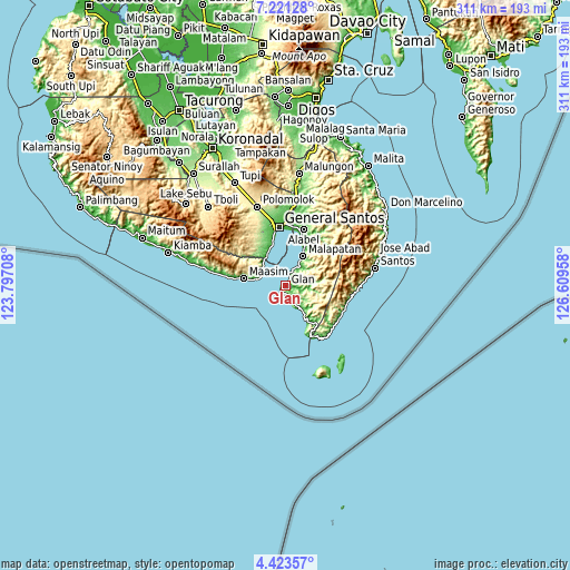
| \ | Map #1 | Map #2 | Topo.Map |
| Scale [m] | -17..326 m | -17..565 m | × |
| Scale [ft] | -56..1070 ft | -56..1854 ft | × |
| Average | 79.4 m = 260 ft | 129.5 m = 425 ft | × |
| Width | 9.72 km = 6 mi | 19.44 km = 12.1 mi | 311.1 km = 193.3 mi |
| Height | 9.72 km = 6 mi | 19.44 km = 12.1 mi | 311.1 km = 193.3 mi |
| ↑Max Latitude | 5.867887° | 5.9116° | 7.22128° |
| Latitude at center | 5.82417° | 5.82417° | 5.82417° |
| ↓Min Latitude | 5.78045° | 5.736726° | 4.42357° |
| ← Min Longitude | 125.159385° | 125.115439° | 123.79708° |
| Longitude center | 125.20333° | 125.20333° | 125.20333° |
| →Max Longitude | 125.247275° | 125.291221° | 126.60958° |
Nearby cities:
Cities around Glan sort by population:
• Sapu Padidu elevation 2 m
12.5 km,  34°
34°
• Baliton 15 m
9.7 km,  157°
157°
• Pangyan 1 m
16.2 km,  147°
147°
• Taluya 1 m
3.7 km,  247°
247°
• Burias 62 m
13.1 km, 154°
• Tinoto 74 m
16.2 km,  295°
295°
• Glan Peidu 10 m
3.8 km, 26°
• Ilaya 23 m
2.8 km,  110°
110°
• Kiupo 324 m
13 km,  81°
81°
• Kapatan 27 m
9.3 km,  23°
23°
• Kablalan 91 m
5 km,  187°
187°
• Tañgo 17 m
6.6 km, 18°
Multilingual:
 En español:
Glan elevación 9 m.
 En France:
Glan élévation 9 m.


Sources and notes:
- [note 1] Map square and city borders are not equal. Map elevation data is calculated only from area inside that square.
- [src 1] Elevation data from geonames database provided with same terms of usage.
- [src 2] The elevation map of Glan is generated using elevation data from NASA's 3 arcsec (90m) resolution SRTM data.
- [src 3] Base (background) map © OpenStreetMap contributors tiles are generated by Geofabrik and OpenTopoMap.
Copyright & License:
This Glan Elevation Map is licensed under CC BY-SA. You may reuse any part from this page, if you give a proper credit by linking to this URL:
 More info on terms of use page.